Category:Rosslare Harbour
village in Ireland  | |||||
| Upload media | |||||
| Instance of | |||||
|---|---|---|---|---|---|
| Location | County Wexford, Leinster, Ireland | ||||
| Elevation above sea level |
| ||||
 | |||||
Deutsch: Rosslare Harbour ( irisch Calafort Ros Láir), auch Rosslare Europort genannt, ist ein Hafen im Südosten Irlands in der Nähe von Wexford.
English: The village of Rosslare Harbour grew up to serve the needs of the harbour of the same name (now called Rosslare Europort), first developed in 1906 by the Great Western Railway and the Great Southern and Western Railway to accommodate steamferry traffic between Great Britain and Ireland. Rosslare Harbour railway station opened on 30 August, 1906.
Subcategories
This category has the following 3 subcategories, out of 3 total.
R
- Rosslare Harbour Lighthouse (7 F)
S
- Ships in Rosslare Harbour (27 F)
Media in category "Rosslare Harbour"
The following 108 files are in this category, out of 108 total.
-
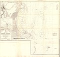 Admiralty Chart No 1772 Wexford Harbour, Published 1883.jpg 15,968 × 15,202; 56.36 MB
-

-
 All aboard the Stena Lynx III - geograph.org.uk - 1388749.jpg 480 × 640; 209 KB
-
 Approaching Rosslare Harbour - geograph.org.uk - 5154770.jpg 2,000 × 1,220; 1.31 MB
-
 Approaching Rosslare Harbour - geograph.org.uk - 5318122.jpg 640 × 427; 390 KB
-
 Baggermolen in de haven van Rosslare, Bestanddeelnr 191-0917.jpg 2,646 × 2,233; 712 KB
-

-
 Beyond the ferry terminal - geograph.org.uk - 1826958.jpg 640 × 425; 157 KB
-
 Breakwater and lighthouse at Rosslare harbour - geograph.org.uk - 6121067.jpg 5,028 × 3,771; 5.25 MB
-
 Breakwater at Rosslare Harbour - geograph.org.uk - 6121065.jpg 4,953 × 3,714; 4.56 MB
-

-

-
 Clifftop Path towards Greenore Point - geograph.org.uk - 5320654.jpg 640 × 480; 418 KB
-
 Coastal Path South of Rosslare Harbour - geograph.org.uk - 5321226.jpg 640 × 427; 440 KB
-
 Coastal Path towards Rosslare Harbour - geograph.org.uk - 5320749.jpg 640 × 480; 471 KB
-

-
 Container Compound at Rosslare Europort - geograph.org.uk - 5318374.jpg 640 × 480; 412 KB
-
 Containers at Rosslare Europort - geograph.org.uk - 5321293.jpg 640 × 427; 402 KB
-
 Dockside at Rosslare Harbour - geograph.org.uk - 6121073.jpg 5,075 × 3,806; 4.97 MB
-
 Entrance to Rosslare Harbour - geograph.org.uk - 5318172.jpg 640 × 481; 389 KB
-

-
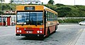 Express bus, Rosslare Harbour - geograph.org.uk - 1601664.jpg 640 × 343; 87 KB
-
 Farm at Ballycronigan - geograph.org.uk - 570494.jpg 640 × 480; 125 KB
-
 Ferry Berths at Rosslare - geograph.org.uk - 5321318.jpg 640 × 427; 374 KB
-

-

-
 Fishguard & Rosslare Railways and Harbours Company Cerificate.jpg 5,936 × 3,456; 3.62 MB
-
 Former Rail Station at Rosslare Terminal - geograph.org.uk - 5318387.jpg 640 × 481; 440 KB
-
 Goederentrein bij de haven van Rosslare, Bestanddeelnr 191-0906.jpg 2,649 × 2,587; 719 KB
-
 Harbour View Hotel - geograph.org.uk - 5319789.jpg 640 × 427; 324 KB
-
 Harbour, Ballygerry - geograph.org.uk - 231981.jpg 640 × 427; 59 KB
-
-
 Havenpier in Rosslare met links een baggermolen, Bestanddeelnr 191-0908.jpg 2,646 × 2,578; 761 KB
-
 Irish Ferries Berth, Rosslare Europort - geograph.org.uk - 5318367.jpg 640 × 481; 407 KB
-
 Marian Shrine, Rosslare Harbour - geograph.org.uk - 5319783.jpg 481 × 640; 334 KB
-

-
 Number 3 Buoy, Rosslare Harbour - geograph.org.uk - 5321454.jpg 640 × 481; 489 KB
-
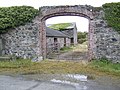
 Old Cooper's Inn - geograph.org.uk - 1251104.jpg 640 × 425; 150 KB
-
 Old link-span at Rosslare Harbour - geograph.org.uk - 6121071.jpg 5,184 × 3,888; 5.41 MB
-
 Pier and Sea Wall at Rosslare Europort - geograph.org.uk - 5318131.jpg 640 × 427; 366 KB
-

-
 Quayside at Rosslare Europort - geograph.org.uk - 5318376.jpg 640 × 481; 408 KB
-
 Rebuilding Rosslare harbour - geograph.org.uk - 1756522.jpg 640 × 390; 125 KB
-

-
 Releasing the ropes - geograph.org.uk - 4551382.jpg 3,648 × 2,736; 3.93 MB
-
 RNLI House, Rosslare Harbour - geograph.org.uk - 5319769.jpg 640 × 427; 344 KB
-
 RNLI Lifeboat Station - geograph.org.uk - 4551387.jpg 3,648 × 2,736; 3.85 MB
-
 Roslare Europort 02.jpg 600 × 450; 63 KB
-
 Roslare Europort.jpg 600 × 450; 26 KB
-
-

-
 Rosslare Europort - geograph.org.uk - 4579173.jpg 1,024 × 768; 110 KB
-
 Rosslare Europort - geograph.org.uk - 5318377.jpg 640 × 481; 439 KB
-
 Rosslare Europort - geograph.org.uk - 5319254.jpg 640 × 481; 408 KB
-
 Rosslare Europort Quayside - geograph.org.uk - 5318416.jpg 640 × 481; 347 KB
-
 Rosslare Europort railway station 1.jpg 640 × 480; 39 KB
-

-
 Rosslare Europort, Red Buoy "Number 2" - geograph.org.uk - 5318160.jpg 640 × 427; 470 KB
-

-
 Rosslare Europort.jpg 1,600 × 1,200; 304 KB
-
 Rosslare Harbour - geograph.org.uk - 1826949.jpg 640 × 428; 220 KB
-
 Rosslare Harbour - geograph.org.uk - 216670.jpg 640 × 480; 66 KB
-
 Rosslare harbour - geograph.org.uk - 4612040.jpg 1,600 × 1,200; 375 KB
-
 Rosslare Harbour - geograph.org.uk - 5319775.jpg 640 × 481; 504 KB
-
 Rosslare Harbour 2006 (2).jpg 2,048 × 1,536; 804 KB
-
 Rosslare Harbour 2008.JPG 800 × 600; 316 KB
-
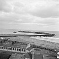
 Rosslare Harbour beach - geograph.org.uk - 1826954.jpg 640 × 427; 159 KB
-
 Rosslare Harbour Beach - geograph.org.uk - 5319211.jpg 640 × 481; 385 KB
-
 Rosslare Harbour Beach - geograph.org.uk - 5321233.jpg 640 × 481; 375 KB
-
 Rosslare Harbour from a Pembroke Dock bound ferry - geograph.org.uk - 2005482.jpg 1,600 × 1,200; 418 KB
-
 Rosslare Harbour from the car ferry - geograph.org.uk - 5119517.jpg 2,000 × 1,333; 1.2 MB
-
 Rosslare Harbour Lifeboat Station - geograph.org.uk - 5318371.jpg 640 × 481; 411 KB
-
 Rosslare Harbour petrol station - geograph.org.uk - 774851.jpg 640 × 480; 71 KB
-
 Rosslare Harbour tonnage rates - circa 1900.jpg 1,817 × 2,775; 1.07 MB
-
 Rosslare Harbour Village - geograph.org.uk - 5319772.jpg 640 × 481; 394 KB
-
-

-
 Rosslare Harbour, Saint Patrick's Church.jpg 7,164 × 5,110; 3.09 MB
-
 Rosslare Harbour, St Brendan's Estate - geograph.org.uk - 5321224.jpg 640 × 427; 320 KB
-
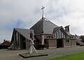
 Rosslare Harbour, St Patrick's Church - geograph.org.uk - 5320172.jpg 640 × 427; 262 KB
-

-
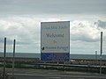 Rosslare Harbour, welcome sign - geograph.org.uk - 2192930.jpg 1,024 × 768; 92 KB
-

-

-
 Rosslare Terminal Building - geograph.org.uk - 17883.jpg 640 × 480; 332 KB
-
 Sandy Beach at Rosslare Harbour - geograph.org.uk - 5321230.jpg 640 × 481; 361 KB
-

-
 St Patrick's Church, Rosslare Harbour - geograph.org.uk - 5320174.jpg 640 × 427; 266 KB
-

-
 Stena Horizon in port at Rosslare - geograph.org.uk - 6121069.jpg 5,184 × 3,888; 4.26 MB
-
 Stile on South Wexford Coastal Path - geograph.org.uk - 5320725.jpg 640 × 480; 428 KB
-
 Terminal Building, Rosslare Europort - geograph.org.uk - 5318421.jpg 640 × 481; 450 KB
-
 The "Earl Harold" at Rosslare - geograph.org.uk - 3235431.jpg 640 × 337; 58 KB
-
 The 'Isle of Inishmore' at Rosslare - geograph.org.uk - 3600796.jpg 640 × 410; 65 KB
-
 The Bay South of Rosslare Harbour - geograph.org.uk - 5320753.jpg 640 × 481; 416 KB
-
 The end of the breakwater, Rosslare Harbour - geograph.org.uk - 6305790.jpg 1,024 × 768; 122 KB
-
 The outer jetty - geograph.org.uk - 3510374.jpg 640 × 427; 259 KB
-
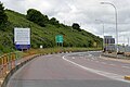
 The Road Into Rosslare Europort - geograph.org.uk - 5319225.jpg 640 × 427; 363 KB
-
 Topaz Filling Station, St Patrick's Road - geograph.org.uk - 5320162.jpg 640 × 427; 353 KB
-
 Train departing from Rosslare harbour - geograph.org.uk - 4607003.jpg 1,799 × 1,098; 146 KB
-
 Train, Ballygeary, Rosslare (1) - geograph.org.uk - 2731135.jpg 640 × 376; 99 KB
-
 Train, Rosslare Harbour (1988) - geograph.org.uk - 3266579.jpg 640 × 358; 68 KB
-
 View Over Rosslare Europort - geograph.org.uk - 5319765.jpg 640 × 481; 423 KB
-
 Waiting for the ferry, Rosslare Harbour - geograph.org.uk - 6743606.jpg 1,024 × 764; 130 KB
-

-
 Water Tower, Rosslare Harbour - geograph.org.uk - 5320718.jpg 640 × 427; 343 KB
-
 Beach near Hilltown - geograph.org.uk - 531511.jpg 581 × 640; 123 KB
-
 New build houses - geograph.org.uk - 565805.jpg 640 × 480; 75 KB


_-_geograph.org.uk_-_3353129.jpg)
_-_geograph.org.uk_-_3353134.jpg)


.jpg)


_-_geograph.org.uk_-_5320160.jpg)


_-_geograph.org.uk_-_2731135.jpg)
_-_geograph.org.uk_-_3266579.jpg)


