Category:Rotgundspitze
mountain in the Allgäu Alps in Tyrol and Bavaria  | |||||
| Upload media | |||||
| Instance of | |||||
|---|---|---|---|---|---|
| Location |
| ||||
| Mountain range | |||||
| Topographic prominence |
| ||||
| Topographic isolation |
| ||||
| Elevation above sea level |
| ||||
 | |||||
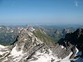
Deutsch: Die Rotgundspitze ist ein 2485 Meter hoher Berg der Allgäuer Alpen über den die Grenze zwischen Deutschland und Österreich verläuft.
English: The Rotgundspitze (2485 m) is a mountain in the Allgäu Alps (Border between Tyrol/ Austria and Bavaria/ Germany).
Media in category "Rotgundspitze"
The following 16 files are in this category, out of 16 total.
-
 Hochgundspitze Grosse Steinscharte Rotgundspitze.JPG 3,264 × 2,448; 4.17 MB
-
 Hochgundspitze Grosse Steinscharte Rotgundspitze02.JPG 3,264 × 2,448; 4.76 MB
-
 Hochgundspitze Rotgundspitze Grosse Steinscharte.JPG 2,797 × 1,686; 2.91 MB
-
 Kleiner Rappensee Linkerskopf.jpg 4,000 × 3,000; 4.77 MB
-
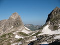
 Linkerskopf Rotgundspitze Hochgundspitze.jpg 4,000 × 3,000; 4.95 MB
-
 Linkerskopf Rotgundspitze reflection in Kleiner Rappensee.JPG 3,264 × 2,448; 4.17 MB
-
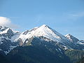
 Linkerskopf Rotgundspitze.jpg 1,430 × 950; 178 KB
-
 Linkerskopf vom Einoedberg.jpg 964 × 640; 120 KB
-
 Linkerskopf.JPG 3,264 × 2,448; 3.11 MB
-
 Rappensee en Rappenseehutte.JPG 3,888 × 2,592; 5.14 MB
-
 Rappenseehütte Kleiner Rappensee Rotgundspitze.jpg 4,000 × 3,000; 4.91 MB
-
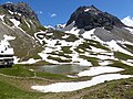
 Rappenseehütte Kleiner Rappensee.jpg 4,000 × 3,000; 4.69 MB
-
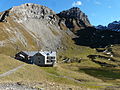 Rappenseehütte mit Linkerskopf.jpg 3,264 × 2,448; 3.75 MB
-
 Rappenseehütte.jpg 3,264 × 2,448; 3.72 MB
-
 Rotgundspitze Linkerskopf.JPG 3,264 × 2,448; 3.34 MB
-
 Rothgundspitze - panoramio.jpg 2,592 × 3,872; 981 KB


