Category:Rothorn-Hütte
| Object location | | View all coordinates using: OpenStreetMap |
|---|
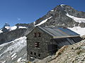
mountain hut in Valais  | |||||
| Upload media | |||||
| Instance of | |||||
|---|---|---|---|---|---|
| Location | Zermatt, Visp District, Valais, Switzerland | ||||
| Owned by | |||||
| Inception |
| ||||
| Mountain range | |||||
| Elevation above sea level |
| ||||
| official website | |||||
 | |||||
Media in category "Rothorn-Hütte"
The following 18 files are in this category, out of 18 total.
-
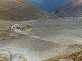 Aufstieg zur Rothornhütte.jpg 4,000 × 3,000; 4.62 MB
-
 Aufstiegsweg vom Hotel du Trift zur Rothornhütte.jpg 3,000 × 4,000; 4.49 MB
-
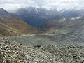 Blick von Rothornhütte.jpg 4,000 × 3,000; 4.85 MB
-
 Rothornhuette abend 20130820.jpg 4,608 × 3,456; 2.67 MB
-
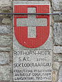
 Rothornhuette schild 20130820.jpg 480 × 640; 123 KB
-
 Rothornhuette wellenkuppe 20130820.jpg 4,608 × 3,456; 4.17 MB
-
 Rothornhütte 2015.jpg 4,000 × 3,000; 4.83 MB
-
 Rothornhütte Hüttenschild.jpg 3,000 × 4,000; 4.76 MB
-
 Rothornhütte mit Triftgletscher.jpg 4,000 × 3,000; 4.93 MB
-
 Rothornhütte vom Berggasthaus Trift (Ausschnitt).jpg 4,000 × 3,000; 5.3 MB
-
 Rothornhütte vom Berggasthaus Trift.jpg 4,000 × 3,000; 4.7 MB
-
 Rothornhütte vom Wisshorn.jpg 4,000 × 3,000; 4.89 MB
-
 Rothornhütte Winterraum.jpg 4,000 × 3,000; 4.76 MB
-
 Rothornhütte.jpg 1,200 × 900; 454 KB
-
 Triftbach Mäander.jpg 4,000 × 3,000; 4.62 MB
-
 Wisshorn Gipfelpanorama.jpg 39,424 × 2,848; 29.69 MB
-
 Zinalrothorn Rothornhütte.jpg 3,000 × 4,000; 4.84 MB
-
 Zinalrothorn vom Wisshorn.jpg 4,000 × 3,000; 4.89 MB


.jpg)


