Category:Rottweil
town in the district of Rottweil, Baden-Württemberg, Germany | |||||
| Upload media | |||||
| Instance of |
| ||||
|---|---|---|---|---|---|
| Location |
| ||||
| Located in or next to body of water | |||||
| Head of government |
| ||||
| Inception |
| ||||
| Population |
| ||||
| Area |
| ||||
| Elevation above sea level |
| ||||
| official website | |||||
 | |||||
Subcategories
This category has the following 24 subcategories, out of 24 total.
- Quality images of Rottweil (14 F)
B
C
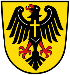
- Coats of arms of Rottweil (19 F)
E
F
L
M
N
P
R
- M1061 Rottweil (ship, 1993) (15 F)
- Rottweiler Dampftage (2 F)
S
- Stadtarchiv Rottweil (1 F)
T
Media in category "Rottweil"
The following 103 files are in this category, out of 103 total.
-
Flagge Rottweil.svg 600 × 1,500; 14 KB
-
Karte rottweil.png 188 × 235; 5 KB
-
Querflagge Rottweil.svg 1,000 × 600; 14 KB
-
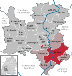
Rottweil in RW.svg 436 × 459; 648 KB
-
"Wanderweg" im Eschachtal - panoramio (1).jpg 2,266 × 1,696; 2.94 MB
-
"Wanderweg" im Eschachtal - panoramio (2).jpg 2,272 × 1,704; 2.83 MB
-
"Wanderweg" im Eschachtal - panoramio.jpg 2,272 × 1,704; 2.94 MB
-
1880 Postkarte P22 Rottweil.jpg 1,703 × 1,137; 2.17 MB
-
A Forest - panoramio (1).jpg 4,000 × 3,000; 4.99 MB
-
B 462 zwischen AS Rottweil und AS Rottweil-Nord.jpg 4,824 × 2,174; 4.82 MB
-
Bahn in Rottweil - panoramio.jpg 3,070 × 2,304; 3.49 MB
-
Beim 366 km langen Neckartalradweg, Blick in das Neckartal bei Rottweil - panoramio.jpg 4,608 × 3,456; 5.8 MB
-
Beim 366 km langen Neckartalradweg, Fahrt Richtung Singen-Zürich - panoramio (1).jpg 4,562 × 3,394; 6.17 MB
-
Beim 366 km langen Neckartalradweg, Jesuskreuz - panoramio.jpg 4,598 × 3,442; 8.64 MB
-
Beim 366 km langen Neckartalradweg, Neckartal von der A81 aus gesehen - panoramio.jpg 3,008 × 1,459; 1.85 MB
-
Beim 366 km langen Neckartalradweg, Rottweil - panoramio.jpg 4,571 × 2,273; 4.63 MB
-
Blick auf Rottweil.jpg 2,272 × 1,704; 1.22 MB
-
Blick vom Albvorland auf die Alb - panoramio.jpg 4,536 × 2,304; 4.17 MB
-
Blick über Rottweil zur Schwäbischen Alb.jpg 5,568 × 3,712; 13.32 MB
-
Bockshof Rottweil.JPG 4,000 × 3,000; 5.2 MB
-
Butterblumen - panoramio.jpg 4,588 × 3,430; 7.23 MB
-
Cable Reels - panoramio.jpg 4,000 × 3,000; 4.78 MB
-
Cables And Wires - panoramio.jpg 3,000 × 4,000; 3.72 MB
-
Climatediagram-metric-english-Rottweil-Germany-1961-1990.png 1,000 × 685; 72 KB
-
Der Goldene Rottweiler - panoramio.jpg 3,000 × 4,000; 3.72 MB
-
Eschachtal - panoramio (2).jpg 2,272 × 1,704; 1.89 MB
-
Fasnetsparty Rottweil 17022015.png 3,620 × 2,715; 22.57 MB
-
Felsen - panoramio (6).jpg 4,558 × 3,388; 8.02 MB
-
Fischpass am Neckarweg in Rottweil - panoramio (1).jpg 4,608 × 3,456; 7.55 MB
-
Fischpass am Neckarweg in Rottweil - panoramio (2).jpg 4,606 × 3,452; 11.39 MB
-
Flugplatz Rottweil - panoramio.jpg 2,048 × 1,536; 479 KB
-
Flugplatz Rottweil - Zepfenhan.jpg 3,843 × 2,783; 4.11 MB
-
FRISTO Getränkemarkt in Rottweil.png 210 × 148; 44 KB
-
Grenzstein am Wanderweg - panoramio (1).jpg 4,608 × 3,456; 10.04 MB
-
Grenzstein am Wanderweg - panoramio.jpg 4,526 × 3,344; 9.27 MB
-
Hanna Levy Henri Wölfflin 1936 Titel.jpg 1,857 × 2,784; 732 KB
-
Hardthauser See - panoramio.jpg 4,602 × 3,448; 9.28 MB
-
Hinter dem Linsenbergweiher - panoramio.jpg 3,075 × 2,304; 3.35 MB
-
Jungbrunnental - panoramio.jpg 4,584 × 3,424; 8.69 MB
-
Klimadiagramm-metrisch-deutsch-Rottweil-Deutschland-1961-1990.png 1,000 × 685; 72 KB
-
Landappbw 100743 1817 Rottweiler Türme Rottweil.jpg 1,000 × 750; 167 KB
-
Landappbw 1012305 1820 Heilig-Kreuz-Münster Rottweil.jpg 2,600 × 1,902; 1,020 KB
-
Landappbw 1012309 1820 Heilig-Kreuz-Münster Rottweil.jpg 2,600 × 1,788; 945 KB
-
Landappbw 1012310 1820 Heilig-Kreuz-Münster Rottweil.jpg 1,819 × 2,600; 754 KB
-
Landappbw 289403 1818 Bockshof.jpg 1,280 × 960; 434 KB
-
Landappbw 409958 1817 Rottweil Rottweil.jpg 1,280 × 1,175; 90 KB
-
Landappbw 491195 1819 Blick aus dem Museumsgarten Rottweil.jpg 960 × 1,280; 247 KB
-
Landappbw 491267 1817 Blick über die Dächer Rottweil.jpg 960 × 1,280; 81 KB
-
Landappbw 611938 1822 Kami Kitchen Rottweil.jpg 1,920 × 1,440; 332 KB
-
Landappbw 77138 1823 Lok 502988 Rottweil.jpg 1,500 × 1,000; 181 KB
-
Landappbw 94815 1817 Rottweiler Türme Rottweil.jpg 1,000 × 750; 151 KB
-
LASB K Hellwig 0665.jpg 7,020 × 4,804; 7.91 MB
-
Nach dem Linsenbergweiher - panoramio.jpg 4,590 × 2,304; 5.41 MB
-
Naturfreundehaus Jungbrunnen - panoramio.jpg 4,608 × 3,456; 5.97 MB
-
Neckar-Baar-Jakobusweg - panoramio.jpg 2,272 × 1,704; 2.4 MB
-
Neckarweg in Rottweil - panoramio (2).jpg 4,608 × 3,456; 13.63 MB
-
Neckarweg in Rottweil - panoramio (6).jpg 4,608 × 3,456; 6.62 MB
-
Neue Rottweiler Zeitung Logo.svg 775 × 259; 11 KB
-
Org e370525c4a8f8aab 1592164604000-1.jpg 8,192 × 4,096; 11.92 MB
-
Oswald-von-Nell-Breuning-Schule Rottweil Schild.jpg 1,989 × 1,492; 794 KB
-
Rapsfeld - panoramio (3).jpg 4,604 × 2,304; 5 MB
-
Roofs - panoramio (16).jpg 3,852 × 2,793; 3.27 MB
-
Rottweil - panoramio (1).jpg 2,256 × 1,496; 1.22 MB
-
Rottweil 2020 -- by-RaBoe 021.jpg 4,288 × 2,848; 13.45 MB
-
Rottweil 2020 -- by-RaBoe 029.jpg 4,288 × 2,848; 9.59 MB
-
Rottweil 27.04.2013 10-03-30.jpg 4,045 × 2,688; 6.43 MB
-
Rottweil 27.04.2013 10-10-40.jpg 4,042 × 2,686; 5.68 MB
-
Rottweil 27.04.2013 15-12-26.jpg 4,672 × 3,104; 7.92 MB
-
Rottweil 28.04.2013 10-06-02.jpg 2,829 × 4,258; 10.33 MB
-
Rottweil Germany Feb 21, 2012, 10-55 AM.56 edit (32600442381).jpg 1,277 × 1,458; 327 KB
-
Rottweil Germany Feb 21, 2012, 11-13 AM.01 edit (32573087232).jpg 1,515 × 1,773; 397 KB
-
Rottweil Nahverkehr Kraftwerk.JPG 1,944 × 2,592; 1.78 MB
-
Rottweil Narrenzunft Feb 21, 2012, 8-53 AM edit (32521428311).jpg 2,048 × 1,536; 263 KB
-
Rottweil Stadion 2.jpg 960 × 720; 63 KB
-
Rottweil Stadion Main Entrance.jpg 960 × 720; 84 KB
-
Rottweil Stadion-Main Stand.jpg 960 × 720; 66 KB
-
Rottweil Stadium-Left Seating.jpg 960 × 720; 121 KB
-
Rottweil vom Aufzugstestturm.jpg 4,000 × 3,000; 4.67 MB
-
Rottweil, Ausblick nahe Pulverturm in Richtung Neckartal und Kraftwerk.JPG 2,592 × 1,944; 1.85 MB
-
Rottweil, Baden-Württemberg - Stadtansicht (Zeno Ansichtskarten).jpg 2,202 × 1,357; 335 KB
-
Rottweil, bemooste Wasserrinne.JPG 1,944 × 2,592; 1.31 MB
-
Rottweil, gelbe Telefonzelle.JPG 1,944 × 2,592; 1.29 MB
-
Rottweil, uitzicht vanaf de Hochbrücke near het oosten IMG 4839 2023-04-30 18.12.jpg 5,346 × 3,516; 12.64 MB
-
Rottweil-Gasse-2014-gje.jpg 5,184 × 3,456; 3.56 MB
-
Rottweil-Weinstube und -Handlung-2014-gje.jpg 5,184 × 3,456; 4.27 MB
-
Route Burgen am oberen Neckar - Heidelberg-Schwarzwald-Bodensee-Weg - panoramio.jpg 4,608 × 2,304; 4.62 MB
-
RW bei der ehem Pulverfabrik.JPG 2,592 × 1,944; 1.93 MB
-
Schild Rottweil.JPG 4,368 × 2,912; 4.15 MB
-
Starzel - panoramio (1).jpg 4,608 × 3,456; 8.5 MB
-
Thyssenkrupp Testturm - Blick auf die Rottweiler Altstadt.jpg 8,162 × 3,911; 11.84 MB
-
Thyssenkrupp Testturm Sicht Altstadt Rottweil.jpg 4,032 × 3,024; 3.29 MB
-
Trees - panoramio (51).jpg 4,000 × 3,000; 4.4 MB
-
Tussen Rottweil en Villingen Dorf, koolzaadveld IMG 4918 2023-05-02 09.58.jpg 5,472 × 3,384; 16.18 MB
-
Wappen Buehlingen.png 140 × 165; 8 KB
-
Wappen Hausen ob Rottweil.png 271 × 284; 9 KB
-
Wappen Neukirch.png 277 × 291; 67 KB
-
Wappen Rottweil-Neufra.png 275 × 293; 18 KB
-
Wappen Zepfenhan.png 279 × 290; 77 KB
-
Widmung des Emmanuel H. (Ausschnitt aus Poesiealbum 1855).jpg 3,120 × 4,160; 2.93 MB
-
Wing And Winglets - panoramio.jpg 2,256 × 1,496; 439 KB


