Category:Round straw bales in the United Kingdom
Countries of Europe: Austria · Belgium · Czech Republic · France‡ · Germany · Italy · Luxembourg · Norway · Poland · Russia‡ · Spain‡ · Switzerland · United Kingdom
‡: partly located in Europe
‡: partly located in Europe
Media in category "Round straw bales in the United Kingdom"
The following 200 files are in this category, out of 547 total.
(previous page) (next page)-

-
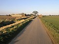
 'Private' road near The Ashes - geograph.org.uk - 1031370.jpg 640 × 463; 90 KB
-

-
 A Former View From The Train - geograph.org.uk - 214849.jpg 640 × 480; 104 KB
-

-
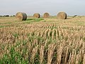
 A pause in the harvest - geograph.org.uk - 528449.jpg 640 × 480; 92 KB
-
 A Round Bale - geograph.org.uk - 217575.jpg 640 × 480; 103 KB
-

-
 A window in the weather - geograph.org.uk - 935184.jpg 640 × 480; 53 KB
-
 Across the field to Londesborough - geograph.org.uk - 1474157.jpg 640 × 480; 78 KB
-
 After the Harvest - geograph.org.uk - 1453625.jpg 640 × 480; 131 KB
-
 After the harvest - geograph.org.uk - 1522839.jpg 640 × 480; 70 KB
-
 After the harvest - geograph.org.uk - 209487.jpg 640 × 427; 45 KB
-
 After the harvest - geograph.org.uk - 910531.jpg 640 × 372; 76 KB
-
 After the harvest, East Tytherley - geograph.org.uk - 517855.jpg 640 × 480; 152 KB
-
 After the harvest, Lund - geograph.org.uk - 1444856.jpg 475 × 640; 185 KB
-
 After the Harvest, Saxby All Saints - geograph.org.uk - 936494.jpg 640 × 425; 75 KB
-
 After the harvest. - geograph.org.uk - 537359.jpg 640 × 479; 85 KB
-
 After the harvest^ - geograph.org.uk - 1383745.jpg 640 × 480; 61 KB
-
 All is safely gathered in - geograph.org.uk - 300489.jpg 640 × 427; 60 KB
-
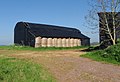
 Angus Farm - Barn - geograph.org.uk - 360588.jpg 640 × 480; 124 KB
-
 Animal Bedding - geograph.org.uk - 378866.jpg 640 × 388; 47 KB
-
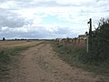
 Annumhills Road - geograph.org.uk - 1214980.jpg 640 × 480; 53 KB
-

-

-
 Ashton Hayes - Straw and Silage.jpg 640 × 483; 111 KB
-
 Bales of wheat straw, Laughton, Lincs - geograph.org.uk - 227505.jpg 640 × 480; 295 KB
-
 Atkinsons Wood Farm, From the West - geograph.org.uk - 215608.jpg 640 × 384; 85 KB
-
 Autumn Colours at Ballathie - geograph.org.uk - 74166.jpg 640 × 480; 121 KB
-
 Autumn straw bales near Monymusk - geograph.org.uk - 44966.jpg 640 × 404; 117 KB
-
 Avoiding Action Was Taken^ - geograph.org.uk - 237414.jpg 546 × 640; 346 KB
-
 Awaiting Collection - geograph.org.uk - 218476.jpg 640 × 480; 98 KB
-
 Awaiting the end of the season clean - geograph.org.uk - 609305.jpg 640 × 480; 92 KB
-
 Badger Lane - geograph.org.uk - 285955.jpg 640 × 481; 101 KB
-
 Bale of straw - geograph.org.uk - 524235.jpg 640 × 426; 140 KB
-
 Bale stack off Newlands Lane - geograph.org.uk - 1472820.jpg 640 × 480; 48 KB
-

-
 Baled straw - geograph.org.uk - 41490.jpg 640 × 367; 77 KB
-
 Baled straw packaged at Chillenden Kent England.jpg 3,000 × 2,000; 5.45 MB
-
 Baled up straw - geograph.org.uk - 970070.jpg 640 × 426; 62 KB
-
 Baler operating near Pikendale Plantation - geograph.org.uk - 542422.jpg 640 × 426; 116 KB
-
 Bales along Newlands Road (geograph 5565417).jpg 800 × 476; 100 KB
-
 Bales and clouds - geograph.org.uk - 213836.jpg 640 × 480; 70 KB
-

-
 Bales at High Barn - geograph.org.uk - 1542962.jpg 640 × 512; 110 KB
-
 Bales at Houghton - geograph.org.uk - 934029.jpg 640 × 638; 218 KB
-
 Bales at Manor Farm, Yapham - geograph.org.uk - 255541.jpg 640 × 466; 154 KB
-

-
 Bales by the Woodland - geograph.org.uk - 969589.jpg 640 × 427; 127 KB
-
 Bales in a shaft of sunshine - geograph.org.uk - 950547.jpg 640 × 480; 74 KB
-
 Bales in field - geograph.org.uk - 540741.jpg 640 × 480; 99 KB
-
 Bales in front of Avenue Wood from B1252 - geograph.org.uk - 253093.jpg 640 × 426; 253 KB
-
 Bales like golden Rolos - geograph.org.uk - 966686.jpg 640 × 412; 126 KB
-
 Bales near Chilton Cantelo - geograph.org.uk - 541312.jpg 640 × 480; 111 KB
-
 Bales near East Barns - geograph.org.uk - 87681.jpg 640 × 427; 126 KB
-
 Bales near Great Ouseburn - geograph.org.uk - 525684.jpg 640 × 478; 152 KB
-
 Bales near Mains of Moyness - geograph.org.uk - 257419.jpg 640 × 480; 165 KB
-
 Bales next to the Cowthorpe road - geograph.org.uk - 249091.jpg 640 × 479; 99 KB
-
 Bales next to track to Horn Bank Farm - geograph.org.uk - 228030.jpg 640 × 480; 116 KB
-
 Bales of straw - geograph.org.uk - 1551532.jpg 640 × 459; 193 KB
-
 Bales of straw - geograph.org.uk - 340818.jpg 640 × 406; 74 KB
-
 Bales of straw - geograph.org.uk - 525136.jpg 640 × 426; 149 KB
-
 Bales of Straw Ready To Go - geograph.org.uk - 536709.jpg 640 × 480; 87 KB
-
 Bales of straw, Mareham on the Hill - geograph.org.uk - 560289.jpg 640 × 480; 101 KB
-
 Bales of wheat straw, Sutton, Cambs - geograph.org.uk - 227322.jpg 640 × 480; 287 KB
-
 Bales on Saxby Wolds - geograph.org.uk - 544035.jpg 640 × 426; 112 KB
-
 Bales on the Scoreby estate - geograph.org.uk - 1429638.jpg 640 × 480; 107 KB
-
 Bales on Trevose Head.jpg 3,704 × 2,623; 4.14 MB
-
 Bales, Upper Obney - geograph.org.uk - 973607.jpg 640 × 359; 97 KB
-
 Baling - geograph.org.uk - 444558.jpg 640 × 426; 107 KB
-
 Baling straw - geograph.org.uk - 499002.jpg 640 × 480; 111 KB
-
 Baling the Straw - geograph.org.uk - 1469143.jpg 640 × 480; 62 KB
-
 Baling time - geograph.org.uk - 515414.jpg 640 × 472; 443 KB
-
 Bankside Farm - geograph.org.uk - 334612.jpg 640 × 480; 82 KB
-

-
 Barn of straw bales, Shrawley - geograph.org.uk - 140086.jpg 640 × 426; 127 KB
-
 Barn, Glebe Farm (geograph 4796642).jpg 640 × 446; 69 KB
-
 Barns near Clapham - geograph.org.uk - 797924.jpg 640 × 438; 76 KB
-
 Beilsbeck Farm Near Market Weighton - geograph.org.uk - 234193.jpg 640 × 426; 142 KB
-
 Ben Rinnes - geograph.org.uk - 3605.jpg 628 × 464; 252 KB
-
 Beverley 20 at Model Farm (geograph 5101371).jpg 1,600 × 1,065; 708 KB
-
 BIG bales - geograph.org.uk - 297896.jpg 640 × 480; 131 KB
-
 Birkenside - geograph.org.uk - 944523.jpg 640 × 427; 84 KB
-
 Bishop Burton Wold - geograph.org.uk - 99927.jpg 640 × 480; 160 KB
-
 Black cat sitting on a round straw bale (UK, 2008; cropped 2023).jpg 897 × 897; 434 KB
-
 Black cat sitting on a round straw bale.jpg 2,304 × 3,072; 2.91 MB
-
 Blocked Field Entrance - geograph.org.uk - 1563428.jpg 640 × 480; 61 KB
-
 Bonfield Farm - geograph.org.uk - 41165.jpg 640 × 480; 110 KB
-
 Bradford Peverell, bales in field - geograph.org.uk - 983891.jpg 640 × 480; 61 KB
-

-
 Bredon Hill from Little Comberton - geograph.org.uk - 39691.jpg 640 × 480; 126 KB
-
 Bridleway and Bales - geograph.org.uk - 197473.jpg 640 × 480; 91 KB
-
 Bridleway Little Catwick.jpg 640 × 480; 57 KB
-
 Brigmerston Down - geograph.org.uk - 426486.jpg 640 × 480; 176 KB
-
 Brindleys Plantation - geograph.org.uk - 129066.jpg 640 × 480; 94 KB
-
 Bringing in the Bales - geograph.org.uk - 2058589.jpg 1,000 × 750; 645 KB
-
 Brooklands Farm - geograph.org.uk - 180427.jpg 640 × 480; 35 KB
-
 Burford banner harvest, stubble fields and straw bales.jpg 3,043 × 435; 1.49 MB
-
 Burford, Oxfordshire, August 2006 harvest, stubble fields and straw bales 1.jpg 3,159 × 2,096; 6.79 MB
-
 Burford, Oxfordshire, August 2006 harvest, stubble fields and straw bales 2.jpg 2,532 × 2,202; 6.49 MB
-
 Burnbutts Lane - geograph.org.uk - 1044326.jpg 640 × 427; 367 KB
-
 Burnt Farm near Goffs Oak - geograph.org.uk - 41620.jpg 638 × 375; 114 KB
-
 By Kenly Law - geograph.org.uk - 231864.jpg 467 × 640; 60 KB
-
 Charmouth, farmer at work - geograph.org.uk - 503853.jpg 640 × 429; 53 KB
-
 Cherry Brook Farmhouse - geograph.org.uk - 1468546.jpg 640 × 480; 110 KB
-
 Circular Straw Bales, Broadway - geograph.org.uk - 52555.jpg 640 × 480; 83 KB
-
 Collecting bales of straw - geograph.org.uk - 1500185.jpg 640 × 480; 85 KB
-
 Collecting Straw Bales - geograph.org.uk - 237394.jpg 640 × 373; 213 KB
-
 Collecting the animal feed - geograph.org.uk - 1781291.jpg 640 × 427; 193 KB
-
 Collecting the hay - geograph.org.uk - 1781282.jpg 640 × 427; 156 KB
-
 Combine Harvester in Field - geograph.org.uk - 385537.jpg 640 × 425; 156 KB
-

-

-
 Compton Down harvest - geograph.org.uk - 127337.jpg 640 × 421; 81 KB
-
 Cottage Farm - geograph.org.uk - 1563758.jpg 640 × 480; 69 KB
-
 Cottam Grange - geograph.org.uk - 256948.jpg 640 × 480; 102 KB
-
 Crawberry Dale - geograph.org.uk - 481133.jpg 640 × 416; 72 KB
-
 Cromar - geograph.org.uk - 237393.jpg 640 × 427; 269 KB
-
 Damp field north of Yatton - geograph.org.uk - 1180799.jpg 640 × 480; 106 KB
-
 Damp straw^ - geograph.org.uk - 1008605.jpg 640 × 467; 55 KB
-
 Deer running across farmland - geograph.org.uk - 237774.jpg 640 × 437; 78 KB
-
 Distant Bales - geograph.org.uk - 63884.jpg 640 × 461; 117 KB
-
 Disused railway line. - geograph.org.uk - 537351.jpg 640 × 433; 111 KB
-
 Dog Kennel Lane bridleway - geograph.org.uk - 687653.jpg 640 × 471; 198 KB
-
 Earls Hall Haystacks^ - geograph.org.uk - 538552.jpg 640 × 426; 127 KB
-
 East Field (geograph 2723902).jpg 1,024 × 768; 109 KB
-
 Ellerton Common - geograph.org.uk - 308367.jpg 640 × 480; 112 KB
-
 English Countryside Shrewton United Kingdom Landscape Photography (168525949).jpeg 2,000 × 1,125; 968 KB
-
 Fallen bales on Figheldean Field - geograph.org.uk - 362423.jpg 640 × 480; 99 KB
-
 Farm at North End - geograph.org.uk - 45874.jpg 640 × 480; 84 KB
-
 Farm Building, Newton - geograph.org.uk - 1603606.jpg 640 × 480; 78 KB
-
 Farm Building, West of Mappleton - geograph.org.uk - 1467234.jpg 640 × 457; 61 KB
-
 Farm Buildings, Church Lane - geograph.org.uk - 1215314.jpg 640 × 480; 98 KB
-
 Farm Buildings, Goodmanham Wold - geograph.org.uk - 1563876.jpg 640 × 480; 48 KB
-
 Farm entrance, near Bolton (E Yorks) (geograph 5746036).jpg 640 × 480; 407 KB
-

-

-
 Farm of Cursiter, Grimbister - geograph.org.uk - 235363.jpg 640 × 480; 76 KB
-
 Farm on Vann Lane - geograph.org.uk - 242885.jpg 640 × 480; 132 KB
-
 Farm on Well Lane, Willerby - geograph.org.uk - 407724.jpg 640 × 401; 234 KB
-
 Farm Track - geograph.org.uk - 54018.jpg 640 × 480; 81 KB
-
 Farm track near Winestead - geograph.org.uk - 1451720.jpg 640 × 480; 62 KB
-
 Farmland - Bewholme, Seaton Road - geograph.org.uk - 41160.jpg 640 × 480; 127 KB
-
 Farmland and Machinery near Littleton Drew - geograph.org.uk - 42842.jpg 640 × 480; 179 KB
-
 Farmland at SE895700 - geograph.org.uk - 203395.jpg 640 × 480; 122 KB
-
 Farmland at TA215415 - geograph.org.uk - 69410.jpg 640 × 480; 111 KB
-
 Farmland below Marridge Hill - geograph.org.uk - 988265.jpg 640 × 480; 133 KB
-
 Farmland below Rivar Down - geograph.org.uk - 1014749.jpg 640 × 480; 127 KB
-
 Farmland in early Autumn, Aberdeenshire - geograph.org.uk - 44503.jpg 640 × 426; 118 KB
-
 Farmland in Grittleton - geograph.org.uk - 43188.jpg 640 × 480; 129 KB
-
 Farmland near Mappleton - geograph.org.uk - 69424.jpg 640 × 480; 96 KB
-
 Farmland near Preston - geograph.org.uk - 988282.jpg 640 × 480; 143 KB
-
 Farmland near Preston - geograph.org.uk - 988288.jpg 640 × 480; 144 KB
-
 Farmland near Rampton - geograph.org.uk - 211321.jpg 640 × 427; 48 KB
-
 Farmland near Sigglesthorne Grange - geograph.org.uk - 1463707.jpg 640 × 480; 76 KB
-
 Farmland next to Allexton Field Road - geograph.org.uk - 538085.jpg 640 × 414; 95 KB
-
 Farmland North of Atwick - geograph.org.uk - 74739.jpg 640 × 480; 136 KB
-
 Farmland north of Lund - geograph.org.uk - 1445760.jpg 640 × 515; 193 KB
-
 Farmland on the outskirts of Bishop Wilton (geograph 3678721).jpg 640 × 427; 97 KB
-
 Farmland South of Burshill - geograph.org.uk - 75117.jpg 640 × 480; 87 KB
-
 Farmland, Haxton - geograph.org.uk - 909780.jpg 640 × 480; 149 KB
-
 Farmland, Inkpen - geograph.org.uk - 1575412.jpg 640 × 480; 171 KB
-
 Farmland, Shalbourne - geograph.org.uk - 1014751.jpg 640 × 480; 152 KB
-
 Farmland, Weatherhill Farm - geograph.org.uk - 1552264.jpg 640 × 480; 71 KB
-
 Farmland, Winterbourne Stoke - geograph.org.uk - 975066.jpg 640 × 480; 167 KB
-
 Farmland, Winterbourne Stoke - geograph.org.uk - 975211.jpg 640 × 480; 169 KB
-
 Farmland,Winterbourne Stoke - geograph.org.uk - 973860.jpg 640 × 480; 146 KB
-

-
 Field at Harvesttime - geograph.org.uk - 1439148.jpg 624 × 417; 152 KB
-
 Field by Dairsie Mains - geograph.org.uk - 229880.jpg 640 × 424; 99 KB
-
 Field by the estuary embankment - geograph.org.uk - 1443175.jpg 640 × 433; 55 KB
-
 Field Near Honey Hill - geograph.org.uk - 252913.jpg 640 × 426; 265 KB
-
 Field Near Hotham Looking East - geograph.org.uk - 235417.jpg 640 × 426; 134 KB
-
 Field near Knowle - geograph.org.uk - 1393534.jpg 640 × 480; 166 KB
-
 Field near Tillytoghills - 2 - geograph.org.uk - 1506418.jpg 640 × 428; 123 KB
-
 Field north of Lund - geograph.org.uk - 1445759.jpg 640 × 465; 185 KB
-
 Field of hay at Manning's Farm - geograph.org.uk - 244499.jpg 640 × 391; 88 KB
-
 Field of round straw bales - geograph.org.uk - 120044.jpg 640 × 484; 94 KB
-

-
 Field West of Cleveland Road - geograph.org.uk - 105076.jpg 640 × 479; 55 KB
-
 Field with bales, Pednor - geograph.org.uk - 1080245.jpg 640 × 480; 140 KB
-
 Fields south of Wood Lane - geograph.org.uk - 223635.jpg 640 × 480; 97 KB
-

-
 Free Range at TA08535185 - geograph.org.uk - 114734.jpg 640 × 480; 160 KB
-
 Fresh Rolls^ - geograph.org.uk - 30619.jpg 640 × 480; 88 KB
-
 Frodingham Hill, Hempholme - geograph.org.uk - 785228.jpg 640 × 458; 118 KB
-
 Frosted wheat - geograph.org.uk - 697135.jpg 442 × 640; 109 KB
-

-
 Gander Down, after the harvest - geograph.org.uk - 216624.jpg 640 × 427; 138 KB
-
 Gate and farmland - geograph.org.uk - 938465.jpg 640 × 426; 70 KB
-
 Gates and straw - geograph.org.uk - 648662.jpg 640 × 338; 64 KB
-
 Getting in the straw - geograph.org.uk - 1422398.jpg 640 × 480; 68 KB
-
 Glebe Farm, Withernwick - geograph.org.uk - 602976.jpg 640 × 475; 98 KB
-
 Glen Dronach, harvest - geograph.org.uk - 97257.jpg 1,900 × 1,280; 563 KB
-
 Goxhill - geograph.org.uk - 516108.jpg 640 × 480; 121 KB
-
 Goxhill Haven Outfall - Landward Side - geograph.org.uk - 541462.jpg 480 × 640; 148 KB
-
 Goxhill Haven Outfall - Landward Side - geograph.org.uk - 665620.jpg 478 × 640; 106 KB
-

-
 Harvest Bales - geograph.org.uk - 219455.jpg 640 × 480; 122 KB
-
 Harvest Bales - geograph.org.uk - 222596.jpg 640 × 480; 149 KB


.jpg)


.jpg)


.jpg)


.jpg)


.jpg)

.jpeg)


_(geograph_5746036).jpg)


.jpg)


