Category:Routes départementales in Savoie
Departments of Metropolitan France: Ain [01] · Aisne [02] · Allier [03] · Alpes-de-Haute-Provence [04] · Hautes-Alpes [05] · Alpes-Maritimes [06] · Ardennes [08] · Ariège [09] · Aube [10] · Aude [11] · Aveyron [12] · Bouches-du-Rhône [13] · Calvados [14] · Cantal [15] · Charente [16] · Charente-Maritime [17] · Cher [18] · Corrèze [19] · Corse-du-Sud [2A]† · Haute-Corse [2B]† · Côte-d’Or [21] · Côtes-d'Armor [22] · Creuse [23] · Dordogne [24] · Doubs [25] · Drôme [26] · Eure [27] · Eure-et-Loir [28] · Finistère [29] · Gard [30] · Haute-Garonne [31] · Gers [32] · Gironde [33] · Hérault [34] · Ille-et-Vilaine [35] · Indre [36] · Indre-et-Loire [37] · Isère [38] · Jura [39] · Landes [40] · Loir-et-Cher [41] · Loire [42] · Haute-Loire [43] · Loire-Atlantique [44] · Loiret [45] · Lot [46] · Lot-et-Garonne [47] · Lozère [48] · Manche [50] · Marne [51] · Haute-Marne [52] · Mayenne [53] · Meurthe-et-Moselle [54] · Meuse [55] · Morbihan [56] · Moselle [57] · Nièvre [58] · Nord [59] · Oise [60] · Orne [61] · Pas-de-Calais [62] · Puy-de-Dôme [63] · Pyrénées-Atlantiques [64] · Hautes-Pyrénées [65] · Pyrénées-Orientales [66] · Bas-Rhin [67] · Haut-Rhin [68] · departmental district of the Rhône [69] · Haute-Saône [70] · Saône-et-Loire [71] · Sarthe [72] · Savoie [73] · Haute-Savoie [74] · Paris [75] · Seine-Maritime [76] · Seine-et-Marne [77] · Yvelines [78] · Deux-Sèvres [79] · Somme [80] · Tarn [81] · Var [83] · Vaucluse [84] · Vendée [85] · Vienne [86] · Haute-Vienne [87] · Vosges [88] · Yonne [89] · Territoire de Belfort [90] · Essonne [91] · Hauts-de-Seine [92] · Val-de-Marne [94] · Val-d'Oise [95]
Overseas departments and regions: Guadeloupe [971] · Martinique [972] · French Guiana [973] · Réunion [974]
Overseas departments and regions: Guadeloupe [971] · Martinique [972] · French Guiana [973] · Réunion [974]
Media in category "Routes départementales in Savoie"
The following 200 files are in this category, out of 228 total.
(previous page) (next page)-
 Challes les Eaux 2 (élargi).jpg 1,984 × 1,488; 688 KB
-
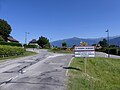
 Entrée Challes-les-Eaux (73).JPG 5,152 × 3,864; 5.9 MB
-
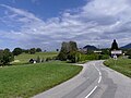
 Panneau Saint-André (Les Marches) 2011.JPG 2,048 × 1,536; 1.55 MB
-
 Panneau Viviers-du-Lac au matin (été 2016).JPG 3,043 × 2,281; 3.8 MB
-
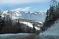
 Col des Égaux.jpg 2,048 × 1,536; 1.2 MB
-
 Entrée Savoie.jpg 1,984 × 1,488; 560 KB
-
 Aillon-le-Jeune (Savoie).JPG 2,048 × 1,536; 923 KB
-
 Route des Grandes Alpes (Bourg St Maurice).JPG 2,048 × 1,536; 1.22 MB
-
 Col des Aravis (2011).JPG 2,048 × 1,536; 418 KB
-
 Autoroute A43 près d'Orelle (septembre 2024).JPG 2,902 × 2,175; 4.31 MB
-
 Berges du Lac du Bourget en début d'été (juin 2022).JPG 3,108 × 2,292; 4.59 MB
-
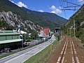
 Centrale La Christine et RD1006 en Maurienne (décembre 2022).JPG 3,048 × 2,244; 4.41 MB
-
 Centre du village de Thoiry dans les Bauges (juillet 2024).JPG 3,108 × 2,336; 4.96 MB
-
 Champ de tabac dans le Val Coisin en automne (octobre 2024).JPG 3,204 × 2,396; 5.25 MB
-
 Chef-lieu du Bois au-dessus d'Aigueblanche (juillet 2024).JPG 2,844 × 2,080; 4.24 MB
-
 Chef-lieu et église de Cruet (octobre 2021).JPG 2,988 × 2,336; 4.17 MB
-
 Col de Champ-Laurent et RD 25 (octobre 2023).JPG 3,264 × 2,448; 4.27 MB
-
 Col de Couz en direction de Chambéry en soirée (juillet 2022).JPG 2,964 × 2,184; 3.03 MB
-
 Col de Tamié et RD 201C (juin 2022).JPG 3,264 × 2,448; 4.33 MB
-
 Col du Petit-St-Bernard après son ouverture direction Italie (juin 2024).JPG 4,000 × 3,000; 7.06 MB
-
 Crue Lac du Bourget 2023 - RD 1201A fermée au Bourget-du-Lac.JPG 3,264 × 2,448; 5.46 MB
-
 Crue Lac du Bourget 2023 - RD 1201A fermée à Viviers-du-Lac.JPG 3,264 × 2,448; 5.38 MB
-
 Crue Lac du Bourget 2023 - RD 1201A inondée aux Mottets (1).JPG 3,844 × 2,812; 7.05 MB
-
 Crue Lac du Bourget 2023 - RD 1201A inondée aux Mottets (2).JPG 3,012 × 2,268; 5.85 MB
-
 Crue Lac du Bourget 2023 - RD 1201A pendant la décrue (1).JPG 3,971 × 2,960; 7.25 MB
-
 Crue Lac du Bourget 2023 - RD 1201A pendant la décrue (2).JPG 4,000 × 3,000; 7.16 MB
-
 Crue Lac du Bourget 2023 - RD 17B à Terre-Nue à Viviers (1).JPG 4,000 × 3,000; 6.48 MB
-
 Crue Lac du Bourget 2023 - RD 17B à Terre-Nue à Viviers (4).JPG 4,000 × 3,000; 7.39 MB
-
 Crue Lac du Bourget 2023 - RD 17B à Terre-Nue à Viviers (5).JPG 4,000 × 3,000; 6.57 MB
-
 Crue Lac du Bourget 2023 - RD 17B à Terre-Nue à Viviers (6).JPG 4,000 × 3,000; 7.74 MB
-
 Crue Lac du Bourget 2023 - RD 17B à Terre-Nue.JPG 3,264 × 2,448; 5.14 MB
-
 Crue Lac du Bourget 2023 - Rond-point de Terre-Nue.JPG 2,018 × 1,497; 2.7 MB
-
 Cyclistes sur la RD 201 aux Marches en hiver (février 2022).JPG 3,264 × 2,448; 4.73 MB
-
 D1090 in Montvalezan 03.jpg 5,054 × 2,027; 8.75 MB
-
 D1090 in Montvalezan 04.jpg 6,656 × 3,313; 19.44 MB
-
 D1090 in Seez 01.jpg 3,272 × 1,856; 5.92 MB
-
 D1090 in Seez 02.jpg 4,069 × 2,523; 12.17 MB
-
 Entrée au Grand-Gondon à Bourg-St-Maurice (février 2022).JPG 3,216 × 2,388; 3.26 MB
-
 Entrée au sud de St-Pierre-d'Albigny (été 2021).JPG 3,264 × 2,448; 4.96 MB
-
 Entrée au Villaret-d'Étable depuis La Rochette (septembre 2021).JPG 3,264 × 2,448; 3.65 MB
-
 Entrée Chamoux-sur-Gelon depuis Champ-Laurent (octobre 2023).JPG 3,056 × 2,324; 5.09 MB
-
 Entrée nord de Chamousset au matin (juillet 2021).JPG 3,020 × 2,272; 4.52 MB
-
 Entrée ouest de Coise en soirée (octobre 2024).JPG 3,148 × 2,364; 5.09 MB
-
 Entrée ouest de Montailleur à midi (août 2021).JPG 3,264 × 2,448; 5.11 MB
-
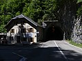
 Entrée ouest du Tunnel des Échelles en soirée (juillet 2022).JPG 2,896 × 2,104; 5.15 MB
-
 Entrée Village de La Table en Savoie (octobre 2023).JPG 2,048 × 1,536; 1.78 MB
-
 Entrée à Bonneval-sur-Arc sous la neige en février 2023.JPG 4,000 × 3,000; 7.04 MB
-
 Entrée à Grésy-sur-Aix sur la RD 1201 (été 2021).JPG 3,000 × 2,268; 4.07 MB
-
 Entrée à Mognard à Entrelacs (septembre 2021).JPG 2,022 × 1,509; 2.24 MB
-
 Entrée à Planaise en fin d'après-midi en été (juillet 2021).JPG 3,212 × 2,400; 5.16 MB
-
 Extrémité de la RD 87 au refuge de Rosuel (août 2022).JPG 3,136 × 2,352; 4.8 MB
-
 Extrémité RD 1006 entre Italie et Mont-Cenis (septembre 2024).JPG 3,936 × 2,936; 7.35 MB
-
 Extrémité RD 1006 sous le col du Mont-Cenis (septembre 2024).JPG 3,172 × 2,356; 5.39 MB
-
 Hameau de l'Esseillon enneigé (janvier 2023).JPG 3,264 × 2,448; 3.46 MB
-
 Intersection des Routes d'Hauteluce et Beaufort (mars 2023).JPG 3,144 × 2,324; 4.72 MB
-
 Intersection RD 202 et RD 30 à Châteauneuf (octobre 2022).JPG 2,048 × 1,536; 2.24 MB
-
 L'Arc et la RD 1006 près de Sollières (septembre 2024).JPG 2,980 × 2,248; 4.74 MB
-
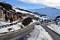
 La Rosière seen from the D119 near Arc 1600, 2008.jpg 2,831 × 1,882; 4.29 MB
-
 Lacet de la RD 914 descendant du col du Chat (juillet 2021).JPG 3,220 × 2,396; 4.8 MB
-
 Lacet de la RD 914 montant au col du Chat (juillet 2021).JPG 3,264 × 2,448; 5.71 MB
-
 Lacet RD 1006 sous barrage du Mont-Cenis (septembre 2024).JPG 2,808 × 2,080; 4.93 MB
-
 Lacet RD 25 sous Champ-Laurent (octobre 2023).JPG 3,264 × 2,448; 4.46 MB
-
 Lacet RD 25 sur Chamoux-sur-Gelon (octobre 2023).JPG 3,264 × 2,448; 4.21 MB
-
 Lacet RD 85 sous Hautecour en soirée (juin 2023).JPG 3,184 × 2,360; 3.63 MB
-
 Lacet RD 85 sur Hautecour en soirée (juin 2023).JPG 3,264 × 2,448; 2.97 MB
-
 Lacet Route du Col du Galibier à Valloire (septembre 2024).JPG 3,264 × 2,448; 6.2 MB
-
 Les Fontanettes, Les Menuires, 2006.jpg 2,016 × 1,512; 317 KB
-
 Les Fontanettes, Les Menuires.jpg 6,016 × 4,000; 12.33 MB
-
 Ligne de la Maurienne et RD1006 à La Chapelle (décembre 2022) 1.JPG 3,068 × 2,304; 3.68 MB
-
 Ligne de la Maurienne et RD1006 à La Chapelle (décembre 2022) 2.JPG 3,184 × 2,388; 5.29 MB
-
 Ligne de la Tarentaise et Carbone Savoie (septembre 2022).JPG 3,104 × 2,332; 5.2 MB
-
 Limite entre Saint-Vital et Montailleur à Fournieux (été 2021).JPG 1,998 × 1,509; 2.49 MB
-
 Mairie et église de Saint-Bon-Tarentaise (juillet 2024).JPG 3,016 × 2,356; 4.07 MB
-
 Montée à Hauteluce depuis la route de Beaufort (mai 2022).JPG 3,184 × 2,360; 3.88 MB
-
 Navette estival des Arcs arrivant à Arc 1950 (août 2024).JPG 3,120 × 2,288; 6.35 MB
-
 Panneau d'entrée au Bois en Tarentaise (juillet 2024).JPG 3,092 × 2,304; 5.22 MB
-
 Panneau d'entrée à Coise en été (juillet 2021).JPG 3,264 × 2,448; 5.42 MB
-
 Panneau d'entrée à Hauteville en Savoie (automne 2022).JPG 3,228 × 2,396; 4.89 MB
-
 Panneau d'entrée à l'est de Saint-Pierre-d'Albigny (octobre 2022).JPG 3,104 × 2,328; 5.01 MB
-
 Panneau d'entrée à La Chapelle-Blanche (otobre 2021).JPG 3,232 × 2,404; 4.95 MB
-
 Panneau d'entrée à Salins-les-Thermes depuis Moûtiers (juillet 2024).JPG 1,944 × 1,476; 1.34 MB
-
 Panneau d'entrée à Sardières en Maurienne (avril 2022).JPG 3,168 × 2,364; 5.37 MB
-
 Panneau d'entrée à Verrens-Arvey sur RD 201C (juin 2022).JPG 3,188 × 2,376; 3.36 MB
-
 Panneau Hameau de La Gare à Ste-Hélène-du-Lac (juillet 2022).JPG 3,264 × 2,448; 5.67 MB
-
 Panneau Savoie à Laissaud en arrivant d'Isère (octobre 2021).JPG 2,876 × 2,180; 4.75 MB
-
 Panneaux PNR Bauges au pied du col de Tamié (juin 2022).JPG 3,264 × 2,448; 3.53 MB
-
 Panorama Route du Col de Champ-Laurent au Pontet (octobre 2023).JPG 7,888 × 1,920; 8.62 MB
-
 PN 34 Ligne St-André-le-Gaz à Chambéry à St-Cassin (juillet 2022).JPG 3,160 × 2,312; 4.41 MB
-
 Pont de la Louie sur le Doron à Queige (mars 2023).JPG 3,216 × 2,396; 4.08 MB
-
 Pont de la RD 25 près de Champix-sur-Gelon (octobre 2023).JPG 2,048 × 1,536; 1.64 MB
-
 Pont de la RD 83 près d'Aussois (janvier 2023).JPG 3,128 × 2,360; 3.96 MB
-
 Pont de la RD 921 à Chanaz en automne (2020).JPG 3,264 × 2,448; 5.2 MB
-
 Pont de la RD 925 sur le Doron à Queige (mai 2022).JPG 3,088 × 2,328; 3.13 MB
-
 Pont sur le Canal de Savières à Portout (été 2018).JPG 3,264 × 2,448; 4.91 MB
-
 Puygros dans la neige dans les Bauges (décembre 2021).JPG 3,208 × 2,380; 4.24 MB
-
 Ralentissement hivernal sur la RD1006 en Savoie (février 2023) 1.JPG 1,950 × 1,461; 1.92 MB
-
 Ralentissement hivernal sur la RD1006 en Savoie (février 2023) 2.JPG 1,558 × 1,152; 1.24 MB
-
 RD 1006 au Col de Couz Direction Chambéry en soirée (été 2022).JPG 3,072 × 2,272; 3.11 MB
-
 RD 1006 au col du Mont-Cenis côté Maurienne (septembre 2024).JPG 3,160 × 2,360; 4.51 MB
-
 RD 1006 Col de Couz Direction Chambéry en soirée (juillet 2022).JPG 2,772 × 2,104; 3.73 MB
-
 RD 1006 emportée à Lanslebourg (septembre 2024) 1.JPG 3,200 × 2,420; 3.96 MB
-
 RD 1006 emportée à Lanslebourg (septembre 2024) 2.JPG 1,696 × 2,120; 2.09 MB
-
 RD 1006 entre Chambéry et St-Thibaud-de-Couz au matin (été 2022).JPG 2,840 × 2,020; 2.71 MB
-
 RD 1006 et Arc à La Chapelle depuis la voie ferrée (décembre 2022).JPG 3,104 × 2,316; 3.11 MB
-
 RD 1006 et Barrage de Bramans sur l'Arc (octobre 2023).JPG 3,176 × 2,360; 2.67 MB
-
 RD 1006 et Tunnel des Échelles direction ouest (juillet 2022) 1.JPG 3,136 × 2,284; 5.23 MB
-
 RD 1006 et Tunnel des Échelles direction ouest (juillet 2022) 2.JPG 3,264 × 2,448; 4.49 MB
-
 RD 1006 sur les hauteurs de Lanslebourg (septembre 2024).JPG 3,264 × 2,448; 4.93 MB
-
 RD 1006 surplombant Termignon (septembre 2024).JPG 4,000 × 3,000; 7.16 MB
-
 RD 1006 à Chignin direction Montmélian en soirée (juillet 2022).JPG 3,264 × 2,448; 3.33 MB
-
 RD 1006 à La Chapelle depuis la voie ferrée (décembre 2022).JPG 2,868 × 2,144; 2.64 MB
-
 RD 119 au départ d'Arc 2000 devant le Mont-Blanc (hiver 2022).JPG 3,264 × 2,448; 3.64 MB
-
 RD 12 à Apremont vers Les Marches en hiver (février 2022).JPG 3,264 × 2,448; 4.78 MB
-
 RD 1212 arrivant à Ugine (juin 2022).JPG 2,920 × 2,164; 3.28 MB
-
 RD 1212 traversant le centre de Flumet (juin 2022).JPG 3,020 × 2,188; 3.84 MB
-
 RD 126 surplombant Termignon en été (août 2022) 1.JPG 3,204 × 2,384; 4.56 MB
-
 RD 126 surplombant Termignon en été (août 2022) 2.JPG 3,938 × 2,920; 6.71 MB
-
 RD 1504 montant vers le tunnel du Chat (juillet 2021).JPG 2,048 × 1,536; 2.2 MB
-
 RD 20 entre Les Mollettes et Villaroux (automne 2021).JPG 3,264 × 2,448; 3.91 MB
-
 RD 201 contournant Montailleur (août 2021).JPG 3,228 × 2,408; 5.73 MB
-
 RD 201 entre Montailleur et Saint-Vital (août 2021).JPG 3,264 × 2,448; 3.81 MB
-
 RD 201 et mairie de Saint-Vital en été (août 2021).JPG 2,912 × 2,144; 3.35 MB
-
 RD 201 quittant Montailleur vers Grésy-sur-Isère (été 2021).JPG 1,725 × 1,320; 1.58 MB
-
 RD 201 quittant Montailleur vers St-Vital (août 2021).JPG 3,096 × 2,396; 3.57 MB
-
 RD 201 quittant St-Pierre-d'Albigny côté Est (octobre 2022).JPG 3,264 × 2,448; 3.49 MB
-
 RD 201C contournant Tournon en Savoie en soirée (juin 2022).JPG 3,136 × 2,340; 3.17 MB
-
 RD 201C dans le centre de Tournon en Savoie (juin 2022).JPG 2,048 × 1,536; 1.53 MB
-
 RD 201C pour Tamié au bas de Verrens-Arvey (juin 2022).JPG 3,264 × 2,448; 3.93 MB
-
 RD 201C quittant Verrens-Arvey en soirée (juin 2022).JPG 3,264 × 2,448; 3.57 MB
-
 RD 202 arrivant de Châteauneuf au Pont de St-Pierre (été 2021).JPG 3,008 × 2,260; 3.17 MB
-
 RD 202 entrant à La Chapelle-Blanche (octobre 2021).JPG 3,192 × 2,364; 4.68 MB
-
 RD 202 montant à La Chapelle-Blanche en automne (octobre 2021).JPG 3,156 × 2,316; 4.07 MB
-
 RD 204 arrivant à Coise par l'ouest en soirée (octobre 2024).JPG 3,060 × 2,304; 5.03 MB
-
 RD 204 et Récolte de tabac dans le Val Coisin (octobre 2024).JPG 2,808 × 2,085; 3.6 MB
-
 RD 207 quittant Bourget-en-Huile vers la Vallée des Huiles (octobre 2023).JPG 3,164 × 2,404; 3.97 MB
-
 RD 207 quittant Le Pontet vers Col du Grand Cucheron (octobre 2023).JPG 3,264 × 2,448; 3.53 MB
-
 RD 21 montant à Curienne dans les Bauges (mai 2023).JPG 3,264 × 2,448; 4.42 MB
-
 RD 211C vers Vingerel à Saint-Ours (septembre 2021).JPG 2,048 × 1,536; 2.2 MB
-
 RD 215AD enneigée montant vers l'Esseillon (janvier 2023).JPG 3,264 × 2,448; 3.86 MB
-
 RD 215AD enneigée sous l'Esseillon (janvier 2023).JPG 3,948 × 2,942; 7.63 MB
-
 RD 215AD enneigée sous l'Esseillon en Maurienne (janvier 2023).JPG 3,850 × 2,838; 6.94 MB
-
 RD 215AD enneigée sous le col de l'Esseillon (janvier 2023).JPG 3,216 × 2,392; 5.11 MB
-
 RD 215AD fermée au col de l'Esseillon en hiver (janvier 2023).JPG 1,905 × 1,431; 1.2 MB
-
 RD 215AD sous la neige direction Avrieux (janvier 2023).JPG 3,264 × 2,448; 3.94 MB
-
 RD 215AD à Avrieux enneigée face au soleil (janvier 2023).JPG 2,048 × 1,536; 1.87 MB
-
 RD 215e entre Le Bourget et Avrieux (novembre 2022).JPG 3,220 × 2,392; 3.47 MB
-
 RD 21b de Chignin à La Boisserette (mai 2023).JPG 3,208 × 2,360; 3.53 MB
-
 RD 220 traversant Mâcot-la-Plagne (novembre 2022).JPG 3,120 × 2,344; 3.01 MB
-
 RD 220 à Hauteville-Gondon en hiver (février 2022).JPG 3,264 × 2,448; 3.45 MB
-
 RD 226 à Vallandry depuis télébenne Lonzagne (août 2022).JPG 3,236 × 2,404; 3.6 MB
-
 RD 23 descendant vers Étable et La Rochette (octobre 2023).JPG 3,120 × 2,312; 3.83 MB
-
 RD 23 sur les hauteurs d'Étable (septembre 2023).JPG 3,264 × 2,448; 5.86 MB
-
 RD 25 descendant à Chamoux-sur-Gelon (octobre 2023).JPG 2,004 × 1,485; 3.04 MB
-
 RD 25 montant au Col de Champ-Laurent à Champ-Laurent (octobre 2023).JPG 2,048 × 1,536; 1.66 MB
-
 RD 25 rejoignant la RD 207 au Pontet en Savoie (octobre 2023).JPG 2,048 × 1,536; 1.77 MB
-
 RD 29 arrivant à St-Pierre-de-Soucy (octobre 2021).JPG 2,840 × 2,096; 2.64 MB
-
 RD 29 entre Laissaud et La Chapelle-Blanche (automne 2021).JPG 2,048 × 1,536; 2.31 MB
-
 RD 29 montant à St-Pierre-de-Soucy (octobre 2021).JPG 3,236 × 2,416; 5.84 MB
-
 RD 29 pour Les Mollettes à St-Pierre-de-Soucy (octobre 2021).JPG 2,001 × 1,509; 2.37 MB
-
 RD 64 entre Cléry et Verrens-Arvey (juin 2022).JPG 3,264 × 2,448; 3.99 MB
-
 RD 64 à Cléry en direction de Tamié (juin 2022).JPG 2,048 × 1,536; 2.26 MB
-
 RD 83 entre Aussois et Sardières en Maurienne (avril 2022).JPG 3,264 × 2,448; 3.82 MB
-
 RD 83 à l'est d'Aussois en hiver (janvier 2023).JPG 3,228 × 2,392; 4.36 MB
-
 RD 85 d'Hautecour traversant Grégny (juin 2023).JPG 3,264 × 2,448; 3.09 MB
-
 RD 85 d'Hautecour traversant Grégny en soirée (juin 2023).JPG 3,264 × 2,448; 3.52 MB
-
 RD 85 descendant d'Hautecour à Moûtiers (juin 2023).JPG 3,172 × 2,376; 3.74 MB
-
 RD 85 entre Hautecour et La Basse en soirée (juin 2023).JPG 2,048 × 1,536; 1.87 MB
-
 RD 85 montant vers Hautecour en soirée (juin 2023).JPG 2,048 × 1,536; 2.51 MB
-
 RD 87 en direction de Nancroix en été (août 2022).JPG 2,048 × 1,536; 2.33 MB
-
 RD 902 longeant Bonneval-sur-Arc en hiver (février 2023).JPG 3,264 × 2,448; 4.91 MB
-
 RD 902 quittant Bonneval pour le col de l'Iseran (juillet 2023).JPG 3,264 × 2,448; 3.99 MB
-
 RD 902 quittant Val-d'Isère pour l'Iseran en été (juillet 2022).JPG 2,019 × 1,488; 2.24 MB
-
 RD 914 montant au col du Chat en été (juillet 2021).JPG 1,917 × 1,449; 2.3 MB
-
 RD 914 sur le Hameau du Col du Chat en été (juillet 2021).JPG 3,116 × 2,300; 4.58 MB
-
 RD 914 à Chindrieux en automne (2020).JPG 3,236 × 2,410; 5.47 MB
-
 RD 915 à Salins-les-Thermes en direction de Moûtiers (juillet 2024).JPG 3,264 × 2,448; 3.42 MB
-
 RD 923 au sud de Laissaud (octobre 2021).JPG 3,196 × 2,360; 4.98 MB
-
 RD 923 traversant Laissaud (octobre 2021).JPG 3,224 × 2,392; 3.37 MB
-
 RD 923 traversant le village de Laissaud (octobre 2021).JPG 3,088 × 2,316; 4.46 MB
-
 RD 991 entre Chambéry et Aix-les-Bains au matin (été 2021) 1.JPG 3,252 × 2,432; 5.52 MB
-
 RD 991 entre Chambéry et Aix-les-Bains au matin (été 2021) 2.JPG 3,244 × 2,422; 4.77 MB
-
 RD12 arrivant entre Savoie et Haute-Savoie (août 2021).JPG 2,028 × 1,509; 2.54 MB
-
 RD2 en direction de Francin au matin (avril 2023).JPG 3,264 × 2,448; 4.56 MB
-
 RD2A en contrebas de Francin au matin (avril 2023).JPG 3,184 × 2,356; 5.12 MB
-
 RD75 à Épierre en direction du sud (avril 2022).JPG 3,264 × 2,448; 3.52 MB
-
 Route d'Hautecour sur les hauteurs de Moûtiers (juin 2023).JPG 3,092 × 2,316; 3.65 MB
-
 Route de Barberaz à Montagnole (octobre 2022).JPG 3,220 × 2,392; 5.42 MB
-
 Route de Beauregard à Laissaud en automne (octobre 2021).JPG 3,228 × 2,400; 5.29 MB
-
 Route de Chanaz longenant le canal de Savières (automne 2020).JPG 3,072 × 2,276; 4.52 MB
-
 Route de Chapareillan sous Francin au matin (avril 2023).jpg 3,212 × 2,388; 5.25 MB
-
 Route de Coise arrivant à Châteauneuf (juillet 2021).JPG 2,048 × 1,536; 2.17 MB
-
 Route de Coise en direction de Châteauneuf (juillet 2021).JPG 2,048 × 1,536; 2.3 MB
-
 Route de Mantala à Saint-Pierre-d'Albigny (octobre 2021).JPG 2,048 × 1,536; 1.71 MB
-
 Route de Mognard au nord d'Épersy (septembre 2021).JPG 3,164 × 2,348; 4.57 MB
-
 Route de Mognard à Épersy (septembre 2021).JPG 3,264 × 2,448; 5.21 MB
-
 Route de Pontcharra sur les hauteurs de Laissaud (octobre 2021).JPG 2,048 × 1,536; 1.16 MB
-
 Route de Valmorel au centre du Bois en été (juillet 2024).JPG 3,264 × 2,448; 2.67 MB
-
 Route de Villaroux quittant La Chapelle-Blanche (octobre 2021).JPG 2,048 × 1,536; 1.6 MB
-
 Route des Arcs à Arc 1950 en hiver (mars 2022).JPG 2,019 × 1,497; 2.06 MB
-
 Route des Arcs à Arc 1950 en été (juillet 2021).JPG 1,989 × 1,470; 2.32 MB
.jpg)
.JPG)
_2011.JPG)
.JPG)


.JPG)
.JPG)
.JPG)
.JPG)
.JPG)
.JPG)
.JPG)
.JPG)
.JPG)
.JPG)
.JPG)
.JPG)
.JPG)
.JPG)


.JPG)
.JPG)
.JPG)
.JPG)
.JPG)
.JPG)
.JPG)
.JPG)


.JPG)


.JPG)
.JPG)
.JPG)
.JPG)
.JPG)
.JPG)
.JPG)
.JPG)
.JPG)

.JPG)
.JPG)
.JPG)
.JPG)
.JPG)
.JPG)
.JPG)
.JPG)
.JPG)
.JPG)

.JPG)
.JPG)
.JPG)
.JPG)
.JPG)
.JPG)
.JPG)
.JPG)


_1.JPG)
_2.JPG)
.JPG)
.JPG)
.JPG)
.JPG)
.JPG)
.JPG)
.JPG)
.JPG)
.JPG)
.JPG)
.JPG)
.JPG)
.JPG)
.JPG)
.JPG)
.JPG)
.JPG)
.JPG)
.JPG)
.JPG)
.JPG)
.JPG)
.JPG)
.JPG)
_1.JPG)
_2.JPG)
.JPG)
.JPG)
.JPG)
_1.JPG)
_2.JPG)
.JPG)
.JPG)
.JPG)
_1.JPG)
_2.JPG)
.JPG)
.JPG)
.JPG)
.JPG)
.JPG)
.JPG)
.JPG)
.JPG)
_1.JPG)
_2.JPG)
.JPG)
.JPG)
.JPG)
.JPG)
.JPG)
.JPG)
.JPG)
.JPG)
.JPG)
.JPG)
.JPG)
.JPG)
.JPG)
.JPG)
.JPG)
.JPG)
.JPG)
.JPG)
.JPG)
.JPG)
.JPG)
.JPG)
.JPG)
.JPG)
.JPG)
.JPG)
.JPG)
.JPG)
.JPG)
.JPG)
.JPG)
.JPG)
.JPG)
.JPG)
.JPG)
.JPG)
.JPG)
.JPG)
.JPG)
.JPG)
.JPG)
.JPG)
.JPG)
.JPG)
.JPG)
.JPG)
.JPG)
.JPG)
.JPG)
.JPG)
.JPG)
.JPG)
.JPG)
.JPG)
.JPG)
.JPG)
.JPG)
.JPG)
.JPG)
.JPG)
.JPG)
.JPG)
_1.JPG)
_2.JPG)
.JPG)
.JPG)
.JPG)
.JPG)
.JPG)
.JPG)
.JPG)
.JPG)
.jpg)
.JPG)
.JPG)
.JPG)
.JPG)
.JPG)
.JPG)
.JPG)
.JPG)
.JPG)
.JPG)
.JPG)