Category:Rowner
village in United Kingdom  | |||||
| Upload media | |||||
| Instance of | |||||
|---|---|---|---|---|---|
| Location | Gosport, Hampshire, South East England, England | ||||
 | |||||
English: Rowner is a village on the Gosport peninsula in Hampshire, set in 200 hectares of woodland known as The Alver Valley Country Park. Its 67 acre Wildgrounds Nature Reserve is a Site Of Special Scientific Interest, owing to its ancient oak trees and diversity of fauna such as oak gall wasps, purple emperor butterflies, and green tortrix moths. The River Alver passes through the valley where it is crossed at Apple Dumpling Bridge, whose name is said to derive from the apple dumplings sold to soldiers by a lady at the bridge during the Crimea war. Carter's Copse, which was named after the Reverend Richard Foster-Carter (1810-1876), boasts the oldest known fortification in Gosport, a Motte and Bailey from the 11th century, which is now a Scheduled Ancient Monument. Legend claims a poacher by the name of Rabbit Skin Jack, haunts the Copse, after hanging himself by his boot laces in Dead Man's Hollow. At the bottom of the Motte or mound is a Second World War Pill Box, which was erected to protect Grange Airfield (now HMS Sultan), which existed from July 1914 to December 1958. The airfield became the home of the Royal Flying Corp and the base for the Special School Of Flying. Fort Rowner was completed on the 20th January 1862, at a cost of £110,388. A small hamlet is said to have been established between 700 and 900AD, with mentions being given to Ruganor in the Anglo-Saxon Charter of 948, and Rugenor in the Doomsday Book of 1086. At that time the manor house was held by William Mauduit, who later became Chamberlain of the Exchequer by grant of King Henry The First. Mention was also given to the local church, which became St. Mary The Virgin in the twelfth century, and in whose grounds have been found Roman burial shrouds. Grange Farm has been a part of Rowner's village since 1295, when the monks of Quarr Abbey on the Isle Of Wight had it built. They carried on using the Grange until the dissolution of the monasteries by Henry VIII in 1536. In 1642, civil war between King and Parliament, saw Gosport supporting Parliament and neighbouring Portsmouth backing the King. This time period and that of rural village life is commemorated at the "Little Woodham Living History Village", which is also known as the "The Seventeenth Century Village". The award winning living museum has a recreated street of period houses and volunteers playing the parts of the villagers. On the 6th December 1966, a new housing estate complete with a thousand new flats, maisonettes and houses was opened as accommodation for service personnel and their families, along with a shopping precinct, that earned this side of Rowner the nickname, "The Concrete Jungle". These properties eventually passed into the ownership of the local council and Housing Associations, but were largely demolished in the early part of the 21st century during the £145, 000, 000 Rowner Renewal Scheme, which provided hundreds of more modern homes and commercial dwellings. Rowner has one of the largest BMX courses in the south of England, allowing the Gosport BMX Club, to compete in, and host national events such as the HSBC UK National BMX Series. Commercial premises in Rowner include a Tesco Superstore, a Subway, and that of The Alver Valley Garden Centre.
Subcategories
This category has the following 4 subcategories, out of 4 total.
Media in category "Rowner"
The following 34 files are in this category, out of 34 total.
-
 17th Century Village, Rowner.jpg 1,024 × 576; 60 KB
-
 Brune Lane (1) - geograph.org.uk - 1775268.jpg 640 × 428; 93 KB
-
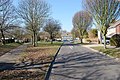 Brune Lane (2) - geograph.org.uk - 1775280.jpg 640 × 428; 106 KB
-
 Brune Lane, Rowner - geograph.org.uk - 1093487.jpg 640 × 480; 66 KB
-
 Brune Lane, Rowner - geograph.org.uk - 1093501.jpg 640 × 480; 159 KB
-
 Demolition of flats (geograph 4172201).jpg 640 × 480; 64 KB
-
 Edgecombe Crescent (1) - geograph.org.uk - 1775468.jpg 640 × 428; 85 KB
-
 Edgecombe Crescent (2) - geograph.org.uk - 1775479.jpg 640 × 428; 63 KB
-
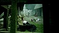
 Exploring the Alver Valley.jpg 960 × 720; 376 KB
-
 Gosport M.O.T. Centre in Rowner Road - geograph.org.uk - 1397051.jpg 640 × 480; 59 KB
-
 Grange Junior School, Rowner Lane, Rowner, Gosport (April 2019).JPG 3,000 × 1,800; 2.33 MB
-
 Open ground, Rowner - geograph.org.uk - 1093509.jpg 640 × 480; 82 KB
-
 Open ground, Rowner - geograph.org.uk - 1093526.jpg 640 × 480; 138 KB
-
 Open ground, Rowner - geograph.org.uk - 1093530.jpg 640 × 480; 139 KB
-
 Open ground, Rowner - geograph.org.uk - 1093536.jpg 640 × 480; 106 KB
-
 Open space Rowner - geograph.org.uk - 1202396.jpg 640 × 480; 118 KB
-
 Thatched cottage on Rowner Lane, Gosport - geograph.org.uk - 385372.jpg 640 × 480; 133 KB
-
 Rowner Health Centre - geograph.org.uk - 1141646.jpg 640 × 480; 61 KB
-
 Sedgewick Close (1) - geograph.org.uk - 1775349.jpg 640 × 428; 64 KB
-
 Sedgewick Close (2) - geograph.org.uk - 1775359.jpg 640 × 428; 75 KB
-
 Shops in Rowner Lane - geograph.org.uk - 1573424.jpg 640 × 480; 86 KB
-
 Shops in St. Nicholas Avenue - geograph.org.uk - 1465707.jpg 640 × 480; 71 KB
-
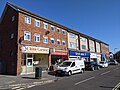 Shops, Rowner, Gosport, Hampshire, UK.jpg 4,032 × 3,024; 13.86 MB
-
 St Nicholas Ave - geograph.org.uk - 1202386.jpg 640 × 480; 82 KB
-
 St Nicholas Ave - geograph.org.uk - 1202414.jpg 640 × 480; 83 KB
-
 St Nicholas Ave, corner of Highwood Road - geograph.org.uk - 1202409.jpg 640 × 480; 143 KB
-
 The Alver Valley Country Park.jpg 960 × 720; 261 KB
-
 The lake in the Wildgrounds Nature Reserve, Rowner.jpg 960 × 543; 125 KB
-
 Woodland by Rowner Lane - geograph.org.uk - 812926.jpg 640 × 488; 164 KB
-
 Woodland by Rowner Lane - geograph.org.uk - 812934.jpg 640 × 480; 130 KB
-
 Woodland by Rowner Lane - geograph.org.uk - 812939.jpg 640 × 480; 133 KB
-
 Woodland by Rowner Lane - geograph.org.uk - 812948.jpg 640 × 480; 121 KB
-
 Woodland north of Rowner Road - geograph.org.uk - 812928.jpg 640 × 480; 173 KB
-
 Boardwalk on Alver Valley trail - geograph.org.uk - 268472.jpg 480 × 640; 162 KB

_-_geograph.org.uk_-_1775268.jpg)
_-_geograph.org.uk_-_1775280.jpg)


.jpg)
_-_geograph.org.uk_-_1775468.jpg)
_-_geograph.org.uk_-_1775479.jpg)


.JPG)


_-_geograph.org.uk_-_1775349.jpg)
_-_geograph.org.uk_-_1775359.jpg)


