Category:Rue Bélanger
| Object location | | View all coordinates using: OpenStreetMap |
|---|
thoroughfare in Montreal, Canada _de_la_rue_B%C3%A9langer-Est_(pr%C3%A8s_du_coin_de_la_rue_Iberville)-2022-10-12.jpg) | |||||
| Upload media | |||||
| Instance of | |||||
|---|---|---|---|---|---|
| Location | Montreal, Urban agglomeration of Montreal, Montreal Region, Quebec, Canada | ||||
 | |||||
Français : La rue Bélanger est une voie d'orientation est-ouest de Montréal située 2 rues au sud de la rue Jean-Talon.
Subcategories
This category has the following 2 subcategories, out of 2 total.
C
- Cinéma Le Château (12 F)
S
- Église Saint-Arsène (9 F)
Media in category "Rue Bélanger"
The following 10 files are in this category, out of 10 total.
-
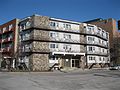 365, rue Belanger.JPG 4,000 × 3,000; 1.55 MB
-
 Cégep Marie-Victorin, Pavillon Bélanger, 2019.jpg 4,032 × 2,268; 5.73 MB
-
 Lit King (4250828227).jpg 1,600 × 1,200; 416 KB
-
 Montréal petite Italie - Jean Talon 517 (8213709108).jpg 1,929 × 1,405; 497 KB
-
 Montréal-Vue (vers l'est) de la rue Bélanger-Est (près du coin de la rue Iberville)-2022-10-12.jpg 12,000 × 5,139; 10.81 MB
-
 Parc Carmela-Galardo-Frascarelli (affiche).jpg 2,976 × 3,968; 3.93 MB
-
 Parc Carmela-Galardo-Frascarelli 01.JPG 4,000 × 3,000; 2.21 MB
-
 Parc Carmela-Galardo-Frascarelli 02.JPG 4,000 × 3,000; 1.86 MB
-
 Parc Carmela-Galardo-Frascarelli.jpg 3,968 × 2,976; 3.74 MB
-
 STM-95Bélanger.JPG 2,444 × 1,872; 1.15 MB


.jpg)
.jpg)
.jpg)


