Category:Rugårdsvej (Fyn)

| Upload media | |||||
| Instance of | |||||
|---|---|---|---|---|---|
| Named after | |||||
| Location | |||||
| Length |
| ||||
 | |||||
Dansk: Landevej på Vestfyn.
Subcategories
This category has the following 3 subcategories, out of 3 total.
H
- Hans Tausens Kirke (Odense) (1 F)
- Humlemagasinet (6 F)
R
- Rugård (Veflinge Sogn) (2 F)
Media in category "Rugårdsvej (Fyn)"
The following 11 files are in this category, out of 11 total.
-
 Blomster Højen.jpg 2,592 × 1,944; 2.68 MB
-
 Bogensebanen12Rugårdsvej.jpg 1,600 × 1,200; 763 KB
-
 Brenderupbanen19Rugårdsvej.JPG 2,048 × 1,536; 1.47 MB
-
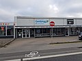
 HarndrupDagliBrugsen.jpg 3,264 × 1,702; 845 KB
-
 Mission Afrika Genbrug Tarup.jpg 4,032 × 3,024; 4.32 MB
-
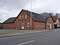 MorudForsamlingshus.JPG 2,048 × 1,536; 235 KB
-
 Oddershede Cykler.jpg 4,032 × 3,024; 3.71 MB
-
 Odense-TV 2 Danmark towards Rugårdsvej.jpg 5,472 × 3,648; 6.26 MB
-
 Rugårdsvej, Korup 01.jpg 2,871 × 1,716; 594 KB
-
 Rugårdsvej, Morud 2009.jpg 3,648 × 2,736; 1.68 MB
-
 SlukefterKro.JPG 1,592 × 1,076; 138 KB


