Category:Ruine Alt-Kienberg
| Object location | | View all coordinates using: OpenStreetMap |
|---|
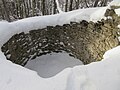
castle ruins in the municipality of Kienberg in the canton of Solothurn, Switzerland  | |||||
| Upload media | |||||
| Instance of | |||||
|---|---|---|---|---|---|
| Part of | |||||
| Location | Kienberg, Gösgen District, Olten-Gösgen, Solothurn, Switzerland | ||||
| Heritage designation |
| ||||
 | |||||
Media in category "Ruine Alt-Kienberg"
This category contains only the following file.
-
 Ruine Alt-Kienberg Turm.jpg 2,048 × 1,536; 947 KB