Category:Ruins in East Ayrshire
Wikimedia category | |||||
| Upload media | |||||
| Instance of | |||||
|---|---|---|---|---|---|
| |||||
Subcategories
This category has the following 23 subcategories, out of 23 total.
A
- Auchencloigh Castle (2 F)
- Auchinleck Castle (19 F)
- Auld Kirk, New Cumnock (2 F)
- Auldhouseburn Viaduct (6 F)
B
- Bailliehill Mount Iron Age Fort (13 F)
- Ballochmyle House ice house (6 F)
D
- Deer Cave, Auchinleck (3 F)
- Dumfries House sawmill (5 F)
H
- Holehouse Mill (13 F)
K
- Kingencleugh Castle tower (2 F)
L
- Lady Constance mine (2 F)
- Laigh Borland (35 F)
- Loudoun lime kilns (3 F)
M
- Muttonhole Strip (5 F)
T
- Templehouse (43 F)
- The Old Place of Auchinleck (9 F)
W
- Waterland Mill (11 F)
Media in category "Ruins in East Ayrshire"
The following 200 files are in this category, out of 368 total.
(previous page) (next page)-
 A Corinthian Capital, Glencairn Aisle, Kilmaurs, East Ayrshire.jpg 2,174 × 2,030; 766 KB
-
 A Loch Doon gunnery range airfield road feature, Dalmellington, East Ayrshire.jpg 4,475 × 2,515; 3.35 MB
-
 A Loch Doon gunnery range airfield site feature, Dalmellington, East Ayrshire.jpg 4,896 × 2,752; 6.73 MB
-
 A Loch Doon gunnery range feature, Dalmellington, East Ayrshire.jpg 4,240 × 2,204; 2.63 MB
-
 A Loch Doon gunnery range officer's huts foundations, Dalmellington, East Ayrshire.jpg 4,896 × 2,752; 6.51 MB
-
 A Sheepfold and cottage ruins, Chapel Hill, Caprington, East Ayrshire.jpg 4,896 × 2,752; 6.96 MB
-
 A WWII pedestrian army exit point, Lainshaw Estate park wall. Stewarton, East Ayrshire.jpg 4,896 × 2,752; 3.11 MB
-

-
 Artificial platform, Mauchline Gorge, East Ayrshire.jpg 4,896 × 2,752; 5.48 MB
-
 Auchinleck Castle, ashlar wall.jpg 4,608 × 3,456; 3.57 MB
-
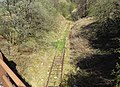
 Baird's railway bared - geograph.org.uk - 1551341.jpg 640 × 480; 84 KB
-
 Ballochmyle Estate - ruins of bridge at Catrine.JPG 3,070 × 2,108; 3.16 MB
-
 Ballochmyle stables ruins, Mauchline, East Ayrshire.jpg 4,363 × 2,842; 5.5 MB
-
 Ballochmyle walled gardens ruins, Mauchline, East Ayrshire.jpg 4,608 × 3,045; 4.6 MB
-
 Ballochmyle walled gardens, interior of ruins of gardener's cottage, Mauchline.jpg 4,608 × 3,456; 3.69 MB
-
 Ballochmyle walled gardens, old gate pier, Mauchline, Scotland.jpg 3,612 × 3,158; 3.44 MB
-
 Ballochmyle walled gardens, ruins of gardener's cottage, Mauchline.jpg 4,608 × 3,456; 4.61 MB
-
 Bello Mill sluice and waterwheel, Lugar, Scotland.jpg 4,536 × 3,358; 6.39 MB
-
 Bello Mill sluice gate, Lugar, Scotland.jpg 4,472 × 3,266; 6.32 MB
-
 Bello Mill waterwheel, Lugar, Scotland.jpg 4,608 × 3,456; 6.18 MB
-
 Benwhat School - geograph.org.uk - 414495.jpg 614 × 461; 126 KB
-

-
-
 Blacksyke Lime Kilns, Caprington, East Ayrshire - end walling - north-east side.jpg 4,698 × 2,991; 4.81 MB
-
-
 Blacksyke Lime Kilns, Caprington, East Ayrshire - one of the kiln eyes - east side.jpg 4,896 × 2,950; 4.88 MB
-
 Blacksyke Lime Kilns, Caprington, East Ayrshire - one of the kiln eyes - south-west side.jpg 4,348 × 2,910; 5.24 MB
-
 Blacksyke Lime Kilns, Caprington, East Ayrshire - one of the kiln eyes - west side.jpg 4,896 × 3,672; 4.82 MB
-
 Blacksyke Lime Kilns, Caprington, East Ayrshire - one of the kiln eyes.jpg 4,379 × 3,217; 5.18 MB
-
 Blacksyke School ruins at Blacksyke Tower, Caprington, East Ayrshire, Scotland.jpg 4,894 × 3,043; 6.45 MB
-
 Blacksyke Tower side building, Caprington, East Ayrshire.jpg 4,896 × 3,672; 5.84 MB
-
 Blacksyke Tower south access, old engine house, Caprington, East Ayrshire.jpg 3,848 × 3,374; 4.35 MB
-
 Blacksyke Tower, Caprington. Detail of gable end.jpg 1,920 × 1,080; 359 KB
-
 Blacksyke Tower, chimney flu access, Caprington, East Ayrshire.jpg 1,920 × 1,080; 957 KB
-
 Blacksyke Tower, detail of east interior wall, Caprington, East Ayrshire.jpg 4,896 × 3,672; 4.71 MB
-
 Blacksyke Tower, detail of south access, Caprington, East Ayrshire.jpg 4,896 × 3,672; 6.21 MB
-
 Blacksyke Tower, detail of west and north interior wall, Caprington, East Ayrshire.jpg 4,896 × 3,672; 5.56 MB
-
 Blacksyke Tower, interior south wall. Caprington, East Ayrshire.jpg 4,275 × 3,672; 4.15 MB
-

-
 Blacksyke Tower, side building chimney flu access, Caprington, East Ayrshire.jpg 1,920 × 1,080; 668 KB
-
 Blacksyke Tower, south wall water spout. Caprington, East Ayrshire.jpg 3,564 × 3,672; 2.15 MB
-
 Blacksyke Tower, view from the west. Caprington, East Ayrshire.jpg 4,896 × 3,672; 6.24 MB
-
 Blacksyke Tower, view of north extension. Caprington, East Ayrshire.jpg 4,896 × 3,672; 6.37 MB
-
 Blacksyke Tower, view of south wall interior. Caprington, East Ayrshire.jpg 4,896 × 3,672; 5.74 MB
-
 Blacksyke Tower, view of west wall exterior. Caprington, East Ayrshire.jpg 4,055 × 3,672; 4.58 MB
-
 Blacksyke Tower, view of west wall interior. Caprington, East Ayrshire.jpg 4,896 × 3,672; 5.88 MB
-

-
-
 Blacksyke Tower. An old engine house, Caprington, East Ayrshire - view from the east.jpg 4,548 × 2,766; 2.76 MB
-
 Bloak hamlet site and old lime kiln, East Ayrshire.jpg 4,896 × 2,752; 4.2 MB
-
 Bloak Mill, Wheel pit, East Ayrshire.jpg 4,876 × 2,560; 4.37 MB
-
 Bloak, Old lime kiln, East Ayrshire.jpg 4,896 × 2,752; 5.51 MB
-
 Bogton Airfield site, Dalmellington, East Ayrshire. Buildings foundations & runways.jpg 4,896 × 2,192; 1.99 MB
-
 Bogton Airfield site, Dalmellington, East Ayrshire. Buildings foundations.jpg 4,244 × 1,657; 2.14 MB
-
 Bogton Airfield, Dalmellington,East Ayrshire. Buildings foundations.jpg 4,216 × 2,273; 2.38 MB
-
 Borland House, Dunlop around 1900.jpg 1,566 × 767; 529 KB
-
 Borland or Dunlop Hill and the Cuckoo Slide.jpg 4,416 × 3,186; 5.71 MB
-

-
 Bridge abutments and support, Lainshaw Estate, Annick Water.jpg 3,321 × 2,027; 1.93 MB
-
 Bridge abutments, Lainshaw Estate, Annick Water.jpg 4,650 × 2,747; 4.04 MB
-
 Burgher Church foundation stone, Mauchline.jpg 2,309 × 2,504; 1.47 MB
-
 Cairnduff Bronze Age Burial Mound, Stewarton, East Ayrshire. View east.jpg 4,896 × 2,752; 3.68 MB
-
 Carmel Water with old dam and caul, East Ayrshire, Scotland.jpg 4,896 × 2,752; 4.94 MB
-
 Carved stone, Glencairn Aisle, Kilmaurs, East Ayrshire.jpg 3,780 × 1,857; 1.16 MB
-
 Chapel Hill at Caprington, East Ayrshire. Footpath earthworks.jpg 4,896 × 2,752; 6.39 MB
-
 Chapel Hill earthwork features, Caprington, East Ayrshire.jpg 4,896 × 2,752; 5.82 MB
-
 Chapel Hill features, Caprington, East Ayrshire.jpg 4,896 × 2,752; 6.06 MB
-
 Chapel Hill likely original site at Caprington, East Ayrshire. Footpath earthworks.jpg 4,896 × 2,752; 6.46 MB
-
 Chapel Hill likely ruins site at Caprington, East Ayrshire. Footpath earthworks.jpg 4,896 × 2,752; 6.31 MB
-
 Chapel Hill site at Caprington, East Ayrshire. Footpath earthworks.jpg 4,896 × 2,752; 6.43 MB
-
 Chapel Hill's likely original site at Caprington, East Ayrshire. Footpath earthworks.jpg 4,896 × 2,752; 6.53 MB
-
 Chapel Hill, Caprington, East Ayrshire.jpg 4,896 × 2,752; 6.8 MB
-
 Clocklowie ruins - geograph.org.uk - 248172.jpg 640 × 480; 91 KB
-
 Commoncraig and water tank, Dunlop, East Ayrshire, Scotland.jpg 4,608 × 3,456; 7.29 MB
-
 Commondyke railway station, old Muirkirk branch, East Ayrshire, Scotland.jpg 4,606 × 2,726; 6.5 MB
-
 Corbie Craigs Miners Row - geograph.org.uk - 414099.jpg 614 × 461; 98 KB
-
 Corinthian Capital, Glencairn Aisle, Kilmaurs, East Ayrshire.jpg 2,207 × 2,351; 890 KB
-
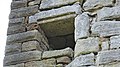 Corsehill Castle - Aumbry detail, inner east facing tower castle wall remnant.jpg 4,896 × 2,752; 2.91 MB
-
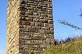
 Corsehill Castle - small section of the east tower castle wall. View from the west.jpg 4,896 × 2,752; 4.43 MB
-
 Corsehill Castle - south facing tower castle wall remnant. Lower section.jpg 4,098 × 2,726; 2.89 MB
-
 Corsehill Castle - south facing tower castle wall remnant.jpg 3,673 × 2,703; 2.27 MB
-

-
 Corsehill Castle - the east facing wall and vaulting remnant.jpg 4,871 × 2,530; 3.92 MB
-
 Corsehill Castle - the north facing tower castle wall remnant. Upper section detail.jpg 3,164 × 2,726; 1.6 MB
-
 Corsehill Castle - the north tower castle wall remnant.jpg 4,896 × 2,752; 5.52 MB
-
 Corsehill Castle, Stewarton - north facing wall. Detail of consolidation in two phases.jpg 2,850 × 2,724; 1.52 MB
-
 Corsehilldam1.JPG 2,288 × 1,712; 732 KB
-
 Corsehouse Reservoir, East Ayrshire. View from Cairn Farm site.jpg 4,797 × 1,998; 2.05 MB
-

-

-

-
 Covered access way, Kyle Castle, Dalblair, East Ayrshire, Scotland.jpg 4,896 × 2,752; 3.8 MB
-
 Covered way, Kyle Castle, Dalblair, East Ayrshire.jpg 4,896 × 2,752; 4.28 MB
-
 Craigmill access lane and drystone dyking.JPG 4,608 × 3,456; 6.89 MB
-
 Craigshiel ruin - geograph.org.uk - 248166.jpg 640 × 480; 107 KB
-
 Crossflatt - geograph.org.uk - 38794.jpg 640 × 480; 71 KB
-
 Dalgain Coal Mine ruins, Holehouse Holm, Sorn, East Ayrshire.jpg 4,896 × 2,752; 4.57 MB
-
 Decorative door jamb ruins, Templehouse, Dunlop, East Ayrshire.jpg 4,896 × 2,752; 3.56 MB
-
 Decorative door jamb, Templehouse, Dunlop, East Ayrshire.jpg 4,255 × 2,735; 2.77 MB
-
 Deer Cave frontage, Dippol Burn, Auchinleck Estate.jpg 4,530 × 3,350; 6.74 MB
-
 Deer Cave, rock cut chamber, Auchinleck Estate.jpg 4,602 × 3,448; 3.95 MB
-
 Des Res. - geograph.org.uk - 434434.jpg 640 × 480; 82 KB
-
 Disused Barn - geograph.org.uk - 398546.jpg 640 × 480; 114 KB
-
 Dragon and grape vine on Cross Slab. Glencairn Aisle. Kilmaurs, East Ayrshire.jpg 4,014 × 2,256; 1.65 MB
-
 Dunlop Cricket Club score board, Dunlop, East Ayrshire.jpg 1,649 × 1,802; 589 KB
-
 East Newton Limestone Quarry.JPG 4,556 × 2,498; 5.67 MB
-
 Eriff ruin - geograph.org.uk - 853387.jpg 640 × 480; 136 KB
-
 Fairlie Colliery coal waste, Laigh Milton Viaduct, Ayrshire.jpg 4,896 × 2,752; 2.16 MB
-
 Farm ruin - geograph.org.uk - 926224.jpg 640 × 499; 295 KB
-
 Foundations of the collegiate college tower, Kilmaurs, East Ayrshire.jpg 4,896 × 2,752; 7.09 MB
-

-
 Glencairn Aisle. Fragment of a burial tomb. Kilmaurs, East Ayrshire.jpg 3,767 × 2,076; 1.84 MB
-
 Glencairn Aisle. Ornate fragment of a burial tomb. Kilmaurs, East Ayrshire.jpg 2,774 × 1,816; 986 KB
-
 Ha-ha, Ballochmyle House, Mauchline, East Ayrshire.jpg 4,608 × 3,456; 4.42 MB
-
 Haggis Bank lime kiln burning chamber, Sorn, East Ayrshire.jpg 4,896 × 2,752; 5.26 MB
-
 Haining Place and door into wheel stairwell.JPG 4,608 × 3,456; 3.98 MB
-
 Haining Place and mound from the west.JPG 4,596 × 3,440; 7.03 MB
-
 Haining Place, byre eastern end wall.JPG 4,608 × 3,456; 3.59 MB
-
 Haining Place, courtyard and entrance.JPG 4,488 × 2,234; 5.04 MB
-
 Haining Place, detail of door jambs.JPG 3,406 × 1,932; 4.02 MB
-
 Haining Place, detail of fireplace flue.JPG 4,584 × 3,424; 8.3 MB
-
 Haining Place, detail of wheel stairwell.JPG 4,608 × 3,456; 3.54 MB
-
 Haining Place, east facing aspect and southern end.JPG 4,501 × 2,789; 6.63 MB
-
 Haining Place, east facing aspect with gable end.JPG 4,608 × 3,456; 3.62 MB
-
 Haining Place, Ground floor and wheel stairwell entry.JPG 4,608 × 3,456; 3.52 MB
-
 Haining Place, middle vaulted chamber and entrance to old wheel stairway.JPG 4,456 × 3,244; 3.54 MB
-
 Haining Place, north gable end and byre junction.JPG 4,608 × 3,456; 3.59 MB
-
 Haining Place, northern chamber looking south.JPG 4,608 × 3,456; 4.78 MB
-
 Haining Place, northern end of old castle with byre.JPG 4,608 × 3,456; 5.04 MB
-
 Haining Place, platform and terrace, south facing end.JPG 4,175 × 2,653; 7.41 MB
-
 Haining Place, rubble beneath the south end terrace and platform.JPG 4,608 × 3,456; 6.88 MB
-
 Haining Place, rubble slope and terrace.JPG 4,608 × 3,456; 6.84 MB
-
 Haining Place, vaulted chamber at north end of the castle.JPG 4,083 × 3,165; 3.63 MB
-
 Haining Place, vaulted kitchen.JPG 4,600 × 3,444; 5.04 MB
-
 Haining Place, wheel stairwell wall.JPG 4,494 × 3,300; 4.9 MB
-
 High Shaw remains - geograph.org.uk - 918165.jpg 640 × 480; 149 KB
-

-
-
-
 Holehouse Mill and miller's house ruins, Sorn, East Ayrshire. View from the south.jpg 4,858 × 1,683; 1.52 MB
-
 Holehouse Mill and miller's house ruins, Sorn, East Ayrshire.jpg 4,896 × 2,752; 5.19 MB
-
 Holehouse Mill and ruins, Sorn, East Ayrshire. View to the south.jpg 4,896 × 2,752; 5.74 MB
-
 Holehouse Mill ruins and raised area, Sorn, East Ayrshire.jpg 4,716 × 2,737; 4.92 MB
-
 Holehouse Mill ruins, Holehouse Holm, Sorn, East Ayrshire.jpg 4,865 × 2,194; 2.23 MB
-
 Holehouse Mill ruins. Gable end. Holehouse Holm, Sorn, East Ayrshire.jpg 4,896 × 2,752; 6.31 MB
-
 Holehouse Mill, ruins of miller's house, Sorn, East Ayrshire.jpg 4,896 × 2,752; 4.53 MB
-
 Holehouse Mill. West facing gable end ruins. Holehouse Holm, Sorn, East Ayrshire.jpg 4,896 × 2,752; 4.97 MB
-
 Holehouse Miller's house ruins, Sorn, East Ayrshire.jpg 4,460 × 2,741; 4.65 MB
-
 Ice House, Dippol Burn, Auchinleck Estate.jpg 4,608 × 3,456; 3.6 MB
-
 Industrial ruin. - geograph.org.uk - 432015.jpg 640 × 480; 127 KB
-
 Industrial ruin. - geograph.org.uk - 434233.jpg 640 × 480; 122 KB
-
 Inner dam wall at Corsehill.JPG 2,288 × 1,712; 1.34 MB
-
 Kilmaurs Place 'ruins' 1.JPG 2,288 × 1,712; 1.39 MB
-
 Kilmaurs Place 'ruins' 2.JPG 2,288 × 1,712; 1.37 MB
-

-
 Kyle Castle from the west, Dalblair, East Ayrshire.jpg 4,896 × 1,898; 1.34 MB
-
 Ladeside clachan ruins.JPG 2,288 × 1,712; 1.3 MB
-
 Lady's Well, Path Foot, Kilmaurs, East Ayrshire.jpg 4,184 × 2,752; 3.19 MB
-
 Laigh Borland 1916 walled garden, Dunlop, Ayrshire.jpg 4,608 × 3,456; 8.14 MB
-
 Laigh Borland Walled Garden, Dunlop.jpg 2,359 × 1,045; 795 KB
-
 Laigh Clunch Farm house ruins, Fenwick, Ayrshire.jpg 4,811 × 2,111; 2.09 MB
-
 Laigh Clunch Farm ruin, Fenwick, Ayrshire.jpg 3,578 × 1,671; 1.4 MB
-
 Laigh Clunch Farm, Fenwick, Ayrshire. Gable end.jpg 2,751 × 2,205; 1.65 MB
-
 Lainshaw Bridge ruins, Annick Water, East Ayrshire.jpg 4,210 × 2,071; 2.35 MB
-
-
 Lainshaw Footbridge.JPG 1,712 × 2,288; 1.32 MB
-
 Lauchensknoll, ruined dwelling - geograph.org.uk - 1215148.jpg 640 × 480; 66 KB
-
 Lime Kilns, Craigdullyeart , New Cumnock - geograph.org.uk - 458950.jpg 640 × 427; 118 KB
-
 Loch Doon gunnery range airfield site feature, Dalmellington, East Ayrshire.jpg 3,362 × 2,665; 2.17 MB
-
 Loch Doon gunnery range anchor point, Dalmellington, East Ayrshire.jpg 4,896 × 2,752; 6.16 MB
-
 Loch Doon gunnery range feature, Dalmellington, East Ayrshire.jpg 3,743 × 2,169; 1.95 MB
-
 Loch Doon gunnery range features near the dam, Dalmellington, East Ayrshire.jpg 4,339 × 2,159; 2.55 MB
-
 Loch Doon gunnery range hut foundation feature at the dam, Dalmellington, East Ayrshire.jpg 4,248 × 2,251; 1.87 MB
-

-
 Loch Doon gunnery range monorail location, East Ayrshire.jpg 4,896 × 2,182; 2.13 MB
-

-
 Loch Doon gunnery range sewage plant foundations, Dalmellington, East Ayrshire.jpg 4,896 × 2,752; 6.63 MB
-
 Loudon Castle, Galston, East Ayrshire, Scotland.jpg 3,950 × 2,410; 2.62 MB
-
 Mains Quarry flooded, Dunlop, East Ayrshire, Scotland.jpg 4,896 × 2,752; 4.51 MB
-
 Mains Quarry site, Whinstone, Dunlop, East Ayrshire.jpg 4,896 × 2,752; 5.49 MB
-
 Mains Quarry tramway, Mains Farm, Dunlop, East Ayrshire. A view to the west.jpg 4,896 × 2,752; 2.73 MB
-
 Mains Quarry tramway, Mains Farm, Dunlop, East Ayrshire. View to the old exchange siding.jpg 4,053 × 2,552; 2.61 MB
-
 Mains Quarry tramway, Mains Farm, Dunlop, East Ayrshire. View to the west.jpg 4,896 × 2,752; 3.47 MB
-
 Mains Quarry tramway, Mains Farm, Dunlop, East Ayrshire. View west.jpg 4,514 × 2,726; 2.72 MB
-
 Mains Quarry tramway, Mains Farm, Dunlop, East Ayrshire.jpg 4,896 × 2,752; 3.04 MB
-
 Medieval carved fragments, Glencairn Aisle, Kilmaurs, East Ayrshire.jpg 3,659 × 1,849; 1.41 MB
-

-
 Mill of Bloak ruins. Lugton Water. East Ayrshire. View of walls. Looking to the east.jpg 4,686 × 2,741; 4.24 MB
-
 Mill of Bloak ruins. Lugton Water. East Ayrshire. View of walls. Looking to the south.jpg 4,896 × 2,752; 4.27 MB
-
 Mill of Bloak ruins. Lugton Water. East Ayrshire. View to the east.jpg 4,896 × 2,752; 4.06 MB
-
 Mill of Bloak ruins. View from the north. East Ayrshire.jpg 4,896 × 2,752; 3.26 MB
-
 Mill of Bloak, Waulkmill and old whinstone quarry, East Ayrshire.jpg 4,896 × 2,752; 2.81 MB
-
 Mill of Bloak. Lugton Water. Stone revetment. East Ayrshire. View to mill site.jpg 4,896 × 2,752; 2.89 MB
-
 Mill of Bloak. Site of waulk mill buildings. Lugton Water. East Ayrshire.jpg 4,896 × 2,752; 3.86 MB
-
 Miller's house, Bloak Mill, North Aryshire.jpg 4,896 × 2,752; 3.96 MB
-
 Monquhill ruin - geograph.org.uk - 891354.jpg 640 × 480; 166 KB
-
 Netherplace House - ruins of the old stables.JPG 4,508 × 3,320; 7.61 MB
-
 Netherplace stable - ruins of the outer wall.JPG 4,594 × 3,438; 6.31 MB
-
 Netherplace stables - old entrance.JPG 4,608 × 3,456; 5.28 MB
-
 North access drive, Netherplace Estate, Mauchline, East Ayrshire.jpg 4,896 × 2,752; 3.41 MB


