Category:Ruins in Powys
Subcategories
This category has the following 12 subcategories, out of 12 total.
Media in category "Ruins in Powys"
The following 60 files are in this category, out of 60 total.
-
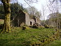
 Abandoned Farm - geograph.org.uk - 1458013.jpg 640 × 427; 108 KB
-
 Abandoned Farmhouse - geograph.org.uk - 403178.jpg 640 × 480; 152 KB
-
 Abandoned house near the Old Village of Llanwddyn - geograph.org.uk - 6110430.jpg 2,880 × 2,160; 2.86 MB
-
 Abandoned mine building in Elan Valley - geograph.org.uk - 5554435.jpg 4,000 × 2,250; 3.26 MB
-
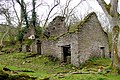
 Adfeilion Ty - Derelict House - geograph.org.uk - 642739.jpg 640 × 480; 92 KB
-
 Blaen-heath - geograph.org.uk - 436140.jpg 640 × 480; 135 KB
-
 Blaen-heath - geograph.org.uk - 436143.jpg 640 × 480; 152 KB
-
 Cnwch, Llangamarch - geograph.org.uk - 3129618.jpg 640 × 480; 93 KB
-

-
 Copse and cottage ruins at Tyn y Pant - geograph.org.uk - 608518.jpg 640 × 480; 84 KB
-
 Craig For - geograph.org.uk - 30905.jpg 449 × 294; 22 KB
-
 Derelict farm building above Bridge 137 - geograph.org.uk - 5519889.jpg 5,179 × 3,451; 4.76 MB
-
 Derelict farmhouse - geograph.org.uk - 461696.jpg 640 × 426; 132 KB
-
 Distant ruin at Tan-yr-allt - geograph.org.uk - 3098582.jpg 640 × 480; 95 KB
-
 Farmhouse chimney ruins in Cwm Llech - geograph.org.uk - 3107113.jpg 640 × 480; 117 KB
-
 Farmstead Ruin in Blaen Llia - geograph.org.uk - 602447.jpg 600 × 402; 210 KB
-
 Fields around the ruin of Gwndwn - geograph.org.uk - 2963410.jpg 1,024 × 544; 115 KB
-
 Gwal y Cadno - geograph.org.uk - 171086.jpg 480 × 359; 42 KB
-
 Inside the submerged farmhouse (geograph 7293736).jpg 1,600 × 901; 510 KB
-
 Nature Reclaims a Ruin - geograph.org.uk - 4896752.jpg 3,264 × 2,448; 3.89 MB
-
 Old roadside building and tree - geograph.org.uk - 638693.jpg 640 × 480; 131 KB
-
 Part of Allt-mawr-uchaf - geograph.org.uk - 682241.jpg 640 × 480; 110 KB
-
 Remains of a Building - geograph.org.uk - 4537975.jpg 1,024 × 768; 296 KB
-
 Roadside ruin - geograph.org.uk - 1906511.jpg 640 × 426; 81 KB
-
 Ruin at Cowlton (1) - geograph.org.uk - 3202856.jpg 1,024 × 678; 236 KB
-
 Ruin at Cowlton (2) - geograph.org.uk - 3202849.jpg 1,024 × 644; 180 KB
-
 Ruin at Cowlton (3) - geograph.org.uk - 3202844.jpg 1,024 × 687; 245 KB
-
 Ruin at Cowlton (4) - geograph.org.uk - 3202840.jpg 1,024 × 577; 204 KB
-
 Ruin at Cowlton - geograph.org.uk - 1124795.jpg 640 × 480; 56 KB
-
 Ruin at Hyddgen Farm - geograph.org.uk - 3459441.jpg 640 × 480; 214 KB
-
 Ruin at Pontneddfechan Gunpowder Works - geograph.org.uk - 2906315.jpg 1,024 × 768; 190 KB
-
 Ruin at Pontneddfechan Gunpowder Works - geograph.org.uk - 2906336.jpg 1,080 × 720; 210 KB
-
 Ruin beside the Usk Valley Walk - geograph.org.uk - 1381195.jpg 640 × 426; 130 KB
-
 Ruin near Pentre-Willey - geograph.org.uk - 5940571.jpg 640 × 480; 132 KB
-
 Ruin on slopes of Fan Nedd - geograph.org.uk - 4374773.jpg 640 × 480; 89 KB
-
 Ruin on the hill - geograph.org.uk - 4619677.jpg 640 × 427; 399 KB
-
 Ruin with a view - geograph.org.uk - 5906630.jpg 5,184 × 3,888; 3.91 MB
-
 Ruin, Llechwedd mawr - geograph.org.uk - 4160081.jpg 4,608 × 3,456; 3.43 MB
-

-
 Ruined building at Cefn-golau - geograph.org.uk - 491385.jpg 640 × 480; 144 KB
-
 Ruined cottage near Waunfach Old Forge - geograph.org.uk - 713802.jpg 640 × 428; 170 KB
-
 Ruined lime kilns at Penwyllt - geograph.org.uk - 589709.jpg 600 × 427; 167 KB
-
 Ruined stone barn - geograph.org.uk - 5938046.jpg 1,024 × 768; 260 KB
-
 Ruined stone wall - geograph.org.uk - 404733.jpg 427 × 640; 100 KB
-
 Ruins at Twyn. - geograph.org.uk - 522308.jpg 640 × 480; 166 KB
-
 Ruins of Nantgwyllt in the Elan Valley - geograph.org.uk - 244574.jpg 640 × 480; 106 KB
-
 Shepherd's ruin - geograph.org.uk - 826242.jpg 640 × 427; 117 KB
-
 The face of a ruin - geograph.org.uk - 4244391.jpg 640 × 360; 111 KB
-
 The Hermitage - geograph.org.uk - 73647.jpg 640 × 433; 94 KB
-
 The ruin of Lluest-cethingrych - geograph.org.uk - 2718337.jpg 1,142 × 857; 367 KB
-
 The ruin of Melin-lech - geograph.org.uk - 2376016.jpg 640 × 480; 154 KB
-
 The ruin of Pwll-y-baw - geograph.org.uk - 2946846.jpg 2,592 × 1,944; 1.56 MB
-
 Thought provoking ruin of Ty-gwyn - geograph.org.uk - 4244409.jpg 640 × 360; 67 KB
-
 Un-named ruin - geograph.org.uk - 1884594.jpg 640 × 480; 88 KB
-
 Yniscedwyn iron works - geograph.org.uk - 400233.jpg 640 × 310; 35 KB
-
 Blaen Clydach Rifle range - geograph.org.uk - 711374.jpg 640 × 480; 93 KB
-
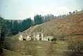
 End of the farm - geograph.org.uk - 660648.jpg 640 × 480; 118 KB
-
 Ruin under Cwar y Gigfran - geograph.org.uk - 402215.jpg 640 × 480; 98 KB
-
 Ruins in Cwm Crew - geograph.org.uk - 516654.jpg 640 × 480; 150 KB
-
 Ruins on Llorfa - geograph.org.uk - 399152.jpg 640 × 480; 87 KB


.jpg)


_-_geograph.org.uk_-_3202856.jpg)
_-_geograph.org.uk_-_3202849.jpg)
_-_geograph.org.uk_-_3202844.jpg)
_-_geograph.org.uk_-_3202840.jpg)


