Category:Ruisbroek train station
| Object location | | View all coordinates using: OpenStreetMap |
|---|
railway station in Belgium  | |||||
| Upload media | |||||
| Instance of | |||||
|---|---|---|---|---|---|
| Location | Sint-Pieters-Leeuw, Arrondissement of Halle-Vilvoorde, Flemish Brabant, Flemish Region, Belgium | ||||
| Transport network | |||||
| Owned by | |||||
| Operator | |||||
| Date of official opening |
| ||||
| Elevation above sea level |
| ||||
| Connecting line | |||||
| Adjacent station | |||||
 | |||||
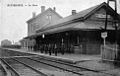
Français : La gare de Ruisbroek est une gare ferroviaire belge de la ligne 96, de Bruxelles-Midi à Quévy (frontière), située à Ruisbroek sur le territoire de la commune de Leeuw-Saint-Pierre dans la province du Brabant flamand en région flamande.
Nederlands: Het station Ruisbroek ligt langs spoorlijn 96 (Brussel - Bergen - Quévy) in Ruisbroek, een deelgemeente van de gemeente Sint-Pieters-Leeuw.
Media in category "Ruisbroek train station"
The following 15 files are in this category, out of 15 total.
-
 GareRuysbroeck-CPancienne.jpg 972 × 615; 371 KB
-
 Ruisbroek doorkomst Eurostar 3012 naar Londen (14762666687).jpg 5,486 × 3,635; 8.94 MB
-
 Ruisbroek doorkomst Eurostar 3216 uit London (14920073855).jpg 5,317 × 3,498; 10.41 MB
-
 Ruisbroek doorkomst Eurostar 3218 uit London (14983116305).jpg 5,686 × 3,163; 9.74 MB
-
 Ruisbroek doorkomst TGV treinstel 4525 als TGV 9826 naar Marseille (14916990881).jpg 5,038 × 3,268; 8.98 MB
-
 Ruisbroek doorkomst Thalys treinstel 4331 als THA 9424 Köln - Paris Nord (14733408019).jpg 5,835 × 3,686; 13.19 MB
-
 Ruisbroek loc 6282 (50960029491).jpg 5,339 × 3,003; 11.23 MB
-
 Ruisbroek NMBS 08154 (50960132802).jpg 4,594 × 2,584; 8.86 MB
-
 Ruisbroek NMBS 08154 als stoptrein L3659 Leuven (16956962488).jpg 4,608 × 2,584; 7.52 MB
-
 SNCB NMBS Class AM08 MS08.png 1,200 × 530; 1.15 MB
-
 Station Ruisbroek Ingang.jpg 3,848 × 2,164; 8.4 MB
-
 Station Ruisbroek Naam.jpg 2,589 × 1,456; 4.42 MB
-
 Station Ruisbroek Perron.jpg 3,783 × 2,128; 8 MB
-
 Station Ruisbroek Plein.jpg 3,740 × 2,107; 6.56 MB
-
 Station Ruisbroek.jpg 800 × 615; 156 KB

.jpg)
.jpg)
.jpg)
.jpg)
.jpg)
.jpg)
.jpg)
.jpg)


