Category:Rushock
village in Worcestershire, England, UK  | |||||
| Upload media | |||||
| Instance of | |||||
|---|---|---|---|---|---|
| Location | Wyre Forest, Worcestershire, West Midlands, England | ||||
| Different from | |||||
| Said to be the same as | Rushock (Wikimedia duplicated page, civil parish) | ||||
 | |||||
Subcategories
This category has only the following subcategory.
M
- St Michael's Church, Rushock (2 F)
Media in category "Rushock"
The following 64 files are in this category, out of 64 total.
-
 Arable land at Rushock - geograph.org.uk - 3065822.jpg 1,024 × 680; 194 KB
-
 Bannut Tree - geograph.org.uk - 222737.jpg 639 × 481; 55 KB
-
 Broken gate to field on Lunnon Lane, Rushock - geograph.org.uk - 5102524.jpg 1,600 × 1,200; 634 KB
-
 Callimore Farm, Rushock, Worcestershire - geograph.org.uk - 5639466.jpg 1,600 × 677; 285 KB
-
 Clattercut Lane - geograph.org.uk - 4072472.jpg 1,600 × 1,067; 452 KB
-
 Clattercut Lane - Purshull Green Lane junction - geograph.org.uk - 5093886.jpg 1,600 × 1,200; 461 KB
-
 Clattercut Lane at Little Gains - geograph.org.uk - 1927828.jpg 640 × 480; 154 KB
-

-

-
 Clattercut Lane, near Rushock - geograph.org.uk - 3649685.jpg 1,024 × 680; 243 KB
-
 Crossroads on Clattercut Lane - geograph.org.uk - 1927830.jpg 640 × 480; 230 KB
-
 Dead tree in a field - geograph.org.uk - 5102599.jpg 1,600 × 1,192; 332 KB
-
 Drumsticks on John Bonham's grave - geograph.org.uk - 3065749.jpg 680 × 1,024; 295 KB
-
 Entrance to Rushock Trading Estate - geograph.org.uk - 3041486.jpg 640 × 360; 53 KB
-

-
 Farmland near Rushock - geograph.org.uk - 3649078.jpg 1,024 × 680; 212 KB
-
 Farmland near Rushock - geograph.org.uk - 3649677.jpg 1,024 × 680; 166 KB
-
 Gated track near Rushock, Worcestershire - geograph.org.uk - 5102423.jpg 1,600 × 1,180; 303 KB
-
 Hedge cutting in Lunnon Lane, Rushock - geograph.org.uk - 5102501.jpg 1,600 × 1,200; 440 KB
-
 Hill House Farm, Rushock - geograph.org.uk - 386567.jpg 640 × 426; 112 KB
-
 Hill House Farm, Rushock, Worcestershire - geograph.org.uk - 5102368.jpg 1,600 × 1,129; 323 KB
-
 Horses near Wood Farm, Rushock, Worcestershire - geograph.org.uk - 5102402.jpg 1,600 × 1,189; 312 KB
-
 House on Clattercut Lane, Rushock, Worcestershire - geograph.org.uk - 5093892.jpg 1,600 × 1,200; 439 KB
-
 House on Well Lane, Rushock, Worcestershire - geograph.org.uk - 5102627.jpg 1,600 × 1,167; 504 KB
-
 Houses in Rushock, Herefordshire - geograph-2621730.jpg 640 × 480; 87 KB
-
 Houses on Clattercut Lane, Cutnall Green, Worcestershire - geograph.org.uk - 5102445.jpg 1,600 × 1,182; 464 KB
-
 John Bonham's grave - geograph.org.uk - 3065742.jpg 1,024 × 680; 293 KB
-
 John Bonham's Grave - geograph.org.uk - 5964008.jpg 3,648 × 2,736; 3.53 MB
-
 John Henry Bonham's grave, Rushock churchyard - geograph.org.uk - 5102359.jpg 1,600 × 1,191; 485 KB
-
 Little London, Lunnon Lane, Rushock, Worcestershire - geograph.org.uk - 5102499.jpg 1,600 × 1,200; 624 KB
-
 Looking across fields from Lunnon Lane, Rushock - geograph.org.uk - 5102536.jpg 1,600 × 1,200; 243 KB
-
 Lunnon Lane warning - geograph.org.uk - 1927836.jpg 640 × 480; 270 KB
-
 Old Rectory from bottom of Rushock Hill - geograph.org.uk - 5102611.jpg 1,600 × 1,140; 275 KB
-
 Pond at Beech Elm Farm, Clattercut Lane, near Rushock - geograph.org.uk - 5102435.jpg 1,600 × 1,170; 452 KB
-
 Pylon and post. - geograph.org.uk - 1538318.jpg 640 × 360; 70 KB
-
 Road junction in Rushock - geograph.org.uk - 388665.jpg 640 × 426; 143 KB
-
 Road junction near Rushock - geograph.org.uk - 3649669.jpg 1,024 × 680; 241 KB
-
 Road junction near Upper Hyde - geograph.org.uk - 4072481.jpg 1,600 × 1,067; 418 KB
-
 Road junction. - geograph.org.uk - 1538329.jpg 640 × 360; 80 KB
-
 Rural road junction, Worcestershire - geograph.org.uk - 5093904.jpg 1,600 × 1,200; 562 KB
-
 Rushock church - geograph.org.uk - 3065718.jpg 680 × 1,024; 193 KB
-
 Rushock church - geograph.org.uk - 3065725.jpg 1,024 × 680; 181 KB
-
 Rushock Church from outside churchyard - geograph.org.uk - 5102620.jpg 1,600 × 1,200; 473 KB
-
 Rushock Church on the hill - geograph.org.uk - 5102603.jpg 1,600 × 1,187; 281 KB
-
 Rushock Village Hall - geograph.org.uk - 388662.jpg 640 × 426; 111 KB
-

-
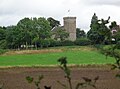
 St Michael's Church, Rushock (1) - geograph.org.uk - 5098978.jpg 1,600 × 1,200; 325 KB
-
 St Michael's Church, Rushock (2) - geograph.org.uk - 5099006.jpg 1,600 × 1,200; 365 KB
-
 Straw bales in field off Clattercut Lane - geograph.org.uk - 5102418.jpg 1,600 × 1,192; 308 KB
-
 The house at Beech Elm Farm - geograph.org.uk - 5663541.jpg 1,600 × 1,200; 367 KB
-
 The Monarch's Way, Rushock - geograph.org.uk - 3065812.jpg 1,024 × 680; 264 KB
-
 Track off Lummon Lane, Rushock - geograph.org.uk - 5102559.jpg 1,600 × 1,165; 463 KB
-
 Tudor Cottage, Lunnon Lane, Rushock, Worcestershire - geograph.org.uk - 5102507.jpg 1,600 × 1,200; 628 KB
-
 Well Lane joins the A442 near Rushock - geograph.org.uk - 5102636.jpg 1,600 × 1,143; 340 KB
-
 Cakebole House Farm - geograph.org.uk - 382990.jpg 640 × 426; 125 KB
-
 Cursley Distribution Park - geograph.org.uk - 382977.jpg 640 × 426; 97 KB
-
 Field beside the Elmley Brook - geograph.org.uk - 386564.jpg 640 × 426; 131 KB
-
 Footpath at Rushock - geograph.org.uk - 388651.jpg 640 × 426; 118 KB
-
 Gate to a field at Cakebole - geograph.org.uk - 389363.jpg 640 × 426; 140 KB
-
 Lane to the east of Rushock - geograph.org.uk - 385737.jpg 640 × 426; 102 KB
-
 Rushock Trading Estate - geograph.org.uk - 386571.jpg 640 × 426; 93 KB
-
 Ryelands Business Centre - geograph.org.uk - 382960.jpg 640 × 426; 89 KB
-
 Track near Elms Farm - geograph.org.uk - 472162.jpg 640 × 480; 136 KB
-
 Warehouses near Hartlebury - geograph.org.uk - 382942.jpg 640 × 426; 123 KB


_-_geograph.org.uk_-_5098978.jpg)
_-_geograph.org.uk_-_5099006.jpg)


