Category:Ryburgh
English: Ryburgh is a civil parish in the English county of Norfolk. The village is south-east of the nearby town of Fakenham. The nearest railway station is at Sheringham for the Bittern Line which runs between Sheringham, Cromer and Norwich. The nearest airport is Norwich International Airport.
civil parish in Norfolk, England  | |||||
| Upload media | |||||
| Instance of | |||||
|---|---|---|---|---|---|
| Location | North Norfolk, Norfolk, East of England, England | ||||
| Area |
| ||||
 | |||||
Subcategories
This category has the following 3 subcategories, out of 3 total.
C
G
L
Media in category "Ryburgh"
The following 47 files are in this category, out of 47 total.
-
 A1067 by Langor Bridge - geograph.org.uk - 5934926.jpg 2,992 × 2,244; 1.8 MB
-
 A1067 heading south east - geograph.org.uk - 3839984.jpg 1,600 × 1,065; 304 KB
-
 A1067 passing Langor Bridge Garage - geograph.org.uk - 3842319.jpg 800 × 537; 154 KB
-
 A1067 road narrows ahead - geograph.org.uk - 3841440.jpg 800 × 507; 93 KB
-

-
 All Saints church in Little Ryburgh - geograph.org.uk - 2713373.jpg 640 × 480; 255 KB
-
 Buffer Stops at Great Ryburgh - geograph.org.uk - 1895407.jpg 800 × 488; 161 KB
-
 Burrow Hill, Little Ryburgh - geograph.org.uk - 5616239.jpg 3,456 × 2,592; 3.95 MB
-
 Cottages in Fakenham Road, Great Ryburgh - geograph.org.uk - 2713416.jpg 640 × 480; 145 KB
-
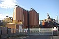 Crisp Maltings, Great Ryburgh - geograph.org.uk - 2681965.jpg 1,280 × 856; 117 KB
-
 Embankment South of the Station - geograph.org.uk - 1895400.jpg 800 × 531; 169 KB
-
 Fakenham Road, Great Ryburgh - geograph.org.uk - 2713415.jpg 640 × 480; 180 KB
-

-
 Former railway crossing, Great Ryburgh - geograph.org.uk - 2713417.jpg 640 × 480; 206 KB
-
 Great Ryburgh Maltings - geograph.org.uk - 1895375.jpg 800 × 531; 109 KB
-
 Great Ryburgh Maltings - geograph.org.uk - 1895408.jpg 800 × 531; 106 KB
-
 Great Ryburgh Station Platform - geograph.org.uk - 1895412.jpg 800 × 531; 162 KB
-
 Great Ryburgh War Memorial screen - geograph.org.uk - 4885592.jpg 3,456 × 2,592; 4.84 MB
-
 Lane to Little Ryburgh - geograph.org.uk - 2681854.jpg 1,280 × 856; 135 KB
-
 Looking South of Great Ryburgh - geograph.org.uk - 1895391.jpg 800 × 531; 192 KB
-
 Maltings at Great Ryburgh, aerial 2018 - geograph.org.uk - 5772834.jpg 1,024 × 683; 127 KB
-
 Old Buffer Stops - geograph.org.uk - 1895403.jpg 800 × 531; 189 KB
-
 Old Gate - geograph.org.uk - 1894529.jpg 800 × 531; 223 KB
-
 Pensthorpe Waterfowl Park - geograph.org.uk - 1962572.jpg 1,280 × 960; 393 KB
-
 Pensthorpe Waterfowl Park - geograph.org.uk - 3263239.jpg 1,000 × 525; 166 KB
-
 Pensthorpe Waterfowl Park - geograph.org.uk - 3263240.jpg 1,000 × 526; 171 KB
-
 River Wensum flowing through Pensthorpe - geograph.org.uk - 3144633.jpg 1,024 × 768; 382 KB
-

-
 Road called Clay Hill, Little Ryburgh - geograph.org.uk - 5616241.jpg 3,456 × 2,592; 3.1 MB
-

-
 Silos at Crisp Maltings, Great Ryburgh - geograph.org.uk - 2713406.jpg 640 × 480; 151 KB
-
 Site of Great Ryburgh Level Crossing - geograph.org.uk - 1895413.jpg 800 × 531; 136 KB
-
 Site of Great Ryburgh Station - geograph.org.uk - 1895415.jpg 800 × 531; 128 KB
-
 Small embankment nearing Great Ryburgh - geograph.org.uk - 1895365.jpg 800 × 531; 212 KB
-
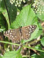 Speckled wood butterfly - geograph.org.uk - 3161375.jpg 781 × 1,024; 253 KB
-
 The Blue Boar Inn, Great Ryburgh - geograph.org.uk - 5300800.jpg 640 × 440; 131 KB
-

-

-
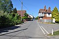
 The Street, Little Ryburgh - geograph.org.uk - 2681844.jpg 1,280 × 856; 208 KB
-
 Trackbed north to Great Ryburgh - geograph.org.uk - 1895395.jpg 800 × 531; 193 KB
-
 Trackbed to Great Ryburgh - geograph.org.uk - 1895370.jpg 800 × 531; 162 KB
-
 Trackbed Walk to Great Ryburgh - geograph.org.uk - 1894561.jpg 800 × 531; 205 KB
-
 Umbellifer seed pods forming - geograph.org.uk - 3144628.jpg 1,024 × 1,024; 419 KB
-
 View of Great Ryburgh Station Site - geograph.org.uk - 1895380.jpg 800 × 531; 125 KB
-

-

-


