Category:Südöstliche Walsertaler Berge
Deutsch: Die Südöstlichen Walsertaler Berge sind eine Untergruppe der Allgäuer Alpen. Grenzen: Oberstdorf — Stillachtal — Rappenalptal — Schrofenpass (1688 m) — Warth (Lechtal) — Hochtannbergpass (1676 m) — Bregenzerach (Bregenzerwald) — Hinterhopfreben — Üntschenpass (1854 m) — Kleinwalsertal — Oberstdorf.
English: The Südöstliche Walsertaler Berge (Southeastern Walser-Valley Mountains) are a sub-range of the Allgäu Alps. Borders: Oberstdorf — Stillach-Valley — Rappenalp-Valley — Schrofen-Pass (1688 m) — Warth (Lech-Valley) — Hochtannberg Pass (1676 m) — Bregenzerach (Bregenzerwald) — Hinterhopfreben — Üntschen-Pass (1854 m) — Kleinwalsertal — Oberstdorf.
mountain range of the Alps along the border Vorarlberg / Bavaria | |||||
| Upload media | |||||
| Instance of |
| ||||
|---|---|---|---|---|---|
| Location |
| ||||
| Mountain range |
| ||||
| Highest point | |||||
 | |||||
Subcategories
This category has the following 37 subcategories, out of 37 total.
A
- Alpgundkopf (25 F)
- Angererkopf (4 F)
B
- Bärenkopf (Allgäu Alps) (23 F)
D
- Dritter Schafalpenkopf (38 F)
E
- Elfer (41 F)
- Erster Schafalpenkopf (19 F)
F
- Fiderepasshütte (20 F)
- Freibergsee (47 F)
G
- Geißhorn (38 F)
- Griesgundkopf (15 F)
- Guggersee (6 F)
H
- Heiterberg (21 F)
- Hochalpsee (10 F)
- Hochgehrenspitze (19 F)
K
- Kemptner Kopf (6 F)
- Kleiner Widderstein (14 F)
L
- Liechelkopf (23 F)
M
- Mindelheimer Hütte (25 F)
O
- Oberstdorfer Hammerspitze (22 F)
R
- Roßgundkopf (19 F)
S
- Schartenkopf (2 F)
- Schlappoltkopf (3 F)
- Schlappoltsee (9 F)
- Söllerkopf (7 F)
W
- Walser Hammerspitze (19 F)
Z
- Zweiter Schafalpenkopf (25 F)
- Zwölfer (24 F)
Media in category "Südöstliche Walsertaler Berge"
The following 41 files are in this category, out of 41 total.
-
 300° Diedamskopf Panorama.jpg 9,559 × 1,362; 1.89 MB
-
 360° Hochkünzelspitze 2397m.jpg 8,950 × 1,728; 3.69 MB
-
 Allgaeuer Alpen.jpg 1,592 × 1,054; 714 KB
-
 Alpen fellhorn.jpg 1,600 × 1,200; 132 KB
-
 Alpen fellhorn2.jpg 1,447 × 1,081; 200 KB
-
 Bach im Allgäu - panoramio.jpg 1,193 × 1,590; 409 KB
-
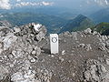 Bockkarkopf Grenzstein.JPG 3,264 × 2,448; 4.58 MB
-
 Fiderepasshuette Sunset.JPG 3,264 × 2,448; 2.72 MB
-
 Geislinger, Jäger Steig Panorama.jpg 7,237 × 2,299; 12.46 MB
-
 Gemstelkoblach from Widderstein.JPG 3,264 × 2,448; 4.14 MB
-
 Gries- Alp- Roßgundkopf03.JPG 3,264 × 2,448; 2.99 MB
-
 Griesgundkopf Schartenkopf.JPG 3,264 × 2,448; 3.59 MB
-
 Haldenwanger-kopf.jpg 2,848 × 2,136; 2.78 MB
-
 Ifen-Plateau Allgaeuer Hauptkamm.JPG 3,264 × 2,448; 3.84 MB
-
 Kanzelwand und Fellhorn 7.JPG 1,600 × 1,200; 605 KB
-
 Kemptner Kopf from Kleinwalsertal.JPG 3,648 × 2,736; 4.34 MB
-
 Mindelheimer Huette from Kemptner Kopf.JPG 3,264 × 2,448; 4.21 MB
-
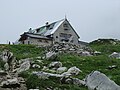 Mindelheimer Hütte 01.jpg 4,608 × 3,456; 5.15 MB
-
 Mindelheimer Klettersteig2.JPG 3,888 × 2,592; 4.93 MB
-
 Mutzenkopf.JPG 3,264 × 2,448; 4.25 MB
-
 Nebelhornpanorama.jpg 4,946 × 694; 2.25 MB
-
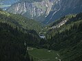
 Oberes Warmatsgundtal.JPG 3,264 × 2,448; 3.43 MB
-
 Oberstdorf-Krappberg03.jpg 2,100 × 1,527; 1.83 MB
-
 Panorama von der Lug (Lechquellengebirge) nach Osten.jpg 7,728 × 1,920; 6.28 MB
-
 Panorama Übergang zum Biberkopf - 3. Tag (9800507295).jpg 1,920 × 1,440; 1.56 MB
-
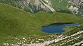
 Rappensee.JPG 1,151 × 770; 67 KB
-
 Rubihorn from Entschenkopf.JPG 3,264 × 2,448; 3.03 MB
-
 Schrofenpass.jpg 640 × 480; 79 KB
-
 Seekopf Hochalpsee (cropped).JPG 1,657 × 932; 732 KB
-
 Seekopf Hochalpsee.JPG 3,264 × 2,448; 3.5 MB
-
 Soellereck vom Rossbichel.jpg 2,396 × 1,592; 575 KB
-
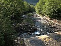
 Stillach bei Faistenoy.JPG 3,264 × 2,448; 3.36 MB
-
 Suedliche Schafalpenkopfgruppe.jpg 1,484 × 990; 240 KB
-
 Sunset Liechelkopf Elferkopf.JPG 3,264 × 2,448; 2.23 MB
-
 Thomas Praßler Weg Butzenspitze.jpg 7,807 × 2,127; 4.29 MB
-
 Warmatsgundbach.JPG 3,264 × 2,448; 5.54 MB
-
 Warmatsgundbach02.JPG 3,264 × 2,448; 4.99 MB
-
 Warmatsgundtal.JPG 3,264 × 2,448; 4.01 MB
-
 Warmatsgundtal02.JPG 3,264 × 2,448; 3.4 MB
-
 Wegweiser Allgäu - panoramio.jpg 1,193 × 1,590; 405 KB
-
 Widdersteinhütte.JPG 2,719 × 2,039; 3.32 MB


.jpg)


.JPG)


_nach_Osten.jpg)