Category:SKH Lui Ming Choi Secondary School
| Object location | | View all coordinates using: OpenStreetMap |
|---|
中文:聖公會呂明才中學
| Upload media | |||||
| Instance of | |||||
|---|---|---|---|---|---|
| Location | Hong Kong, PRC | ||||
| Inception |
| ||||
| official website | |||||
 | |||||
Media in category "SKH Lui Ming Choi Secondary School"
The following 10 files are in this category, out of 10 total.
-
 Far view of Wah Fu (II) Estate.JPG 4,128 × 3,096; 2.85 MB
-
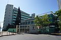 Sheng Kung Hui Lui Ming Choi Secondary School (blue sky).jpg 5,953 × 3,935; 13.68 MB
-
 Sheng Kung Hui Lui Ming Choi Secondary School.JPG 3,648 × 2,736; 1.83 MB
-
 Skhlmcsscp.jpg 4,912 × 3,264; 3.59 MB
-
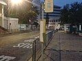
 Wah Fu Central Bus Terminus.JPG 3,648 × 2,736; 1.87 MB
-
 Wah Fu Estate (better contrast).jpg 2,560 × 1,920; 2.79 MB
-
 Wah Fu Estate.JPG 2,560 × 1,920; 950 KB
-
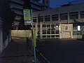
 WahFuCentralB.jpg 2,560 × 1,920; 1.22 MB
-
 WahFuCentralBusTerminus2016.jpg 1,600 × 1,200; 497 KB
-
 WahFuCentralC.jpg 2,560 × 1,920; 1.1 MB
_Estate.JPG)
.jpg)


.jpg)


