Category:SVG blank maps of France
Countries of Europe: Austria · Belgium · Czech Republic · France‡ · Germany · Italy · Montenegro · Portugal‡ · Spain‡ · Ukraine · United Kingdom
‡: partly located in Europe
‡: partly located in Europe
Pages in category "SVG blank maps of France"
This category contains only the following page.
Media in category "SVG blank maps of France"
The following 71 files are in this category, out of 71 total.
-
 Blank France map, no Departments.svg 507 × 520; 16 KB
-
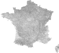
 Blank Map of Communes, France.svg 1,000 × 900; 12.02 MB
-
 Blank Map of France with Communes & Departments 2020.svg 1,567 × 1,500; 9.2 MB
-
 Blank Map of France with Communes 2017.svg 1,567 × 1,500; 12.31 MB
-
 Blank map of France with overseas territories.svg 512 × 575; 281 KB
-
 Blank Map of France, with Arrondissements.svg 512 × 475; 939 KB
-
 Blank map of France, with communes and departments.svg 1,000 × 900; 14.7 MB
-
 Blank Map of France, with Communes bw.svg 1,000 × 900; 13.34 MB
-
 Blank Map of France, with Communes.svg 1,000 × 900; 12.03 MB
-
 Blank map of French Saint Martin.svg 512 × 234; 41 KB
-
 Blank map of New Caledonia.svg 512 × 406; 47 KB
-
 Blank map of Saint Barthelemy.svg 512 × 389; 49 KB
-
 Blank map of Saint Pierre and Miquelon.svg 512 × 1,139; 1 KB
-
 Blank map of Tahiti.svg 512 × 274; 34 KB
-
 Blank map of Wallis and Futuna.svg 512 × 430; 38 KB
-
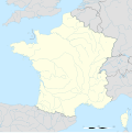
 Departements de France map.svg 588 × 550; 273 KB
-
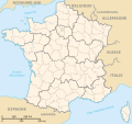
 Départements et régions de France vide.svg 530 × 550; 210 KB
-
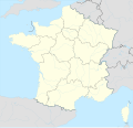
 Fond de carte des 13 nouvelles régions de France métropolitaine.svg 495 × 544; 43 KB
-
 France 1814 map-blank.svg 2,000 × 1,898; 303 KB
-
 France 5fleuves.svg 2,000 × 1,898; 869 KB
-
 France adm location map.svg 2,000 × 1,922; 524 KB
-
 France adm-2 location map.svg 2,000 × 1,922; 759 KB
-
 France blank 1.svg 1,796 × 1,797; 265 KB
-
 France blank 2.svg 1,796 × 1,797; 261 KB
-
 France blank.svg 1,796 × 1,797; 240 KB
-
 France blank1.svg 1,796 × 1,796; 1.09 MB
-
 France blank3.svg 1,796 × 1,796; 973 KB
-
 France location map-Departements 1790.svg 2,000 × 1,922; 581 KB
-
 France location map-Departements 1791.svg 2,000 × 1,922; 568 KB
-
 France location map-Departements 1793.svg 2,000 × 1,922; 565 KB
-
 France location map-Departements 1795.svg 2,000 × 1,922; 640 KB
-
 France location map-Departements 1797.svg 2,000 × 1,922; 603 KB
-
 France location map-Departements 1798.svg 2,000 × 1,922; 890 KB
-
 France location map-Departements 1800.svg 2,000 × 1,922; 886 KB
-
 France location map-Departements 1801.svg 2,000 × 1,922; 883 KB
-
 France location map-Departements 1802.svg 2,000 × 1,922; 869 KB
-
 France location map-Departements 1805.svg 2,000 × 1,922; 869 KB
-
 France location map-Departements 1808.svg 2,000 × 1,922; 868 KB
-
 France location map-Departements 1810.svg 2,000 × 1,922; 890 KB
-
 France location map-Departements 1811.svg 2,000 × 1,922; 913 KB
-
 France location map-Departements 1812.svg 2,000 × 1,922; 890 KB
-
 France location map-Departements 1813.svg 2,000 × 1,922; 885 KB
-
 France location map-Departements 1814.svg 2,000 × 1,922; 808 KB
-
 France location map-Departements 1815.svg 2,000 × 1,922; 588 KB
-
 France location map-Departements 1848.svg 2,000 × 1,922; 587 KB
-
 France location map-Departements 1852.svg 2,000 × 1,922; 580 KB
-
 France location map-Departements 1860.svg 2,000 × 1,922; 567 KB
-
 France location map-Departements 1919.svg 2,000 × 1,922; 575 KB
-
 France location map-Departements 1947.svg 2,000 × 1,922; 573 KB
-
 France location map-Departements 1964.svg 2,000 × 1,922; 577 KB
-
 France location map-Departements 1967.svg 2,000 × 1,922; 598 KB
-
 France location map-Departements 1970.svg 2,000 × 1,922; 578 KB
-
 France location map-Departements 1971-1972.svg 2,000 × 1,922; 620 KB
-
 France location map-Departements 1973-1974.svg 2,000 × 1,922; 673 KB
-
 France location map-Departements 1975-1996.svg 2,000 × 1,922; 675 KB
-
 France location map-Departements 1997-2014.svg 2,000 × 1,922; 783 KB
-
 France location map-Provinces 1789.svg 2,000 × 1,922; 557 KB
-
 France location map-Regions and departments with Paris and inner ring in a box-2016.svg 2,000 × 1,922; 598 KB
-
 France location map.svg 1,041 × 997; 643 KB
-
 France map Lambert-93 topographic with regions and departements-blank.svg 2,000 × 1,898; 1.67 MB
-
 France map Lambert-93 topographic with regions-blank.svg 2,000 × 1,898; 1.61 MB
-
 France map Lambert-93 topographic-blank.svg 2,000 × 1,898; 1.56 MB
-
 France map Lambert-93 with regions and departments polygons-blank.svg 2,000 × 1,898; 1.57 MB
-
 France map Lambert-93 with regions and departments-blank.svg 2,000 × 1,898; 808 KB
-
 France map Lambert-93 with regions-blank.svg 2,000 × 1,898; 713 KB
-
 France map Lambert-93 with rivers and regions-blank.svg 2,000 × 1,898; 929 KB
-
 France map Lambert-93 with rivers-blank.svg 2,000 × 1,898; 875 KB
-
 France map Lambert-93-blank.svg 2,000 × 1,898; 642 KB
-
 Gains territoriaux de la France en 1814.svg 2,000 × 1,898; 314 KB
-
 Tour de France base map empty.svg 2,385 × 2,292; 5.87 MB
-
 Tour de France base map.svg 2,385 × 2,292; 5.85 MB


