Category:SVG locator maps of Canada
Countries of North America: Antigua and Barbuda · The Bahamas · Barbados · Belize · Canada · Costa Rica · Cuba · Dominica · Dominican Republic · El Salvador · Grenada · Guatemala · Haiti · Honduras · Jamaica · Mexico · Nicaragua · Panama · Saint Kitts and Nevis · Saint Lucia · Saint Vincent and the Grenadines · Trinidad and Tobago‡ · United States of America‡
Other territories: Anguilla · Cayman Islands · Greenland · Guadeloupe · Martinique · Puerto Rico · Saint Barthélemy · Turks and Caicos Islands
‡: partly located in North America
Other territories: Anguilla · Cayman Islands · Greenland · Guadeloupe · Martinique · Puerto Rico · Saint Barthélemy · Turks and Caicos Islands
‡: partly located in North America
Subcategories
This category has the following 3 subcategories, out of 3 total.
Media in category "SVG locator maps of Canada"
The following 53 files are in this category, out of 53 total.
-
 Abitibi-Temiscamingue (Quebec) map.svg 1,630 × 2,000; 304 KB
-
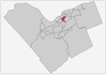
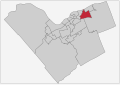
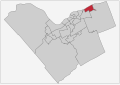
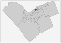
 Alta Vista Ward locator map.svg 1,400 × 987; 181 KB
-
 Baie Burrard Fond de carte.svg 1,273 × 918; 49 KB
-
 Barrhaven Ward locator map.svg 1,400 × 987; 181 KB
-
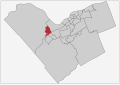
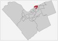
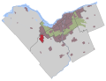
 Bay Ward locator map.svg 1,400 × 987; 181 KB
-
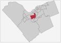
 Beacon Hill-Cyrville Ward locator map.svg 1,400 × 987; 181 KB
-
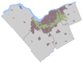
 Bells Corners locator map.svg 780 × 595; 1.13 MB
-
 Blackburn Hamlet locator map.svg 780 × 595; 1.13 MB
-
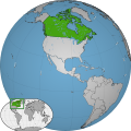 Canada w1 locator.svg 1,000 × 1,000; 110 KB
-
 Canada w2 locator.svg 1,000 × 1,000; 226 KB
-
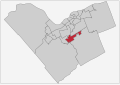
 Capital Ward locator map.svg 1,400 × 987; 181 KB
-
 Carlsbad Springs locator map.svg 780 × 595; 1.13 MB
-
 Carp locator map.svg 780 × 595; 1.13 MB
-
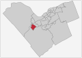
 College Ward locator map.svg 1,400 × 987; 181 KB
-
 Constance Bay locator map.svg 780 × 595; 1.13 MB
-
 Cumberland locator map.svg 780 × 595; 1.13 MB
-
 Cumberland Ward locator map.svg 1,400 × 987; 181 KB
-
 Dunrobin locator map.svg 780 × 595; 1.13 MB
-
 Gloucester-South Nepean Ward locator map.svg 1,400 × 987; 181 KB
-
 Gloucester-Southgate Ward locator map.svg 1,400 × 987; 181 KB
-
 Greely locator map.svg 780 × 595; 1.13 MB
-
 Innes Ward locator map.svg 1,400 × 987; 181 KB
-
 Kanata locator map.svg 780 × 595; 1.13 MB
-
 Kanata North Ward locator map.svg 1,400 × 987; 181 KB
-
 Kanata South Ward locator map.svg 1,400 × 987; 181 KB
-
 Kars locator map.svg 780 × 595; 1.13 MB
-
 Kinburn locator map.svg 780 × 595; 1.13 MB
-
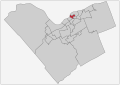
 Kitchissippi Ward locator map.svg 1,400 × 987; 181 KB
-
 Knoxdale-Merivale Ward locator map.svg 1,400 × 987; 181 KB
-
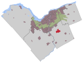
 Leitrim locator map.svg 780 × 595; 1.13 MB
-
 Manotick locator map.svg 780 × 595; 1.13 MB
-
 Metcalfe locator map.svg 780 × 595; 1.13 MB
-
 Munster, Ottawa locator map.svg 780 × 595; 1.13 MB
-
 Navan locator map.svg 780 × 595; 1.13 MB
-
 North Gower locator map.svg 780 × 595; 1.13 MB
-
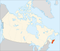
 Nova Scotia in Canada (modern).svg 512 × 492; 245 KB
-
 Nova Scotia peninsula.svg 1,084 × 920; 93 KB
-
 Orleans Ward locator map.svg 1,400 × 987; 181 KB
-
 Osgoode Ward locator map.svg 1,400 × 987; 181 KB
-
 Prince Edward Island in Canada (modern).svg 512 × 492; 249 KB
-
 Quebec in Canada (modern).svg 512 × 492; 250 KB
-
 Richmond locator map.svg 780 × 595; 1.13 MB
-
 Rideau-Goulbourn Ward locator map.svg 1,400 × 987; 181 KB
-
 Rideau-Rockcliffe Ward locator map.svg 1,400 × 987; 181 KB
-
 Rideau-Vanier Ward locator map.svg 1,400 × 987; 181 KB
-
 River Ward locator map.svg 1,400 × 987; 181 KB
-
 Sarsfield locator map.svg 780 × 595; 1.13 MB
-
 Somerset Ward locator map.svg 1,400 × 987; 181 KB
-
 Stittsville locator map.svg 780 × 595; 1.13 MB
-
 Stittsville-Kanata West Ward locator map.svg 1,400 × 987; 181 KB
-
 Vars locator map.svg 780 × 595; 1.13 MB
-
 Vernon locator map.svg 780 × 595; 1.13 MB
-
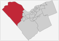 West Carleton-March Ward locator map.svg 1,400 × 987; 181 KB
_map.svg)


.svg)


.svg)
.svg)


