Category:SVG locator maps of former countries of Africa (location map scheme)
Media in category "SVG locator maps of former countries of Africa (location map scheme)"
The following 13 files are in this category, out of 13 total.
-
 Benin Republic in its region (1967).svg 361 × 231; 251 KB
-
 Biafra in its region.svg 361 × 231; 254 KB
-
 British Somaliland in its region.svg 556 × 315; 283 KB
-
 Central African Empire in its region.svg 490 × 276; 292 KB
-
 Empire of Benin on the globe (Africa centered).svg 797 × 797; 282 KB
-
 Ethiopia in its region (before 1993).svg 556 × 315; 259 KB
-
 Italian Somaliland in its region.svg 556 × 315; 283 KB
-
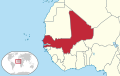
 Mali Federation in its region (1959).svg 443 × 282; 257 KB
-
 Mali Federation in its region.svg 443 × 282; 261 KB
-
 Map of Biafra with Benin and Nigeria.svg 512 × 327; 518 KB
-
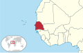 Senegambia in its region.svg 443 × 282; 231 KB
-
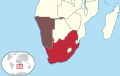
 South Africa in its region (1990).svg 478 × 303; 207 KB
-
 Union of South Africa in its region.svg 478 × 303; 210 KB
.svg)


.svg)
.svg)

.svg)


.svg)
