Category:SVG maps of Holyoke, Massachusetts
Media in category "SVG maps of Holyoke, Massachusetts"
The following 20 files are in this category, out of 20 total.
-

-

-
 HolyokeMA neighborhoods.svg 501 × 828; 25 KB
-
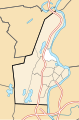
 USA Holyoke location map Churchill highlighted.svg 176 × 266; 204 KB
-
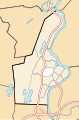
 USA Holyoke location map Downtown highlighted.svg 176 × 266; 204 KB
-
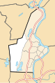
 USA Holyoke location map Elmwood highlighted.svg 176 × 266; 204 KB
-
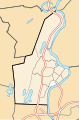
 USA Holyoke location map Highland Park highlighted.svg 176 × 266; 204 KB
-
 USA Holyoke location map Highlands highlighted.svg 176 × 266; 204 KB
-
 USA Holyoke location map Homestead Avenue highlighted.svg 176 × 266; 204 KB
-
 USA Holyoke location map Ingleside highlighted.svg 176 × 266; 204 KB
-
 USA Holyoke location map Jarvis Avenue highlighted.svg 176 × 266; 204 KB
-
 USA Holyoke location map lg.svg 176 × 266; 314 KB
-
 USA Holyoke location map Oakdale highlighted.svg 176 × 266; 204 KB
-
 USA Holyoke location map Rock Valley highlighted.svg 176 × 266; 204 KB
-
 USA Holyoke location map Smiths Ferry highlighted.svg 176 × 266; 204 KB
-
 USA Holyoke location map South Holyoke highlighted.svg 176 × 266; 204 KB
-
 USA Holyoke location map Springdale highlighted.svg 176 × 266; 204 KB
-
 USA Holyoke location map The Flats highlighted.svg 176 × 266; 204 KB
-
 USA Holyoke location map Whiting Farms highlighted.svg 176 × 266; 204 KB
-
 USA Holyoke location map.svg 176 × 266; 205 KB


