Category:SVG maps of Kiribati
Subcategories
This category has only the following subcategory.
L
Media in category "SVG maps of Kiribati"
The following 21 files are in this category, out of 21 total.
-
 Kiribati Gilbert Islands location map.svg 638 × 560; 41 KB
-
 Kiribati Kiritimati location map.svg 1,367 × 1,118; 71 KB
-
 Kiribati location map.svg 1,488 × 673; 68 KB
-
 Kiribati regions map mk.svg 1,820 × 1,370; 6.15 MB
-
 Kiribati regions map.svg 1,820 × 1,370; 6.12 MB
-
 Kiritimati Kiribati labels.svg 1,468 × 1,114; 41 KB
-
 Kiritimati Kiribati mk.svg 1,468 × 1,114; 44 KB
-
 Kiritimati Kiribati.svg 1,468 × 1,114; 32 KB
-
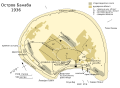
 Map Banaba Island 1936-en.svg 750 × 545; 49 KB
-
 Map Banaba Island 1936-fr.svg 512 × 358; 252 KB
-
 Map Banaba Island 1936-mk.svg 750 × 545; 68 KB
-
 Map Banaba Island 1936-sr.svg 750 × 545; 50 KB
-
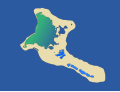
 Map of Millennium Island (Caroline Atoll), Kiribati.svg 1,792 × 2,258; 523 KB
-
 South Tarawa (north and south labeled).svg 694 × 694; 39 KB
-
 South Tarawa (separated to north and south) - bel.svg 694 × 694; 31 KB
-
 South Tarawa (separated to north and south).svg 694 × 694; 35 KB
-
 Tamana Island mk.svg 984 × 540; 21 KB
-
 Tamana Island.svg 984 × 540; 21 KB
-
 Tarawa Atoll, Kiribati mk.svg 694 × 694; 30 KB
-
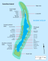
 Tarawa Atoll, Kiribati.svg 694 × 694; 25 KB
-
 Territorial waters - Kiribati.svg 800 × 400; 694 KB


,_Kiribati.svg)
.svg)
_-_bel.svg)
.svg)


