Category:SVG maps of Punjab, India
States of India: Andhra Pradesh · Arunachal Pradesh · Assam · Bihar · Chhattisgarh · Goa · Gujarat · Haryana · Himachal Pradesh · Jharkhand · Karnataka · Kerala · Madhya Pradesh · Maharashtra · Manipur · Meghalaya · Mizoram · Nagaland · Odisha · Punjab · Rajasthan · Sikkim · Tamil Nadu · Telangana · Tripura · Uttar Pradesh · Uttarakhand · West Bengal
Union territories: Andaman and Nicobar Islands · Chandigarh · Dadra and Nagar Haveli and Daman and Diu · Delhi · Jammu and Kashmir · Ladakh · Lakshadweep · Puducherry
Former states of India: Jammu and Kashmir ·
Former union territories:
Union territories: Andaman and Nicobar Islands · Chandigarh · Dadra and Nagar Haveli and Daman and Diu · Delhi · Jammu and Kashmir · Ladakh · Lakshadweep · Puducherry
Former states of India: Jammu and Kashmir ·
Former union territories:
Subcategories
This category has only the following subcategory.
Media in category "SVG maps of Punjab, India"
The following 42 files are in this category, out of 42 total.
-
 2014 Punjab Lok Sabha.svg 512 × 546; 1,016 KB
-
 2017 Punjab Legislative Assembly election map.svg 512 × 546; 2.51 MB
-
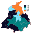
 2019 Punjab Lok Sabha Election Result Seatwise Map.svg 580 × 618; 869 KB
-
 2022 Punjab Legislative Assembly election NDA Seat Sharing.svg 610 × 650; 5.36 MB
-
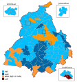
 2022 Punjab Legislative Assembly election results.svg 610 × 650; 3.32 MB
-
 2024 Lok Sabha Punjab NDA Coloured.svg 580 × 618; 1.63 MB
-
 2024 Lok Sabha Punjab Result Map.svg 580 × 618; 870 KB
-
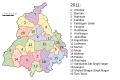
 Districts of Punjab, India.svg 955 × 1,029; 122 KB
-
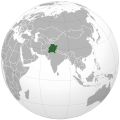
 India Punjab location map.svg 979 × 1,086; 311 KB
-
 India Punjab relief map.svg 979 × 1,086; 1.44 MB
-
 Map of Punjab Lok Sabha constituencies.svg 512 × 546; 1,021 KB
-
 Punjab (orthographic projection).svg 970 × 970; 13.19 MB
-
 Punjab 1951-66 as.svg 1,055 × 427; 50 KB
-
 Punjab 1951-66-bn.svg 1,055 × 427; 63 KB
-
 Punjab 1951-66-gu.svg 1,055 × 427; 51 KB
-
 Punjab 1951-66-hi.svg 1,055 × 427; 53 KB
-
 Punjab 1951-66-kn.svg 1,055 × 427; 62 KB
-
 Punjab 1951-66-ml.svg 1,055 × 427; 76 KB
-
 Punjab 1951-66-mr.svg 1,055 × 427; 54 KB
-
 Punjab 1951-66-pa.svg 1,055 × 427; 52 KB
-
 Punjab 1951-66-te.svg 1,055 × 427; 54 KB
-
 Punjab 1951-66.od.svg 1,055 × 427; 52 KB
-
 Punjab 1951-66.svg 1,055 × 427; 50 KB
-
 Punjab 2011 administrativ.svg 900 × 600; 257 KB
-
 Punjab 2012 administrativ as.svg 900 × 600; 258 KB
-
 Punjab 2012 administrativ-bn.svg 800 × 600; 402 KB
-
 Punjab 2012 administrativ-hi.svg 900 × 600; 271 KB
-
 Punjab 2012 administrativ-kn.svg 900 × 600; 287 KB
-
 Punjab 2012 administrativ-ml.svg 900 × 600; 281 KB
-
 Punjab 2012 administrativ-mr.svg 900 × 600; 272 KB
-
 Punjab 2012 administrativ-pa.svg 900 × 600; 277 KB
-
 Punjab 2012 administrativ-te.svg 900 × 600; 271 KB
-
 Punjab 2012 administrativ.svg 900 × 600; 259 KB
-
 Punjab 2012 administrative-gu.svg 900 × 600; 163 KB
-
 Punjab locator map.svg 955 × 1,029; 174 KB
-
 Punjab map for WLM-IN.svg 873 × 986; 14 KB
-
 Punjab outline shape.svg 300 × 300; 81 KB
-
 Punjab Wahlkreise Lok Sabha.svg 580 × 618; 856 KB
-
 Wahl im Punjab 2017.svg 610 × 650; 3.36 MB
-
 Wahl im Punjab 2022.svg 610 × 650; 3.36 MB
-
 Wahlkreise zur Vidhan Sabha von Punjab.svg 610 × 650; 3.38 MB
-
 পাঞ্জাবের লোকসভা কেন্দ্র.svg 580 × 618; 1.4 MB


.svg)


