Category:SVG maps of Somaliland
Subcategories
This category has the following 4 subcategories, out of 4 total.
Media in category "SVG maps of Somaliland"
The following 43 files are in this category, out of 43 total.
-
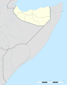
 Administrative Regions of Somaliland.svg 800 × 522; 57 KB
-
 Awdal relief location map.svg 586 × 794; 546 KB
-
 Blank Somaliland Map (districts).svg 1,052 × 744; 38 KB
-
 Blank Somaliland Map.svg 1,052 × 744; 33 KB
-
 Districts of Somaliland.svg 1,010 × 737; 97 KB
-
 Flag-map of Somaliland (1991-1996).svg 2,368 × 1,315; 17 KB
-
 Flag-map of Somaliland.svg 1,078 × 601; 60 KB
-
 Gobolada Somaliland.svg 1,052 × 744; 146 KB
-
 Invasione italiana della Somalia brittanica (1940) mappa.svg 1,057 × 674; 55 KB
-
 LocationSomaliland.svg 1,000 × 500; 2.32 MB
-
 Locator map of Somaliland in Africa.svg 863 × 848; 132 KB
-
 Map of Somaliland.svg 1,194 × 636; 2.54 MB
-
 Marodi Jeh location map relief.svg 429 × 582; 381 KB
-
 Regions of Somaliland labelled EN.svg 800 × 504; 58 KB
-
 Regions of Somaliland.svg 800 × 600; 21 KB
-
 Salal.svg 2,161 × 994; 559 KB
-
 Sanaag location relief map.svg 609 × 735; 930 KB
-
 Somaliland Awdal location map.svg 533 × 727; 147 KB
-
 Somaliland Clans map.svg 800 × 504; 81 KB
-
 Somaliland districts.svg 1,010 × 737; 66 KB
-
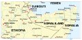
 Somaliland in East Africa.svg 771 × 895; 35 KB
-
 Somaliland location map (1).svg 800 × 504; 57 KB
-
 Somaliland location map (2).svg 1,051 × 1,338; 174 KB
-
 Somaliland location map.svg 1,051 × 1,338; 139 KB
-
 Somaliland map (disputed territory).svg 800 × 504; 189 KB
-
 Somaliland map.svg 497 × 245; 1.11 MB
-
 Somaliland Map.svg 460 × 337; 319 KB
-
 Somaliland Map1.svg 800 × 504; 55 KB
-
 Somaliland Marodi Jeh location map.svg 533 × 727; 54 KB
-
 Somaliland regions.svg 1,006 × 764; 53 KB
-
 Somaliland relief location map.svg 800 × 504; 8.49 MB
-
 Somaliland Sahil location map.svg 533 × 727; 74 KB
-
 Somaliland Sahil relief location map.svg 581 × 755; 413 KB
-
 Somaliland Sanaag location map.svg 533 × 727; 179 KB
-
 Somaliland Sool location map.svg 533 × 727; 82 KB
-
 Somaliland Togdheer location map.svg 533 × 727; 48 KB
-
 Somaliland-Maroodi Jeh Region.svg 1,123 × 770; 3.21 MB
-
 Somaliland-Sahil Region.svg 1,123 × 770; 3.21 MB
-
 Somaliland-Togdheer Region.svg 1,123 × 793; 2.61 MB
-
 Sool location relief map.svg 585 × 592; 784 KB
-
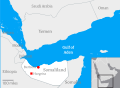
 Territorial Waters of Somaliland.svg 800 × 400; 699 KB
-
 Togdheer location relief map.svg 528 × 607; 456 KB
-
 محافظات صوماليلاند.svg 1,006 × 764; 50 KB


.svg)


_mappa.svg)


.svg)
.svg)

.svg)


.svg)