Category:SVG maps of Ukraine
Subcategories
This category has the following 9 subcategories, out of 9 total.
*
B
- SVG Bilateral maps of Ukraine (212 F)
- SVG blank maps of Ukraine (10 F)
C
F
H
L
T
- SVG topographic maps of Ukraine (26 F)
Media in category "SVG maps of Ukraine"
The following 46 files are in this category, out of 46 total.
-
 2022 Russian invasion of Ukraine sandbox.svg 2,199 × 1,478; 4.3 MB
-
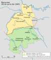 Bucovina division es.svg 1,003 × 1,189; 336 KB
-
 Bucovina division.svg 820 × 1,065; 395 KB
-
 Dnister-Nistru. hu.svg 619 × 555; 86 KB
-
 Dzielnice Lwowa.svg 320 × 306; 62 KB
-
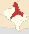 Ivano-Frankivsk Raion 2020.svg 533 × 637; 91 KB
-
 Kharkiv Oblast UPA.svg 1,546 × 1,038; 885 KB
-
 Koppen-Geiger Map UKR future.svg 1,816 × 850; 1.14 MB
-
 Lavric proposal for a Moldova–Ukraine territorial transfer, 2011.svg 1,478 × 1,538; 390 KB
-
 Left-Bank Ukraine.png 632 × 322; 55 KB
-
 Locator map of Zaporizhzhya province.svg 887 × 589; 544 KB
-
 Map of Donbas region.svg 1,018 × 1,005; 1.32 MB
-
 Map of Ukraine en.svg 602 × 448; 1.28 MB
-
 Map of Ukraine hu.svg 377 × 264; 742 KB
-
 Map of Ukraine Oblasts 4 colors.svg 550 × 380; 728 KB
-
 Map of Ukraine Oblasts simple 4 colors.svg 700 × 480; 178 KB
-
 Nuclear power plants map Ukraine-fr.png 634 × 324; 78 KB
-
 Raions of Ukraine (after Oct. 2020) EN.svg 1,488 × 1,052; 2.65 MB
-
 Raions of Ukraine (after Oct. 2020).svg 1,488 × 1,052; 3.1 MB
-
 Roma in Ukraine percents.svg 700 × 480; 312 KB
-
 Roma in Ukraine.svg 700 × 480; 312 KB
-
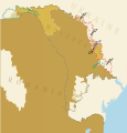
 Romanian-Ukrainian territorial dispute.svg 1,035 × 868; 41 KB
-
 RomaniDialectsUkraine.svg 700 × 480; 325 KB
-
 RomaofUkraine2001language.svg 620 × 477; 775 KB
-
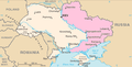
 Ukraine - Europe centrale.svg 1,090 × 756; 365 KB
-
 Ukraine adm location map improved.svg 3,780 × 2,540; 1.77 MB
-
 Ukraine adm location map.svg 1,546 × 1,038; 499 KB
-
 Ukraine location map.svg 1,546 × 1,038; 429 KB
-
 Ukraine regions map uk.svg 744 × 1,052; 2.06 MB
-
 Ukraine under russian occupation grey.svg 3,780 × 2,540; 1.8 MB
-
 Ukraine under russian occupation.svg 3,780 × 2,540; 1.85 MB
-
 Ukrainian cities of regional significance.svg 1,052 × 744; 2.2 MB
-
 Ukrainian language in Kherson Governorate, 1897.svg 1,572 × 1,320; 127 KB
-
 Ukrainian wikipedians geography.svg 550 × 380; 769 KB
-
 Ukrainians uk.svg 1,001 × 640; 1.98 MB
-
 Zaporizhzhia En.svg 512 × 404; 475 KB
-
 Zaporizhzhia Ukr.svg 512 × 404; 477 KB
-
 Zhydachiv Raion.svg 497 × 744; 961 KB
-
 Амурська площа.svg 1,820 × 1,438; 360 KB
-
 Карта України (українською) з назвами міст.svg 700 × 480; 544 KB
-
 Карта Украины.svg 792 × 612; 2.2 MB
-
 Княжество Глинских 15 век.svg 392 × 353; 1.18 MB
-
 Лощина СКА Карта.svg 744 × 1,052; 661 KB
-
 Польша и Литва ок. 1400.svg 574 × 475; 140 KB
-
 Районы Запорожья.svg 793 × 526; 55 KB
-
 Русинские субэтносы.svg 800 × 571; 56 KB


_EN.svg)
.svg)


_%D0%B7_%D0%BD%D0%B0%D0%B7%D0%B2%D0%B0%D0%BC%D0%B8_%D0%BC%D1%96%D1%81%D1%82.svg)


