Category:SVG maps of tehsils of India
Subcategories
This category has only the following subcategory.
T
Media in category "SVG maps of tehsils of India"
The following 18 files are in this category, out of 18 total.
-
 Achampeta assembly constituency.svg 340 × 285; 304 KB
-
 Achanta assembly constituency.svg 292 × 350; 227 KB
-
 Adilabad assembly constituency.svg 344 × 203; 227 KB
-
 Adilabad mandals outline pre 2016.svg 350 × 213; 129 KB
-
 Alampur assembly constituency.svg 340 × 285; 291 KB
-
 Asifabad assembly constituency.svg 344 × 203; 301 KB
-
 Assembly constituencies in Adilabad district pre 2016.svg 344 × 203; 322 KB
-
 Assembly constituencies in Mahbubnagar district pre 2016 1.svg 340 × 285; 548 KB
-
 Assembly constituencies in Mahbubnagar district ప్రె 2016.svg 340 × 285; 444 KB
-
 Bellampalli assembly constituency pre 2016.svg 344 × 203; 267 KB
-
 Bhimavaram assembly constituency pre 2022.svg 292 × 350; 223 KB
-
 Boath assembly constituency pre 2016.svg 344 × 203; 276 KB
-
 Chandragiri assembly constituency pre 2022.svg 350 × 253; 294 KB
-
 Chennur assembly constituency pre 2016.svg 344 × 203; 242 KB
-
 Chinatalapudi assembly constituency pre 2022.svg 292 × 350; 266 KB
-
 Inda states districts tehsils by census 2011.svg 1,544 × 1,498; 10.81 MB
-
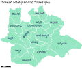
 Narmadapuram division Madhya Pradesh locator map.svg 1,829 × 1,187; 1.05 MB
-
 Tehsils of Sri Ganganagar District, Rajasthan, India.svg 3,822 × 3,820; 128 KB


