Category:SVG maps the Danube watercourse system
Media in category "SVG maps the Danube watercourse system"
The following 19 files are in this category, out of 19 total.
-
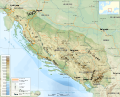 Dinaric Alps map-fr.svg 1,857 × 1,503; 3.63 MB
-
 Autriche hydro-de.svg 711 × 399; 164 KB
-
 Autriche hydro-fr.svg 711 × 399; 233 KB
-
 Bečva River (CZE) - location and watershed.svg 5,342 × 3,123; 138 KB
-
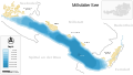
 Map at millstaetter see sv.svg 1,313 × 744; 238 KB
-
 Map at millstaetter see.svg 1,313 × 744; 124 KB
-
 Hornád River - location and watershed map.svg 4,680 × 2,518; 119 KB
-
 Hron River - location and watershed map.svg 4,680 × 2,518; 121 KB
-
 Hungary map blank.svg 1,600 × 1,400; 231 KB
-
 Ipeľ River (SVK) - location and watershed.svg 4,680 × 2,518; 122 KB
-
 Karte Traisen (Fluss).svg 1,200 × 1,200; 125 KB
-
 Belene Island map.svg 850 × 476; 59 KB
-
 Np gesaeuse.svg 1,270 × 950; 331 KB
-
 Rožnovská brázda (CZE) - location map.svg 5,342 × 3,123; 327 KB
-
 Slaná River - location and watershed map.svg 4,680 × 2,518; 118 KB
-
 Slovakia rivers without text 2008-11-17.svg 1,220 × 630; 190 KB
-
 Váh River (SVK) - location and watershed.svg 4,680 × 2,518; 128 KB
-
 Waterways of SE Central Europe.svg 1,415 × 1,059; 286 KB
-
 HQL Plan 4C.svg 1,140 × 655; 289 KB


_-_location_and_watershed.svg)


_-_location_and_watershed.svg)
.svg)


_-_location_map.svg)


_-_location_and_watershed.svg)

