Category:SVG topographic maps of Chile
Media in category "SVG topographic maps of Chile"
The following 23 files are in this category, out of 23 total.
-
 Arica-y-parinacota.svg 1,002 × 1,099; 2.96 MB
-
 Chile.cuencas.hidrograficas.region.del.biobio.svg 800 × 715; 1.34 MB
-
 Chile.puyehue.svg 749 × 610; 1.27 MB
-
 Dakar Rally 2010 map-blank.svg 1,513 × 1,584; 3.52 MB
-
 Dakar Rally 2010 map-ca.svg 1,513 × 1,584; 3.53 MB
-
 Dakar Rally 2010 map-cs.svg 1,513 × 1,584; 3.53 MB
-
 Dakar Rally 2010 map-de.svg 1,513 × 1,584; 3.53 MB
-
 Dakar Rally 2010 map-en.svg 1,513 × 1,584; 3.53 MB
-
 Dakar Rally 2010 map-es.svg 1,513 × 1,584; 3.58 MB
-
 Dakar Rally 2010 map-fr.svg 1,513 × 1,584; 3.53 MB
-
 Dakar Rally 2010 map-hu.svg 1,513 × 1,584; 3.53 MB
-
 Dakar Rally 2010 map-mk.svg 1,513 × 1,584; 3.53 MB
-
 Dakar Rally 2011 map-cs.svg 1,513 × 1,584; 3.42 MB
-
 Dakar Rally 2011 map-en.svg 1,513 × 1,584; 3.42 MB
-
 Dakar Rally 2011 map-es.svg 1,513 × 1,584; 3.42 MB
-
 Dakar Rally 2011 map-fr.svg 1,513 × 1,584; 3.42 MB
-
 Dakar Rally 2011 map-mk.svg 1,513 × 1,584; 3.43 MB
-
 Easter Island map-en.svg 1,750 × 1,245; 878 KB
-
 Golfo de Arauco-es.svg 512 × 512; 25.23 MB
-
 Map Palena-es.svg 2,519 × 3,371; 7.16 MB
-
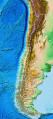 Relief Map of Chile.svg 1,183 × 2,658; 2.1 MB
-
 Rios-antofagasta-region.svg 1,698 × 1,233; 5.05 MB
-
 Río-loa-(origen).svg 890 × 592; 1.04 MB


.svg)