Category:SVG topographic maps of Kenya
Media in category "SVG topographic maps of Kenya"
The following 24 files are in this category, out of 24 total.
-
 Great Rift Valley in Kenya (shaded map).svg 1,000 × 1,100; 2.09 MB
-
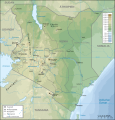
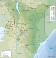
 Kenya topographic map-be.svg 1,181 × 1,231; 3.24 MB
-
 Kenya topographic map-bg.svg 1,181 × 1,231; 3.23 MB
-
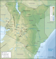
 Kenya topographic map-de.svg 1,181 × 1,231; 3.24 MB
-
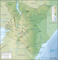
 Kenya topographic map-fr.svg 1,181 × 1,231; 3.26 MB
-
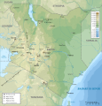
 Kenya topographic map-hu.svg 1,181 × 1,231; 3.28 MB
-
 Kenya topographic map-mk.svg 1,181 × 1,231; 3.22 MB
-
 Kenya topographic map-sr.svg 1,181 × 1,231; 3.26 MB
-
 Kenya topographic map-sw.svg 1,181 × 1,231; 3.18 MB
-
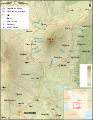
 Mount Kenya Population map-en.svg 1,802 × 2,793; 1.18 MB
-
 Mount Kenya Population map-fr.svg 1,802 × 2,793; 1.18 MB
-
 Mount Kenya Population map-mk.svg 1,802 × 2,793; 1.39 MB
-
 Mount Kenya Region map-de.svg 1,782 × 2,300; 1.46 MB
-
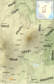
 Mount Kenya Region map-en.svg 1,782 × 2,300; 1.34 MB
-
 Mount Kenya Region map-fr.svg 1,782 × 2,300; 1.46 MB
-
 Mount Kenya Region map-he.svg 1,782 × 2,300; 1.49 MB
-
 Mount Kenya Region map-hu.svg 1,782 × 2,300; 1.47 MB
-
 Mount Kenya Region map-mk.svg 1,782 × 2,300; 1.34 MB
-
 Mount Kilimanjaro and Mount Meru map-es.svg 2,242 × 1,888; 1.68 MB
-
 Mount Kilimanjaro and Mount Meru map-fr.jpg 3,362 × 2,830; 2.11 MB
-
 Mount Kilimanjaro and Mount Meru map-fr.svg 2,242 × 1,888; 1.68 MB
-
 Mount Kilimanjaro and Mount Meru map-nl.svg 2,242 × 1,888; 1.69 MB
-
 Mount Kilimanjaro Ethnic Groups map-fr.svg 2,050 × 1,907; 794 KB
-
 Карта Кеніі.svg 1,181 × 1,231; 3.24 MB
.svg)


