Category:SVG topographic maps of Mauritius
Media in category "SVG topographic maps of Mauritius"
The following 15 files are in this category, out of 15 total.
-
 Agalega Islands map-en.svg 1,500 × 1,825; 434 KB
-
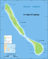 Agalega Islands map-fr.svg 1,500 × 1,825; 434 KB
-
 Agalega Islands map-mk.svg 1,500 × 1,825; 431 KB
-
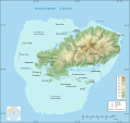 Rodrigues Island topographic map-de.svg 1,700 × 1,600; 750 KB
-
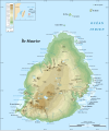
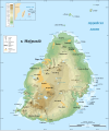 Mauritius Island topographic map-be.svg 1,810 × 2,160; 1.92 MB
-
 Mauritius Island topographic map-de.svg 1,810 × 2,160; 1.93 MB
-
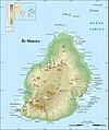 Mauritius Island topographic map-fr.jpg 1,810 × 2,160; 942 KB
-
 Mauritius Island topographic map-fr.svg 1,810 × 2,160; 1.93 MB
-
 Rodrigues Island bathymetric environment map-fr.svg 1,776 × 1,173; 1.02 MB
-
 Rodrigues Island bathymetric environment map-mk.svg 1,776 × 1,173; 1.02 MB
-
 Rodrigues Island relief map.svg 1,700 × 1,600; 697 KB
-
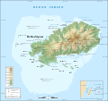
 Rodrigues Island topographic map-be.svg 1,700 × 1,600; 971 KB
-
 Rodrigues Island topographic map-fr.svg 1,700 × 1,600; 1,001 KB
-
 Rodrigues Island topographic map-rus.svg 1,700 × 1,600; 1,016 KB
-
 Rodrigues Island topographic-zones map-fr.svg 1,700 × 1,600; 989 KB


