Category:SVG topographic maps of the Philippines
Media in category "SVG topographic maps of the Philippines"
The following 17 files are in this category, out of 17 total.
-
 2013 Lahad Datu standoff ms.svg 512 × 320; 123 KB
-
 2013 Lahad Datu standoff.svg 512 × 320; 123 KB
-
 Carte topographique de Mindanao.svg 2,339 × 1,789; 1.42 MB
-
 Filipini.svg 844 × 530; 2.26 MB
-
 Philippines Albay relief location map.svg 938 × 703; 5.22 MB
-
 Philippines Batanes relief location map.svg 1,000 × 1,000; 813 KB
-
 Philippines Camarines Norte relief location map.svg 938 × 703; 4.01 MB
-
 Philippines Catanduanes relief location map.svg 703 × 703; 2.16 MB
-
 Philippines Nueva Ecija relief location map.svg 1,000 × 1,000; 1.76 MB
-
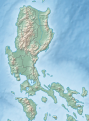 Philippines relief location map (Luzon mainland).svg 391 × 529; 2.21 MB
-
 Philippines relief location map (Luzon).svg 743 × 743; 2.21 MB
-
 Philippines relief location map (Mindanao).svg 656 × 486; 2.21 MB
-
 Philippines relief location map (Palawan).svg 377 × 377; 2.21 MB
-
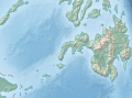
 Philippines relief location map (square).svg 1,332 × 1,332; 2.23 MB
-
 Philippines relief location map (Visayas).svg 365 × 365; 2.21 MB
-
 Philippines Sorsogon relief location map.svg 1,000 × 750; 5.24 MB
-
 Topographie Diuata.svg 957 × 1,240; 1.75 MB


.svg)
.svg)
.svg)
.svg)
.svg)
.svg)

