Category:Saddell
village in Argyll and Bute, Scotland, UK  | |||||
| Upload media | |||||
| Instance of | |||||
|---|---|---|---|---|---|
| Location |
| ||||
 | |||||
Brezhoneg: Saghadal ( distaget: /sɤ.əd̪̊əlˠ̪/) e gouezeleg (Saddell e saozneg) zo ur gêriadenn e Bro-Skos, e reter ledenez Cinn Tìre en Argyll and Bute, dirak Kilbrannan Sound hag Enez Arran, un 10 km eus Campbeltown, war an hent (B842) da g-Carradale. Dont a ra an anv Saddell eus ur ger norsek a dalv kement ha traonienn draezhek.
Subcategories
This category has the following 9 subcategories, out of 9 total.
- Saddell Abbey (64 F)
- Saddell Castle (43 F)
B
- Saddell Bay (31 F)
K
- Kildonan Dun (7 F)
S
- Saddell Cul na Shee (6 F)
- Saddell Ferryman's Cottage (4 F)
- Saddell House (8 F)
- Saddell Lodge (3 F)
- Saddell Shore Cottage (2 F)
Media in category "Saddell"
The following 172 files are in this category, out of 172 total.
-
 Allt na Beiste. - geograph.org.uk - 383292.jpg 640 × 480; 61 KB
-
 Ardnacross Bay - geograph.org.uk - 817776.jpg 640 × 427; 215 KB
-
 Ardnacross Bay, Peninver, Kintyre - geograph.org.uk - 36701.jpg 640 × 480; 48 KB
-
 Askomil from Kilkerran - geograph.org.uk - 192378.jpg 640 × 480; 159 KB
-

-
 Beach at Carradale. - geograph.org.uk - 105470.jpg 640 × 480; 75 KB
-
 Campbeltown - geograph.org.uk - 14470.jpg 640 × 409; 175 KB
-
 Campbeltown Bay - geograph.org.uk - 23070.jpg 640 × 455; 126 KB
-
 Campbeltown Bay from near Askomill - geograph.org.uk - 23077.jpg 640 × 441; 89 KB
-
 Campbeltown Bay from near Askomill - geograph.org.uk - 23078.jpg 640 × 435; 82 KB
-
 Campbeltown from Trench Point - geograph.org.uk - 23072.jpg 640 × 445; 92 KB
-
 Campbeltown from Trench Point - geograph.org.uk - 23075.jpg 640 × 455; 113 KB
-
 Carradale War Memorial - geograph.org.uk - 610671.jpg 640 × 480; 90 KB
-

-
 Close Up of Wind Turbine. - geograph.org.uk - 255102.jpg 636 × 477; 37 KB
-

-
-
 Forestry near Kildonan. - geograph.org.uk - 105172.jpg 640 × 480; 130 KB
-
 Forestry road to Ifferdale Glen. - geograph.org.uk - 383326.jpg 640 × 480; 51 KB
-
 Forestry road. - geograph.org.uk - 383258.jpg 640 × 480; 60 KB
-
 Forestry Track on Braid Hill. - geograph.org.uk - 255051.jpg 636 × 477; 114 KB
-
 Forestry West of Ballochgair. - geograph.org.uk - 446803.jpg 640 × 427; 54 KB
-

-
 LAND And Sea - geograph.org.uk - 4577999.jpg 1,600 × 1,144; 128 KB
-

-
-
 Ordnance Survey One-Inch Sheet 65 Kintyre, Published 1955.jpg 8,585 × 10,706; 13.76 MB
-
 Ordnance Survey One-Inch Sheet 76 Kintyre, Published 1925.jpg 10,558 × 15,392; 14.21 MB
-
 Saddell - geograph.org.uk - 1432995.jpg 640 × 428; 71 KB
-
 Saddell Castle - geograph.org.uk - 4577963.jpg 1,198 × 1,600; 477 KB
-
 Saddell House.jpg 3,264 × 2,448; 2.98 MB
-
 Saddell House2.jpg 2,448 × 3,264; 2.81 MB
-
 Saddell House4.JPG 1,600 × 1,200; 348 KB
-
 Saddell House5.JPG 1,600 × 1,200; 180 KB
-
 Saddell House7.JPG 1,600 × 1,200; 204 KB
-
 Saddell lords of the isles stones.jpg 1,200 × 900; 388 KB
-
 Seals Basking at Peninver. - geograph.org.uk - 347251.jpg 640 × 480; 95 KB
-
 Seals on Yellow Rock at Peninver. - geograph.org.uk - 256600.jpg 640 × 480; 114 KB
-
-

-

-
 The View from Beinn an Tuirc. - geograph.org.uk - 255368.jpg 640 × 480; 60 KB
-
 Torrisdale Bay on a calm spring day. - geograph.org.uk - 553194.jpg 640 × 480; 54 KB
-
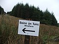
 Turn Off for the Bein an Tuirc Windfarm. - geograph.org.uk - 255125.jpg 640 × 480; 109 KB
-
 Ugadale Point. - geograph.org.uk - 256593.jpg 640 × 480; 61 KB
-

-

-
 A Sign^ - geograph.org.uk - 255129.jpg 640 × 480; 102 KB
-
 Alderlea, Torrisdale Glen. - geograph.org.uk - 551533.jpg 640 × 480; 88 KB
-
 Ardnacross farmstead, Kintyre. - geograph.org.uk - 60207.jpg 640 × 480; 58 KB
-
 Askomill Hill view - geograph.org.uk - 672002.jpg 640 × 480; 39 KB
-
 Askomill Hill view - geograph.org.uk - 672006.jpg 640 × 480; 31 KB
-
 At the End of Carradale Pier - geograph.org.uk - 663177.jpg 640 × 427; 171 KB
-
 B842 between Saddell and Torrisdale. - geograph.org.uk - 60185.jpg 640 × 480; 63 KB
-
 Base of a Wind Turbine. - geograph.org.uk - 255144.jpg 640 × 480; 65 KB
-
 Base of Wind Turbine and Substation - geograph.org.uk - 255160.jpg 640 × 480; 50 KB
-
-
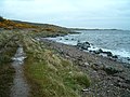
 Beach at Saddell Bay - geograph.org.uk - 1433137.jpg 640 × 428; 54 KB
-
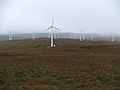
 Beinn an Tuirc Windfarm - geograph.org.uk - 255071.jpg 636 × 477; 63 KB
-

-
 Beinn an Tuirc Windfarm. - geograph.org.uk - 255178.jpg 636 × 477; 68 KB
-
 Beinn an Tuirc Windfarm. - geograph.org.uk - 255326.jpg 640 × 480; 50 KB
-
 Beinn an Tuirc Windfarm. - geograph.org.uk - 255327.jpg 640 × 480; 52 KB
-
 Beinn an Tuirc Windfarm. - geograph.org.uk - 255329.jpg 640 × 480; 40 KB
-
 Beinn an Tuirc Windfarm. - geograph.org.uk - 255333.jpg 640 × 480; 59 KB
-
 Beinn an Tuirc Windfarm. - geograph.org.uk - 255337.jpg 640 × 480; 38 KB
-
 Beinn an Tuirc Windfarm. - geograph.org.uk - 255342.jpg 640 × 480; 33 KB
-
 Boats at Port Crannaich - geograph.org.uk - 663151.jpg 640 × 256; 133 KB
-
 Bridge at Torrisdale. - geograph.org.uk - 138930.jpg 640 × 480; 123 KB
-
 Bridge at Torrisdale. - geograph.org.uk - 554333.jpg 640 × 427; 302 KB
-
 Bridge over the Saddell Water - geograph.org.uk - 1433002.jpg 640 × 428; 83 KB
-
 Bridgend Church and Church Wood. - geograph.org.uk - 447808.jpg 640 × 427; 129 KB
-
 Bridgend Church and Church Wood. - geograph.org.uk - 474675.jpg 640 × 480; 287 KB
-
 Bull in barn at Saddel. - geograph.org.uk - 138927.jpg 640 × 480; 98 KB
-
 Carradale - geograph.org.uk - 1433150.jpg 640 × 428; 79 KB
-
 Carradale - geograph.org.uk - 1433157.jpg 640 × 428; 57 KB
-
 Carradale Bay Caravan Park. - geograph.org.uk - 553198.jpg 640 × 480; 65 KB
-
 Carradale Bay from Dippen Hill. - geograph.org.uk - 553196.jpg 640 × 480; 41 KB
-
 Carradale Bay. - geograph.org.uk - 553197.jpg 640 × 480; 57 KB
-
 Carradale caravan site - geograph.org.uk - 639399.jpg 640 × 433; 57 KB
-
 Carradale Estate Dog Graveyard (1) - geograph.org.uk - 518299.jpg 640 × 427; 285 KB
-
 Carradale Estate Dog Graveyard (2). - geograph.org.uk - 518304.jpg 640 × 427; 289 KB
-
 Carradale Estate Dog Graveyard (3). - geograph.org.uk - 518307.jpg 427 × 640; 285 KB
-
 Carradale Golf Course. - geograph.org.uk - 488220.jpg 640 × 480; 32 KB
-
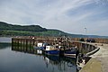
 Carradale Harbour at High Tide - geograph.org.uk - 737889.jpg 640 × 427; 224 KB
-
 Carradale Pier - geograph.org.uk - 1433141.jpg 640 × 428; 57 KB
-
 Carradale Pier - geograph.org.uk - 1433147.jpg 640 × 428; 54 KB
-
 Carradale Pier - geograph.org.uk - 1433163.jpg 640 × 428; 69 KB
-
 Carradale Point - geograph.org.uk - 663061.jpg 640 × 427; 190 KB
-
 Carradale Point from Dippen Hill. - geograph.org.uk - 553199.jpg 640 × 480; 42 KB
-
 Carradale Point. - geograph.org.uk - 551639.jpg 640 × 426; 224 KB
-
 Carradale Water at Waterfoot - geograph.org.uk - 1433793.jpg 640 × 428; 54 KB
-
 Carradale Water at Waterfoot. - geograph.org.uk - 518274.jpg 640 × 426; 211 KB
-
 Carradale Water at Waterfoot. - geograph.org.uk - 518279.jpg 640 × 426; 203 KB
-
 Carradale Water Meets the Sea. - geograph.org.uk - 518276.jpg 640 × 426; 184 KB
-

-
 Cleared forestry. - geograph.org.uk - 383313.jpg 640 × 480; 74 KB
-

-
 Cnoc Donn and a Wind Turbine. - geograph.org.uk - 255349.jpg 640 × 480; 43 KB
-
 Cnoc na Dippen and Cnoc Breac. - geograph.org.uk - 446828.jpg 640 × 427; 106 KB
-
 Cnoc nan Gabhar - geograph.org.uk - 484793.jpg 640 × 480; 80 KB
-
 Coastal scene south of Whitestone - geograph.org.uk - 737089.jpg 640 × 480; 30 KB
-
 Coastal view from the B842 - geograph.org.uk - 737091.jpg 640 × 480; 30 KB
-
 Cottage and beach at Port na Gael - geograph.org.uk - 1433133.jpg 640 × 428; 72 KB
-
 Dog on Beach at Saddell Bay - geograph.org.uk - 660894.jpg 640 × 426; 234 KB
-
 Driftwood on Saddell Beach - geograph.org.uk - 660914.jpg 427 × 640; 207 KB
-
 Drumvalanree Hotel, Port Righ - geograph.org.uk - 1433742.jpg 640 × 428; 82 KB
-
 Eagle statue at GlenHead, Torrisdale. - geograph.org.uk - 552731.jpg 640 × 480; 46 KB
-
 Eagle statue,Glenhead. - geograph.org.uk - 552734.jpg 640 × 480; 57 KB
-
 Entrance to the Beinn an Tuirc Windfarm. - geograph.org.uk - 255139.jpg 640 × 480; 109 KB
-

-

-
 Farmland at Saddell - geograph.org.uk - 660963.jpg 640 × 427; 289 KB
-

-
 Fire Break on Braid Hill. - geograph.org.uk - 255054.jpg 636 × 477; 118 KB
-
 Foam on Rocks at Saddell Bay (2) - geograph.org.uk - 660921.jpg 640 × 427; 256 KB
-
 Foam on Rocks at Saddell Bay - geograph.org.uk - 660919.jpg 640 × 427; 280 KB
-
 Ford crossing Torrisdale Water. - geograph.org.uk - 551536.jpg 640 × 480; 86 KB
-
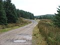
 Forest road Kintyre Way Saddell. - geograph.org.uk - 559135.jpg 640 × 480; 51 KB
-
 Forestry by Allt na Beiste. - geograph.org.uk - 383309.jpg 640 × 480; 66 KB
-
 Forestry Clearfell at Kildonan. - geograph.org.uk - 347305.jpg 640 × 480; 67 KB
-
 Forestry from the Kintyre Way - geograph.org.uk - 559137.jpg 640 × 480; 58 KB
-
 Forestry on Braid Hill. - geograph.org.uk - 255059.jpg 636 × 477; 86 KB
-
 Forestry road, Kintyre Way Walk. - geograph.org.uk - 383283.jpg 640 × 480; 59 KB
-
 Forestry. - geograph.org.uk - 383271.jpg 640 × 480; 76 KB
-
 Frogspawn. - geograph.org.uk - 347312.jpg 480 × 640; 139 KB
-
-
 High Smerby. - geograph.org.uk - 105514.jpg 640 × 480; 85 KB
-
 Hills above Saddel Glen. - geograph.org.uk - 60189.jpg 640 × 480; 48 KB
-
 Ifferdale Cottage. - geograph.org.uk - 105169.jpg 640 × 480; 110 KB
-
 Ifferdale. - geograph.org.uk - 105167.jpg 640 × 480; 83 KB
-
 Island Ross. - geograph.org.uk - 347332.jpg 640 × 480; 44 KB
-
 Just South of Beinn an Tuirc. - geograph.org.uk - 255354.jpg 640 × 480; 88 KB
-

-
 Kintyre Way notice board, Saddell - geograph.org.uk - 559141.jpg 640 × 480; 62 KB
-

-
 Kintyre Way views. - geograph.org.uk - 559142.jpg 640 × 480; 38 KB
-

-

-

-

-
 Peninver and Ardnacross Bay. - geograph.org.uk - 448362.jpg 640 × 427; 68 KB
-

-
 Picnic area and managed woodland. - geograph.org.uk - 60203.jpg 640 × 480; 120 KB
-

-
 Rear of Wind Turbine. - geograph.org.uk - 255150.jpg 636 × 477; 34 KB
-
 Rock formation. - geograph.org.uk - 142684.jpg 640 × 480; 146 KB
-
 Rough Sea at Torrisdale. - geograph.org.uk - 347289.jpg 640 × 480; 48 KB
-
 Saddell Castle Drive - geograph.org.uk - 660950.jpg 427 × 640; 307 KB
-
 Saddell Glen from the Kintyre Way - geograph.org.uk - 559145.jpg 640 × 480; 44 KB
-
 Saddell Water, Kintyre. - geograph.org.uk - 59221.jpg 640 × 480; 151 KB
-
 Salmon Rock. - geograph.org.uk - 105415.jpg 640 × 480; 86 KB
-
 Sheep Beneath a Radio Mast. - geograph.org.uk - 255084.jpg 480 × 640; 62 KB
-
 Shoreline at Kildonald Bay - geograph.org.uk - 408466.jpg 640 × 425; 125 KB
-

-

-
 Snowdrops - geograph.org.uk - 660966.jpg 640 × 427; 351 KB
-
 South side of Beinn an Tuirc. - geograph.org.uk - 255356.jpg 640 × 480; 80 KB
-
 Stone by the side of the Forestry Track. - geograph.org.uk - 255118.jpg 640 × 480; 157 KB
-
 The Beach at Carradale. - geograph.org.uk - 455223.jpg 427 × 640; 52 KB
-
 The Church at Bridgend. - geograph.org.uk - 346541.jpg 640 × 480; 69 KB
-
 Trigpoint and Cairn on Beinn an Tuirc. - geograph.org.uk - 255361.jpg 640 × 480; 107 KB
-

-
 Uprooted forestry trees. - geograph.org.uk - 383278.jpg 640 × 480; 63 KB
-
 Viewpoint. - geograph.org.uk - 255366.jpg 640 × 480; 50 KB
-

-
 Wind Turbine number 46. - geograph.org.uk - 255180.jpg 477 × 636; 55 KB
-
 Wind Turbine. - geograph.org.uk - 255074.jpg 636 × 477; 47 KB
-
 Wind Turbine. - geograph.org.uk - 255097.jpg 480 × 640; 32 KB
-
 Wind Turbine. - geograph.org.uk - 255154.jpg 640 × 480; 34 KB
-
 Wind Turbine. - geograph.org.uk - 255332.jpg 640 × 480; 52 KB
-
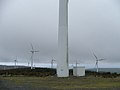
 Wind Turbines. - geograph.org.uk - 255170.jpg 640 × 480; 38 KB


_-_geograph.org.uk_-_518299.jpg)
._-_geograph.org.uk_-_518304.jpg)
._-_geograph.org.uk_-_518307.jpg)


_-_geograph.org.uk_-_660921.jpg)


