Category:Saint Procopius church in Jadowniki
| Object location | | View all coordinates using: OpenStreetMap |
|---|
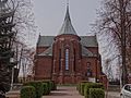
church building in Jadowniki, Lesser Poland Voivodeship, Poland  | |||||
| Upload media | |||||
| Instance of | |||||
|---|---|---|---|---|---|
| Location | Jadowniki, Lesser Poland Voivodeship, Gmina Brzesko, Brzesko County, Lesser Poland Voivodeship, Poland | ||||
| Heritage designation |
| ||||
| Inception |
| ||||
 | |||||
Polski: Jadowniki - rzymskokatolicki kościół parafialny pw. św. Prokopa Opata, 1910
Media in category "Saint Procopius church in Jadowniki"
The following 30 files are in this category, out of 30 total.
-
 Jadowniki gm. Brzesko kościół Prokopa Opata A 255 A 253 jas.jpg 5,212 × 5,212; 17.89 MB
-
 Jadowniki gm. Brzesko kościół Prokopa Opata A 255 A 253 jasny.jpg 5,304 × 7,952; 31.21 MB
-
 Jadowniki gm. Brzesko kościół Prokopa Opata A 255 A 253 n.jpg 4,974 × 7,082; 26.39 MB
-
 Jadowniki gm. Brzesko kościół Prokopa Opata A 255 A 253 n1.jpg 5,242 × 6,553; 28.31 MB
-
 Jadowniki gm. Brzesko kościół Prokopa Opata A 255 A 253 n2.jpg 4,553 × 5,253; 22.46 MB
-
 Jadowniki gm. Brzesko kościół Prokopa Opata A 255 A 253 n3.jpg 4,355 × 5,806; 20.91 MB
-
 Jadowniki gm. Brzesko kościół Prokopa Opata A 255 A 253 n4.jpg 5,304 × 7,952; 34.99 MB
-
 Jadowniki gm. Brzesko kościół Prokopa Opata A 255 A 253 n5.jpg 2,650 × 3,533; 9.17 MB
-
 Jadowniki gm. Brzesko kościół Prokopa Opata A 255 A 253 nw.jpg 4,552 × 7,143; 23.04 MB
-
 Jadowniki gm. Brzesko kościół Prokopa Opata A 255 A 253 nw1.jpg 5,139 × 6,494; 27.17 MB
-
 Jadowniki gm. Brzesko kościół Prokopa Opata A 255 A 253 nw2.jpg 4,757 × 6,246; 21.81 MB
-
 Jadowniki gm. Brzesko kościół Prokopa Opata A 255 A 253 nw3.jpg 4,930 × 5,685; 18.38 MB
-
 Jadowniki gm. Brzesko kościół Prokopa Opata A 255 A 253 nw4.jpg 4,895 × 7,342; 24.72 MB
-
 Jadowniki gm. Brzesko kościół Prokopa Opata A 255 A 253 portal.jpg 4,729 × 4,860; 17.59 MB
-
 Jadowniki gm. Brzesko kościół Prokopa Opata A 255 A 253 sklepienie n.jpg 7,466 × 5,291; 19.16 MB
-
 Jadowniki gm. Brzesko kościół Prokopa Opata A 255 A 253 sklepienie n1.jpg 7,952 × 5,289; 22.28 MB
-
 Jadowniki gm. Brzesko kościół Prokopa Opata A 255 A 253 sklepienie n2.jpg 4,891 × 4,891; 12.53 MB
-
 Jadowniki gm. Brzesko kościół Prokopa Opata A 255 A 253 sklepienie prezbiterium n.jpg 7,925 × 5,118; 23.3 MB
-
 Jadowniki gm. Brzesko kościół Prokopa Opata A 255 A 253 sklepienie prezbiterium.jpg 5,277 × 6,150; 20.3 MB
-
 Jadowniki gm. Brzesko kościół Prokopa Opata A 255 A 253 sygnaturka.jpg 5,304 × 7,952; 18.84 MB
-
 Jadowniki gm. Brzesko kościół Prokopa Opata A 255 A 253 wieża.jpg 3,716 × 6,340; 10.94 MB
-
 Jadowniki gm. Brzesko kościół Prokopa Opata A 255 A 253.jpg 5,212 × 5,212; 17.78 MB
-
 Jadowniki kościół 2.jpg 2,592 × 1,944; 1.69 MB
-
 Jadowniki kościół.jpg 2,360 × 1,770; 1.44 MB
-
 JADOWNIKI, kościół, fot. K. Fidyk MIK 2015 (1) (29897688891).jpg 2,560 × 1,920; 2.52 MB
-
 JADOWNIKI, kościół, fot. K. Fidyk MIK 2015 (2) (29897688121).jpg 2,560 × 1,920; 2.73 MB
-
 JADOWNIKI, kościół, fot. K. Fidyk MIK 2015 (29897685561).jpg 1,920 × 2,560; 2.8 MB
-
 JADOWNIKI, kościół, fot. K. Fidyk MIK 2015 (3) (29354476803).jpg 1,920 × 2,560; 2.47 MB
-
 JADOWNIKI, kościół, fot. K. Fidyk MIK 2015 (4) (29354475993).jpg 2,560 × 1,920; 2.71 MB
-
 St Prokop Church Jadowniki.jpg 3,000 × 2,000; 7.78 MB


_(29897688891).jpg)
_(29897688121).jpg)
.jpg)
_(29354476803).jpg)
_(29354475993).jpg)