Category:Saint Radegund Church (St. Radegund, Upper Austria)
| Object location | | View all coordinates using: OpenStreetMap |
|---|
parish church with cemetery in Sankt Radegund, Austria  _Interior_01.jpg) | |||||
| Upload media | |||||
| Instance of | |||||
|---|---|---|---|---|---|
| Named after | |||||
| Location | Sankt Radegund, Braunau District, Upper Austria, Austria | ||||
| Street address |
| ||||
| Heritage designation | |||||
 | |||||
Subcategories
This category has the following 2 subcategories, out of 2 total.
C
Media in category "Saint Radegund Church (St. Radegund, Upper Austria)"
The following 9 files are in this category, out of 9 total.
-
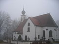 Kirche StRadegund.JPG 2,592 × 1,944; 1.03 MB
-
 Pfarrkirche Hl. Radegund & Friedhof am 27.1.2024 (2).jpg 4,032 × 3,024; 4.26 MB
-
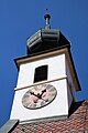 Pfarrkirche St. Radegund 01.jpg 2,656 × 3,984; 1.48 MB
-
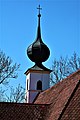
 Pfarrkirche St. Radegund 02.jpg 3,984 × 2,656; 2.63 MB
-
 Pfarrkirche St. Radegund 03.jpg 3,585 × 2,656; 3.41 MB
-
 Pfarrkirche St. Radegund 04.jpg 2,656 × 3,984; 3.22 MB
-
 Pfarrkirche St. Radegund 05.jpg 2,656 × 3,984; 2.35 MB
-
 Sankt Radegund Pfarrkirche1.jpg 1,208 × 970; 323 KB
-
 Sankt Radegund Pfarrkirche2.jpg 1,014 × 1,201; 255 KB

.jpg)


