Category:Salterforth
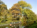
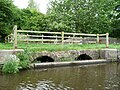
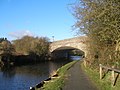
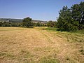
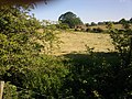
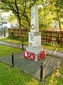
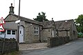
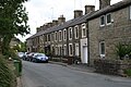
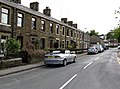
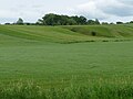
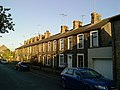
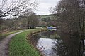
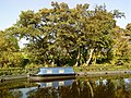
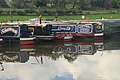
English: Salterforth is a village and civil parish within the Borough of Pendle in Lancashire, England. It lies on the B6383 road that connects Barnoldswick to the A56 road at Kelbrook. The Leeds and Liverpool Canal cuts through the village and there are several narrowboat moorings at Salterforth. The canal footpath provides a picturesque walk to Barnoldswick or to Foulridge in the opposite direction. (→Salterforth)
Nederlands: Salterforth is een plaats en civil parish in het bestuurlijke gebied Pendle, in het Engelse graafschap Lancashire met 625 inwoners. (→Salterforth)
Polski: Salterforth – wieś w Anglii, w hrabstwie Lancashire, w dystrykcie Pendle. Leży 49 km na północ od miasta Manchester i 300 km na północny zachód od Londynu. W 2001 miejscowość liczyła 625 mieszkańców. (→Salterforth)
village and civil parish in Lancashire, UK  | |||||
| Upload media | |||||
| Instance of | |||||
|---|---|---|---|---|---|
| Location | Pendle, Lancashire, North West England, England | ||||
 | |||||
Subcategories
This category has the following 3 subcategories, out of 3 total.
Media in category "Salterforth"
The following 189 files are in this category, out of 189 total.
-

-
 Abyssinian goats - geograph.org.uk - 1629549.jpg 640 × 543; 93 KB
-
 Abyssinian goats, Salterforth - geograph.org.uk - 704478.jpg 640 × 564; 100 KB
-
 Alleyway in Salterforth - geograph.org.uk - 2119467.jpg 640 × 480; 53 KB
-
 Approaching Barnoldswick on High Lane - geograph.org.uk - 3165307.jpg 640 × 480; 149 KB
-
 Aqueduct over Wanless Beck.jpg 4,000 × 3,000; 6.21 MB
-
 B6383 looking towards Barnoldswick - geograph.org.uk - 1577096.jpg 640 × 403; 67 KB
-
 Barn behind the pub - geograph.org.uk - 2265665.jpg 2,592 × 1,944; 1.61 MB
-
 Bashfield Farm in the morning mist - geograph.org.uk - 2104765.jpg 800 × 600; 184 KB
-
 Bashfield Farm, Salterforth - geograph.org.uk - 28373.jpg 640 × 480; 73 KB
-

-

-
 Boundary marker on Gisburn Old Road - geograph.org.uk - 1671745.jpg 1,840 × 1,232; 3.25 MB
-
 Boundary marker on Gisburn Old Road - geograph.org.uk - 54336.jpg 640 × 429; 167 KB
-
 Boundary Marker. - geograph.org.uk - 6206256.jpg 682 × 1,024; 194 KB
-

-
 Bridge 152 - geograph.org.uk - 6129523.jpg 4,752 × 3,168; 3.61 MB
-
 Brown House Farm, Gisburn Old Road - geograph.org.uk - 2355481.jpg 3,456 × 2,304; 4.23 MB
-
 Buildings in Salterforth - geograph.org.uk - 2119457.jpg 640 × 480; 73 KB
-
 Bungalows in Salterforth - geograph.org.uk - 2119463.jpg 640 × 480; 61 KB
-

-
 Canal basin near Salterforth - geograph.org.uk - 28370.jpg 640 × 480; 82 KB
-
 Canal overflow under the towpath - geograph.org.uk - 2119424.jpg 640 × 480; 116 KB
-
 Canalside field, near Higher Green Hill Farm - geograph.org.uk - 5442662.jpg 1,024 × 768; 123 KB
-
 Cottage on the canal towpath - geograph.org.uk - 2120365.jpg 640 × 480; 84 KB
-
 County Bridge - geograph.org.uk - 694752.jpg 640 × 529; 143 KB
-
 County Brook Mill - geograph.org.uk - 5223768.jpg 6,000 × 4,000; 5.02 MB
-
 County Mill - geograph.org.uk - 695067.jpg 640 × 528; 82 KB
-
 Dry stone wall on White Moor - geograph.org.uk - 2265656.jpg 2,592 × 1,944; 1.47 MB
-
 Duck pond near Salterforth - geograph.org.uk - 2120924.jpg 640 × 480; 118 KB
-
 Eastern abutment of dismantled railway bridge - geograph.org.uk - 5428912.jpg 1,024 × 768; 118 KB
-
 Ebenezer (5885634454).jpg 3,698 × 2,882; 7.17 MB
-
 Embankment, Whitemoor Reservoir - geograph.org.uk - 5873247.jpg 640 × 480; 65 KB
-
 Entrance to Woodend Farm - geograph.org.uk - 3165304.jpg 640 × 480; 128 KB
-
 Far Hey, near Barnoldswick - geograph.org.uk - 5428909.jpg 1,024 × 768; 106 KB
-
 Farm animals near Salterforth - geograph.org.uk - 2120393.jpg 640 × 480; 93 KB
-
 Farmland, west bank, Leeds ^ Liverpool Canal - geograph.org.uk - 5442658.jpg 1,024 × 768; 131 KB
-
 Field edge footpath at Heather Leigh - geograph.org.uk - 6086894.jpg 4,000 × 3,000; 4.27 MB
-
 Fields by the Leeds Liverpool Canal - geograph.org.uk - 2120772.jpg 640 × 480; 124 KB
-
 Fields by the Leeds Liverpool Canal - geograph.org.uk - 2120776.jpg 640 × 480; 79 KB
-
 Fields near Salterforth - geograph.org.uk - 2120385.jpg 640 × 480; 60 KB
-
 Fields near Salterforth - geograph.org.uk - 2120930.jpg 640 × 480; 98 KB
-
 Fields near the canal - geograph.org.uk - 2120800.jpg 640 × 480; 84 KB
-
 Fields near the canal - geograph.org.uk - 2120823.jpg 640 × 480; 47 KB
-
 Footpath to Kelbrook - geograph.org.uk - 2223952.jpg 2,592 × 1,944; 1.71 MB
-

-
 From the A56 at Kelbrook - geograph.org.uk - 3514206.jpg 3,648 × 2,736; 4.71 MB
-
-
 Gateway off the towpath - geograph.org.uk - 2120756.jpg 640 × 480; 86 KB
-
 Grazing, Park Close - geograph.org.uk - 5873243.jpg 640 × 480; 88 KB
-
 Grazing, Wood End Farm - geograph.org.uk - 5873245.jpg 640 × 480; 83 KB
-
 High Lane (B6251) - geograph.org.uk - 5873250.jpg 640 × 480; 66 KB
-
 High Lane (B6251) near Wood End Farm - geograph.org.uk - 5873246.jpg 640 × 480; 97 KB
-
 High Lane (B6251) towards Foulridge - geograph.org.uk - 5873244.jpg 640 × 480; 82 KB
-
 High Lane at the Fanny Grey Hotel - geograph.org.uk - 3165305.jpg 640 × 480; 127 KB
-
 Hillside below Brown House Farm - geograph.org.uk - 5216781.jpg 6,000 × 4,000; 5.97 MB
-

-
 Inghamite Church, Salterforth - geograph.org.uk - 103522.jpg 640 × 426; 149 KB
-
 Junction of High Lane and Moor Lane - geograph.org.uk - 3165306.jpg 640 × 480; 223 KB
-
 June moored on the Leeds Liverpool Canal - geograph.org.uk - 2120837.jpg 640 × 480; 105 KB
-
 Kay Field farm - geograph.org.uk - 3250614.jpg 2,048 × 1,536; 581 KB
-
 Kay Field farm - geograph.org.uk - 3250615.jpg 2,048 × 1,536; 543 KB
-
 Kelbrook Road - geograph.org.uk - 4323982.jpg 3,648 × 2,736; 4.05 MB
-
-
 Lancashire Fields - geograph.org.uk - 3111027.jpg 3,072 × 2,304; 2.42 MB
-
 Lancashire sign - geograph.org.uk - 5873249.jpg 640 × 480; 72 KB
-
 Leaving Salterforth on Earby Road - geograph.org.uk - 2483097.jpg 4,320 × 3,240; 3.3 MB
-
 Leeds & Liverpool Canal, Boat Club moorings - geograph.org.uk - 1922518.jpg 3,264 × 2,448; 6 MB
-
 Leeds & Liverpool Canal, Moorings at Salterforth - geograph.org.uk - 1922558.jpg 3,264 × 2,448; 5.57 MB
-

-
-
 Leeds and Liverpool Canal at Salterforth - geograph.org.uk - 5956413.jpg 640 × 520; 123 KB
-
 Leeds Liverpool Canal - geograph.org.uk - 2119422.jpg 640 × 480; 89 KB
-
 Leeds Liverpool Canal - geograph.org.uk - 2120760.jpg 640 × 480; 99 KB
-
 Leeds Liverpool Canal - geograph.org.uk - 2120764.jpg 640 × 480; 119 KB
-
 Leeds Liverpool Canal - geograph.org.uk - 2120792.jpg 640 × 480; 87 KB
-
 Leeds Liverpool Canal - geograph.org.uk - 2120804.jpg 640 × 480; 112 KB
-
 Leeds Liverpool Canal - geograph.org.uk - 2120851.jpg 640 × 480; 149 KB
-
 Leeds Liverpool Canal - geograph.org.uk - 5915217.jpg 4,752 × 3,168; 3.94 MB
-
 Leeds Liverpool Canal at Salterforth - geograph.org.uk - 2445030.jpg 4,320 × 3,240; 4.33 MB
-
 Leeds Liverpool Canal at Salterforth - geograph.org.uk - 28367.jpg 640 × 480; 151 KB
-
 Leeds Liverpool Canal in Salterforth - geograph.org.uk - 2119431.jpg 640 × 480; 96 KB
-
 Leeds Liverpool Canal in Salterforth - geograph.org.uk - 2120371.jpg 640 × 480; 112 KB
-

-

-
 Leeds Liverpool Canal towpath - geograph.org.uk - 2119420.jpg 640 × 480; 150 KB
-
 Listed mounting block in Salterforth.jpg 4,000 × 3,000; 6.56 MB
-
 Lister Well Road - geograph.org.uk - 154451.jpg 640 × 417; 56 KB
-
 Lower park Marina - geograph.org.uk - 4220594.jpg 4,752 × 3,168; 7.5 MB
-
 Lower Park Marina - geograph.org.uk - 5222496.jpg 5,754 × 3,836; 2.31 MB
-

-
 Marina near Salterforth - geograph.org.uk - 2120819.jpg 640 × 480; 75 KB
-

-
 Milepost on the Leeds Liverpool Canal - geograph.org.uk - 2120376.jpg 480 × 640; 152 KB
-
 Mixed dairy cows and a few black sheep - geograph.org.uk - 1922491.jpg 3,264 × 2,448; 4.76 MB
-

-

-

-
 Narrowboats moored near Salterforth - geograph.org.uk - 2120833.jpg 640 × 480; 84 KB
-
 Narrowboats moored on the Leeds ^ Liverpool Canal - geograph.org.uk - 5223745.jpg 6,000 × 4,000; 3.81 MB
-
 Narrowboats on the canal - geograph.org.uk - 2119428.jpg 640 × 480; 80 KB
-
 Narrowboats on the canal at Salterforth - geograph.org.uk - 2119427.jpg 640 × 480; 114 KB
-

-

-
 New houses in Salterforth - geograph.org.uk - 2119462.jpg 640 × 480; 65 KB
-
 Old building in Salterforth - geograph.org.uk - 2119447.jpg 640 × 480; 42 KB
-
 Old stone footbridge over the mill stream - geograph.org.uk - 2402184.jpg 1,600 × 1,198; 781 KB
-
 On the Leeds Liverpool Canal - geograph.org.uk - 2120928.jpg 640 × 480; 90 KB
-

-
 Overflow weir, Leeds & Liverpool Canal - geograph.org.uk - 5428916.jpg 1,024 × 768; 481 KB
-
 Park Bridge, Leeds and Liverpool Canal - geograph.org.uk - 3251080.jpg 2,048 × 1,536; 675 KB
-
 Pasture next to Bashfield Farm - geograph.org.uk - 5956378.jpg 640 × 472; 56 KB
-
 Pastures near Hey Fold - geograph.org.uk - 2439180.jpg 4,320 × 3,240; 3.44 MB
-
 Reflections in the Leeds Liverpool Canal - geograph.org.uk - 2120787.jpg 640 × 480; 100 KB
-

-
 Road junction in Salterforth - geograph.org.uk - 2119454.jpg 640 × 480; 62 KB
-
 Rough grazing below the Leeds & Liverpool Canal - geograph.org.uk - 5223742.jpg 5,792 × 3,861; 4.64 MB
-
 Salterforth - panoramio (1).jpg 3,264 × 2,448; 2.18 MB
-
 Salterforth - panoramio (2).jpg 3,264 × 2,448; 2.13 MB
-
 Salterforth - panoramio (3).jpg 3,264 × 2,448; 2.28 MB
-
 Salterforth - panoramio (4).jpg 3,264 × 2,448; 2.2 MB
-
 Salterforth - panoramio (5).jpg 3,264 × 2,448; 2.24 MB
-
 Salterforth - panoramio (6).jpg 3,264 × 2,448; 2.18 MB
-
 Salterforth - panoramio - jim walton.jpg 2,816 × 2,112; 1.1 MB
-
 Salterforth - panoramio.jpg 2,291 × 1,890; 760 KB
-
 Salterforth Baptist Chapel - geograph.org.uk - 103519.jpg 640 × 426; 141 KB
-
 Salterforth Baptist Church - geograph.org.uk - 2120352.jpg 640 × 480; 74 KB
-
 Salterforth Lane Top - geograph.org.uk - 1624247.jpg 640 × 490; 120 KB
-
 Salterforth Lane west of Kay Field - geograph.org.uk - 3250620.jpg 2,048 × 1,536; 544 KB
-
 Salterforth School - geograph.org.uk - 2119470.jpg 640 × 480; 97 KB
-
 Salterforth Village - geograph.org.uk - 1922614.jpg 3,264 × 2,448; 5.41 MB
-
 Salterforth village, Yorkshire - geograph.org.uk - 624028.jpg 640 × 528; 66 KB
-
 Salterforth War Memorial - geograph.org.uk - 2120359.jpg 480 × 640; 151 KB
-
 Salterforth Wharf (5891260591).jpg 3,536 × 2,887; 6.83 MB
-
 Salterforth, 21 Salterforth Lane - geograph.org.uk - 5441551.jpg 3,456 × 2,304; 4.53 MB
-
 Salterforth, Canal wharf - geograph.org.uk - 5441454.jpg 3,456 × 2,304; 4.07 MB
-
 Salterforth, Cottages - geograph.org.uk - 5441537.jpg 3,456 × 2,304; 4.4 MB
-
 Salterforth, Former National School - geograph.org.uk - 5441515.jpg 3,456 × 2,304; 2.71 MB
-
 Salterforth, Mill Cottages - geograph.org.uk - 5441541.jpg 3,456 × 2,304; 4.08 MB
-
 Salterforth, Park View Terrace - geograph.org.uk - 5441474.jpg 3,456 × 2,304; 3.92 MB
-
 Salterforth, Salterforth Lane (Park View Terrace) - geograph.org.uk - 1922577.jpg 3,201 × 2,379; 5.16 MB
-
 Salterforth, West End House - geograph.org.uk - 5441530.jpg 3,456 × 2,304; 4.14 MB
-
 Salterforth. A divided village - geograph.org.uk - 5441526.jpg 3,456 × 2,304; 3.47 MB
-
 Sheep below Sunny Bank Farm - geograph.org.uk - 5216677.jpg 6,000 × 4,000; 3.64 MB
-
 Sheep by Cockshott Bridge - geograph.org.uk - 5222469.jpg 6,000 × 4,000; 4.57 MB
-
 Standing Stone Lane - geograph.org.uk - 5216671.jpg 6,000 × 4,000; 7.19 MB
-
 Standing Stone Lane - geograph.org.uk - 5873285.jpg 640 × 480; 67 KB
-
 Start of a track to Duck Pond - geograph.org.uk - 4238319.jpg 1,600 × 1,200; 570 KB
-
 Stone waymarker - geograph.org.uk - 5970465.jpg 2,816 × 2,112; 1,021 KB
-
 Stream gully, north of Far Hey - geograph.org.uk - 5428910.jpg 1,024 × 768; 104 KB
-

-
 Terraced housing in Salterforth - geograph.org.uk - 2119452.jpg 640 × 480; 71 KB
-
 Terraced housing in Salterforth - geograph.org.uk - 2120357.jpg 640 × 480; 70 KB
-
 The B6383 entering Salterforth - geograph.org.uk - 4816771.jpg 1,500 × 999; 189 KB
-
 The B6383 to Barnoldswick - geograph.org.uk - 4816765.jpg 1,500 × 999; 178 KB
-
 The B6383 to Barnoldswick - geograph.org.uk - 4816779.jpg 1,500 × 999; 135 KB
-
 The entrance to Cross Flats Crescent - geograph.org.uk - 2119468.jpg 640 × 480; 73 KB
-
 The Leeds & Liverpool Canal south of Salterforth - geograph.org.uk - 5223734.jpg 6,000 × 4,000; 3.91 MB
-
 The Pennine Bridleway near Spen Head Farm - geograph.org.uk - 6327725.jpg 4,000 × 3,000; 4.79 MB
-
 The shortest narrowboat - geograph.org.uk - 2120844.jpg 640 × 480; 147 KB
-
 To Salterforth - geograph.org.uk - 3514214.jpg 3,648 × 2,736; 4.66 MB
-

-

-
 Track to Higher Close Farm - geograph.org.uk - 5873241.jpg 640 × 480; 72 KB
-
 Tranquility - geograph.org.uk - 4220611.jpg 4,752 × 3,168; 5.64 MB
-
 Tree reflections in the Leeds ^ Liverpool Canal - geograph.org.uk - 5222505.jpg 6,000 × 4,000; 4.6 MB
-
-
 Trees near Salterforth - geograph.org.uk - 2120389.jpg 640 × 480; 78 KB
-

-

-

-
 View of Salterforth - geograph.org.uk - 2119459.jpg 640 × 480; 69 KB
-
 View over Salterforth - geograph.org.uk - 1600902.jpg 640 × 553; 77 KB
-
 View over Salterforth from High Lane - geograph.org.uk - 1623879.jpg 640 × 487; 104 KB
-
 War Memorial - geograph.org.uk - 1577095.jpg 480 × 640; 161 KB
-
 Whinberry Boathouse in Spring - geograph.org.uk - 2439194.jpg 4,320 × 3,240; 2.31 MB
-
 Whitemoor Reservoir - geograph.org.uk - 5422976.jpg 4,032 × 3,024; 2.56 MB
-
 Whitemoor Reservoir, southern end - geograph.org.uk - 5422970.jpg 4,032 × 3,024; 2.8 MB
-

-

-
 Copy Nook - geograph.org.uk - 144108.jpg 640 × 480; 129 KB
-
 County Bridge - geograph.org.uk - 694815.jpg 640 × 598; 159 KB
-

-
 Cragg Row, Salterforth - geograph.org.uk - 624058.jpg 640 × 553; 70 KB
-
 Ebeneezer Baptist Chapel, Salterforth - geograph.org.uk - 762538.jpg 640 × 525; 116 KB
-
 Mill Dam, County Mill - geograph.org.uk - 695018.jpg 640 × 545; 128 KB
-
 Mill Dam, County Mill - geograph.org.uk - 695033.jpg 640 × 534; 80 KB
-
 Mount Pleasant Methodist Chapel - geograph.org.uk - 85346.jpg 640 × 426; 113 KB
-
 Railway bridge, Salterforth, Yorkshire - geograph.org.uk - 136264.jpg 640 × 480; 107 KB


.jpg)


_-_geograph.org.uk_-_5873250.jpg)
_near_Wood_End_Farm_-_geograph.org.uk_-_5873246.jpg)
_towards_Foulridge_-_geograph.org.uk_-_5873244.jpg)


.jpg)
.jpg)
.jpg)
.jpg)
.jpg)
.jpg)


.jpg)


_-_geograph.org.uk_-_1922577.jpg)


