Category:San Pitch Mountains
mountain range in Juab and Sanpete counties in Utah, United States  | |||||
| Upload media | |||||
| Instance of | |||||
|---|---|---|---|---|---|
| Location |
| ||||
| Highest point |
| ||||
| Elevation above sea level |
| ||||
 | |||||
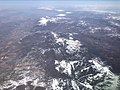
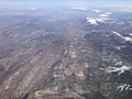
English: Media related to the San Pitch Mountains, a mountain range that runs along the border of Juab and Sanpete counties in central Utah, United States. The range borders the northwest of the north-flowing Sevier River as it travels north, northwest, west, then west-southwest to the Sevier Desert.
Media in category "San Pitch Mountains"
The following 16 files are in this category, out of 16 total.
-

-
-
-
 Greasewood 03.jpg 2,000 × 1,349; 1.28 MB
-
 I15 exit167 i1495.jpg 4,032 × 3,024; 4.03 MB
-
 Moroni pano.jpg 2,000 × 755; 227 KB
-

-
 Sevier River Valley, South of Gunnison Utah 1872 - NARA - 519739.jpg 3,000 × 1,872; 1.43 MB
-
 Sevier River Valley, South of Gunnison Utah 1872 - NARA - 519739.tif 3,000 × 1,872; 5.36 MB
-
 Site of Gunnison Massacre BHoU-p469.png 2,952 × 1,982; 137 KB
-
 Sr78 wbegin i1472.jpg 4,032 × 3,024; 5.07 MB
-
 US 89 Centerfield.jpg 1,600 × 1,200; 301 KB
-
 US 89 Gunnison.jpg 1,600 × 1,200; 251 KB
-
 Utah (2798858492).jpg 3,872 × 2,592; 6.01 MB
-
 Utah (2798862520).jpg 3,854 × 2,580; 5.91 MB
-
 Utah (2798874054).jpg 3,872 × 2,592; 6.05 MB


.jpg)


.jpg)
.jpg)
.jpg)