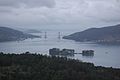
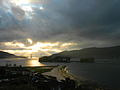
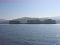
Category:San Simón island
This is a category about a historical place listed in the Spanish heritage register of Bienes de Interés Cultural under the reference RI-54-0000135. |
| Object location | | View all coordinates using: OpenStreetMap |
|---|
island in Cesantes, Spain .jpg) | |||||
| Upload media | |||||
| Instance of | |||||
|---|---|---|---|---|---|
| Location | Ría de Vigo, Pontevedra Province, Galicia | ||||
| Located in or next to body of water | |||||
 | |||||
Media in category "San Simón island"
The following 39 files are in this category, out of 39 total.
-
 Agustín Fernández Paz nos Xerais 2009.jpg 1,670 × 2,446; 2.22 MB
-
 Antiga central eléctrica.JPG 3,072 × 2,304; 1.3 MB
-
 Antigo cárcere da illa.JPG 2,739 × 1,785; 1,013 KB
-
 Arquipélago de San Simón 2.JPG 3,047 × 1,423; 867 KB
-
 Arquipélago de San Simón.JPG 3,072 × 2,304; 1.73 MB
-
 Capela de San Simón.JPG 1,856 × 2,370; 804 KB
-
 Catamarán da Illa de San Simón.JPG 2,893 × 1,683; 1.05 MB
-
 Cesantes e San Simón.jpg 1,280 × 960; 504 KB
-
 Cesantes, Illa de San Antón.JPG 2,713 × 1,809; 1.92 MB
-
 Cesantes, Illa de San Simón e Illa de San Antón.JPG 3,872 × 1,542; 3.18 MB
-
 Cesantes, Illa de San Simón.JPG 3,658 × 2,439; 3.99 MB
-
 Cesantesillasansimon.JPG 2,048 × 1,536; 689 KB
-
 Cesantesss.JPG 1,120 × 740; 409 KB
-
 Enseada de San Simón, Rede Natura 2000.JPG 3,872 × 2,592; 4.18 MB
-
 Ensenada de San Simón.jpg 4,000 × 2,000; 4.06 MB
-
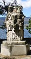 Estatua dos xograres.JPG 1,050 × 1,982; 530 KB
-
 Illa de San Simón en Cesantes, Redondela, Galiza.jpg 800 × 600; 363 KB
-
 Isla de San Simon - panoramio.jpg 2,592 × 1,944; 178 KB
-
 Isla de San Simón (414775380).jpg 1,600 × 1,200; 266 KB
-
 Isla de San Simón - panoramio.jpg 4,115 × 2,074; 3.39 MB
-
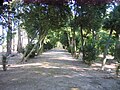
 Isla de San Simón-Paseo de bojes (14587766290).jpg 4,608 × 3,456; 5.43 MB
-
 Isla de San Simón.jpg 2,592 × 1,944; 1.23 MB
-
 Isla deSan Simon puente - panoramio.jpg 3,888 × 2,592; 4.13 MB
-
 Isladesansimon.JPG 3,648 × 2,736; 3.83 MB
-
 Islas de San Simón y San Antón (16281795065).jpg 4,608 × 3,072; 1.63 MB
-
 Mapa do arquipélado de San Simón.JPG 2,935 × 1,487; 628 KB
-
 Mirador do Alto da Cabaleira 15II2015.jpg 3,008 × 2,000; 2.29 MB
-
 Na enseada de San Simón.JPG 3,888 × 2,592; 3.8 MB
-
 Ponte de San Simón.JPG 2,048 × 1,515; 685 KB
-
 Praia de Cesantes atardecer.JPG 4,320 × 3,240; 4.28 MB
-
 Redondela-Isla de San Simón-Un mirador (5865765030).jpg 1,280 × 960; 400 KB
-
 Redondela-Isla San Simón (3195838395).jpg 800 × 600; 138 KB
-
 Sam simao2.jpg 1,600 × 1,200; 529 KB
-
 Sam simom1.jpg 1,600 × 1,200; 504 KB
-
 Sam simom3.jpg 1,600 × 1,200; 979 KB
-
 San Antón y San Simón (16012321663).jpg 4,608 × 3,072; 2.61 MB
-
 San Simón 08 053.JPG 3,072 × 1,823; 1.07 MB
-
 San Simón e a súa enseada.JPG 3,888 × 2,592; 2.85 MB
-
 San Simón, Isla de San Simón ∕ San Simon, San Simon Island.jpg 2,327 × 1,552; 933 KB


.jpg)

.jpg)


.jpg)
.jpg)


.jpg)


