Category:Sanborn Fire Insurance Map from Caldwell, Sumner County, Kansas
Subcategories
This category has the following 6 subcategories, out of 6 total.
S
Media in category "Sanborn Fire Insurance Map from Caldwell, Sumner County, Kansas"
The following 12 files are in this category, out of 12 total.
-
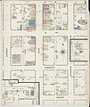
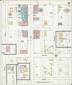
 Sanborn Fire Insurance Map from Caldwell, Sumner County, Kansas. LOC sanborn02912 001-1.jpg 6,450 × 7,650; 3.91 MB
-
 Sanborn Fire Insurance Map from Caldwell, Sumner County, Kansas. LOC sanborn02912 001-1.tif 6,450 × 7,650; 141.17 MB
-
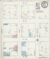
 Sanborn Fire Insurance Map from Caldwell, Sumner County, Kansas. LOC sanborn02912 001-2.jpg 6,450 × 7,650; 3.96 MB
-
 Sanborn Fire Insurance Map from Caldwell, Sumner County, Kansas. LOC sanborn02912 001-2.tif 6,450 × 7,650; 141.17 MB
-
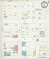
 Sanborn Fire Insurance Map from Caldwell, Sumner County, Kansas. LOC sanborn02912 002-1.jpg 6,450 × 7,650; 3.25 MB
-
 Sanborn Fire Insurance Map from Caldwell, Sumner County, Kansas. LOC sanborn02912 002-1.tif 6,450 × 7,650; 141.17 MB
-
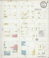
 Sanborn Fire Insurance Map from Caldwell, Sumner County, Kansas. LOC sanborn02912 002-2.jpg 6,450 × 7,650; 3.61 MB
-
 Sanborn Fire Insurance Map from Caldwell, Sumner County, Kansas. LOC sanborn02912 002-2.tif 6,450 × 7,650; 141.17 MB
-
 Sanborn Fire Insurance Map from Caldwell, Sumner County, Kansas. LOC sanborn02912 003-1.jpg 6,450 × 7,650; 3.18 MB
-
 Sanborn Fire Insurance Map from Caldwell, Sumner County, Kansas. LOC sanborn02912 003-1.tif 6,450 × 7,650; 141.17 MB
-
-
 Sanborn Fire Insurance Map from Caldwell, Sumner County, Kansas. LOC sanborn02912 003-2.tif 6,450 × 7,650; 141.17 MB


