Category:Sanborn Fire Insurance Map from Cherokee, Cherokee County, Iowa
Media in category "Sanborn Fire Insurance Map from Cherokee, Cherokee County, Iowa"
The following 61 files are in this category, out of 61 total.
-
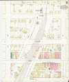
 Sanborn Fire Insurance Map from Cherokee, Cherokee County, Iowa. LOC sanborn02602 001.jpg 6,450 × 7,650; 4.51 MB
-
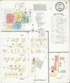
 Sanborn Fire Insurance Map from Cherokee, Cherokee County, Iowa. LOC sanborn02602 002-1.jpg 6,450 × 7,650; 3.78 MB
-
 Sanborn Fire Insurance Map from Cherokee, Cherokee County, Iowa. LOC sanborn02602 002-1.tif 6,450 × 7,650; 141.17 MB
-
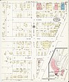
 Sanborn Fire Insurance Map from Cherokee, Cherokee County, Iowa. LOC sanborn02602 002-2.jpg 6,450 × 7,650; 3.89 MB
-
 Sanborn Fire Insurance Map from Cherokee, Cherokee County, Iowa. LOC sanborn02602 002-2.tif 6,450 × 7,650; 141.17 MB
-
 Sanborn Fire Insurance Map from Cherokee, Cherokee County, Iowa. LOC sanborn02602 002-3.jpg 6,450 × 7,650; 3.29 MB
-
 Sanborn Fire Insurance Map from Cherokee, Cherokee County, Iowa. LOC sanborn02602 002-3.tif 6,450 × 7,650; 141.17 MB
-

-
 Sanborn Fire Insurance Map from Cherokee, Cherokee County, Iowa. LOC sanborn02602 003-1.tif 6,450 × 7,650; 141.17 MB
-
 Sanborn Fire Insurance Map from Cherokee, Cherokee County, Iowa. LOC sanborn02602 003-2.jpg 6,450 × 7,650; 2.64 MB
-
 Sanborn Fire Insurance Map from Cherokee, Cherokee County, Iowa. LOC sanborn02602 003-2.tif 6,450 × 7,650; 141.17 MB
-
 Sanborn Fire Insurance Map from Cherokee, Cherokee County, Iowa. LOC sanborn02602 003-3.jpg 6,450 × 7,650; 3.14 MB
-
 Sanborn Fire Insurance Map from Cherokee, Cherokee County, Iowa. LOC sanborn02602 003-3.tif 6,450 × 7,650; 141.17 MB
-
 Sanborn Fire Insurance Map from Cherokee, Cherokee County, Iowa. LOC sanborn02602 003-4.jpg 6,450 × 7,650; 3.03 MB
-
 Sanborn Fire Insurance Map from Cherokee, Cherokee County, Iowa. LOC sanborn02602 003-4.tif 6,450 × 7,650; 141.17 MB
-
 Sanborn Fire Insurance Map from Cherokee, Cherokee County, Iowa. LOC sanborn02602 003-5.jpg 6,450 × 7,650; 2.77 MB
-
 Sanborn Fire Insurance Map from Cherokee, Cherokee County, Iowa. LOC sanborn02602 003-5.tif 6,450 × 7,650; 141.17 MB
-
 Sanborn Fire Insurance Map from Cherokee, Cherokee County, Iowa. LOC sanborn02602 004-1.jpg 6,450 × 7,650; 3.65 MB
-
 Sanborn Fire Insurance Map from Cherokee, Cherokee County, Iowa. LOC sanborn02602 004-1.tif 6,450 × 7,650; 141.17 MB
-
 Sanborn Fire Insurance Map from Cherokee, Cherokee County, Iowa. LOC sanborn02602 004-2.jpg 6,450 × 7,650; 3.28 MB
-
 Sanborn Fire Insurance Map from Cherokee, Cherokee County, Iowa. LOC sanborn02602 004-2.tif 6,450 × 7,650; 141.17 MB
-

-
 Sanborn Fire Insurance Map from Cherokee, Cherokee County, Iowa. LOC sanborn02602 004-3.tif 6,450 × 7,650; 141.17 MB
-
 Sanborn Fire Insurance Map from Cherokee, Cherokee County, Iowa. LOC sanborn02602 004-4.jpg 6,450 × 7,650; 3.24 MB
-
 Sanborn Fire Insurance Map from Cherokee, Cherokee County, Iowa. LOC sanborn02602 004-4.tif 6,450 × 7,650; 141.17 MB
-
 Sanborn Fire Insurance Map from Cherokee, Cherokee County, Iowa. LOC sanborn02602 004-5.jpg 6,450 × 7,650; 3.22 MB
-
 Sanborn Fire Insurance Map from Cherokee, Cherokee County, Iowa. LOC sanborn02602 004-5.tif 6,450 × 7,650; 141.17 MB
-

-
 Sanborn Fire Insurance Map from Cherokee, Cherokee County, Iowa. LOC sanborn02602 004-6.tif 6,450 × 7,650; 141.17 MB
-
 Sanborn Fire Insurance Map from Cherokee, Cherokee County, Iowa. LOC sanborn02602 005-1.jpg 6,450 × 7,650; 3.49 MB
-
 Sanborn Fire Insurance Map from Cherokee, Cherokee County, Iowa. LOC sanborn02602 005-1.tif 6,450 × 7,650; 141.17 MB
-
 Sanborn Fire Insurance Map from Cherokee, Cherokee County, Iowa. LOC sanborn02602 005-2.jpg 6,450 × 7,650; 3.28 MB
-
 Sanborn Fire Insurance Map from Cherokee, Cherokee County, Iowa. LOC sanborn02602 005-2.tif 6,450 × 7,650; 141.17 MB
-
 Sanborn Fire Insurance Map from Cherokee, Cherokee County, Iowa. LOC sanborn02602 005-3.jpg 6,450 × 7,650; 3.42 MB
-
 Sanborn Fire Insurance Map from Cherokee, Cherokee County, Iowa. LOC sanborn02602 005-3.tif 6,450 × 7,650; 141.17 MB
-
 Sanborn Fire Insurance Map from Cherokee, Cherokee County, Iowa. LOC sanborn02602 005-4.jpg 6,450 × 7,650; 3.24 MB
-
 Sanborn Fire Insurance Map from Cherokee, Cherokee County, Iowa. LOC sanborn02602 005-4.tif 6,450 × 7,650; 141.17 MB
-
 Sanborn Fire Insurance Map from Cherokee, Cherokee County, Iowa. LOC sanborn02602 005-5.jpg 6,450 × 7,650; 2.39 MB
-
 Sanborn Fire Insurance Map from Cherokee, Cherokee County, Iowa. LOC sanborn02602 005-5.tif 6,450 × 7,650; 141.17 MB
-
 Sanborn Fire Insurance Map from Cherokee, Cherokee County, Iowa. LOC sanborn02602 005-6.jpg 6,450 × 7,650; 2.88 MB
-
 Sanborn Fire Insurance Map from Cherokee, Cherokee County, Iowa. LOC sanborn02602 005-6.tif 6,450 × 7,650; 141.17 MB
-
 Sanborn Fire Insurance Map from Cherokee, Cherokee County, Iowa. LOC sanborn02602 005-7.jpg 6,450 × 7,650; 2.26 MB
-
 Sanborn Fire Insurance Map from Cherokee, Cherokee County, Iowa. LOC sanborn02602 005-7.tif 6,450 × 7,650; 141.17 MB
-
 Sanborn Fire Insurance Map from Cherokee, Cherokee County, Iowa. LOC sanborn02602 006-1.jpg 6,450 × 7,650; 4.46 MB
-
 Sanborn Fire Insurance Map from Cherokee, Cherokee County, Iowa. LOC sanborn02602 006-1.tif 6,450 × 7,650; 141.17 MB
-
 Sanborn Fire Insurance Map from Cherokee, Cherokee County, Iowa. LOC sanborn02602 006-2.jpg 6,450 × 7,650; 2.82 MB
-
 Sanborn Fire Insurance Map from Cherokee, Cherokee County, Iowa. LOC sanborn02602 006-2.tif 6,450 × 7,650; 141.17 MB
-
 Sanborn Fire Insurance Map from Cherokee, Cherokee County, Iowa. LOC sanborn02602 006-3.jpg 6,450 × 7,650; 3.11 MB
-
 Sanborn Fire Insurance Map from Cherokee, Cherokee County, Iowa. LOC sanborn02602 006-3.tif 6,450 × 7,650; 141.17 MB
-
 Sanborn Fire Insurance Map from Cherokee, Cherokee County, Iowa. LOC sanborn02602 006-4.jpg 6,450 × 7,650; 3.35 MB
-
 Sanborn Fire Insurance Map from Cherokee, Cherokee County, Iowa. LOC sanborn02602 006-4.tif 6,450 × 7,650; 141.17 MB
-
 Sanborn Fire Insurance Map from Cherokee, Cherokee County, Iowa. LOC sanborn02602 006-5.jpg 6,450 × 7,650; 4.25 MB
-
 Sanborn Fire Insurance Map from Cherokee, Cherokee County, Iowa. LOC sanborn02602 006-5.tif 6,450 × 7,650; 141.17 MB
-
 Sanborn Fire Insurance Map from Cherokee, Cherokee County, Iowa. LOC sanborn02602 006-6.jpg 6,450 × 7,650; 3.31 MB
-
 Sanborn Fire Insurance Map from Cherokee, Cherokee County, Iowa. LOC sanborn02602 006-6.tif 6,450 × 7,650; 141.17 MB
-
-
 Sanborn Fire Insurance Map from Cherokee, Cherokee County, Iowa. LOC sanborn02602 006-7.tif 6,450 × 7,650; 141.17 MB
-
 Sanborn Fire Insurance Map from Cherokee, Cherokee County, Iowa. LOC sanborn02602 006-8.jpg 6,450 × 7,650; 3.72 MB
-
 Sanborn Fire Insurance Map from Cherokee, Cherokee County, Iowa. LOC sanborn02602 006-8.tif 6,450 × 7,650; 141.17 MB
-
 Sanborn Fire Insurance Map from Cherokee, Cherokee County, Iowa. LOC sanborn02602 006-9.jpg 6,450 × 7,650; 3.04 MB
-
 Sanborn Fire Insurance Map from Cherokee, Cherokee County, Iowa. LOC sanborn02602 006-9.tif 6,450 × 7,650; 141.17 MB


