Category:Sanborn Fire Insurance Map from Girard, Crawford County, Kansas, 1935
See parent category for index.
Media in category "Sanborn Fire Insurance Map from Girard, Crawford County, Kansas, 1935"
The following 6 files are in this category, out of 6 total.
-
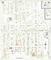
 Sanborn Fire Insurance Map from Girard, Crawford County, Kansas, 1935, Plate 0001.jpg 6,450 × 7,650; 3.3 MB
-
 Sanborn Fire Insurance Map from Girard, Crawford County, Kansas, 1935, Plate 0002.jpg 6,450 × 7,650; 2.67 MB
-
 Sanborn Fire Insurance Map from Girard, Crawford County, Kansas, 1935, Plate 0003.jpg 6,450 × 7,650; 2.92 MB
-
 Sanborn Fire Insurance Map from Girard, Crawford County, Kansas, 1935, Plate 0004.jpg 6,450 × 7,650; 2.74 MB
-
 Sanborn Fire Insurance Map from Girard, Crawford County, Kansas, 1935, Plate 0005.jpg 6,450 × 7,650; 2.56 MB
-
 Sanborn Fire Insurance Map from Girard, Crawford County, Kansas, 1935, Plate 0006.jpg 6,450 × 7,650; 2.98 MB


