Category:Sanborn Fire Insurance Map from La Grange, Oldham County, Kentucky, 1901
See parent category for index.
Media in category "Sanborn Fire Insurance Map from La Grange, Oldham County, Kentucky, 1901"
The following 3 files are in this category, out of 3 total.
-
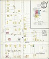 Sanborn Fire Insurance Map from La Grange, Oldham County, Kentucky, 1901, Plate 0001.jpg 6,450 × 7,650; 2.64 MB
-
 Sanborn Fire Insurance Map from La Grange, Oldham County, Kentucky, 1901, Plate 0002.jpg 6,450 × 7,650; 2.74 MB
-
 Sanborn Fire Insurance Map from La Grange, Oldham County, Kentucky, 1901, Plate 0003.jpg 6,450 × 7,650; 2.72 MB


