Category:Sanborn Fire Insurance Map from Le Claire, Scott County, Iowa
Subcategories
This category has only the following subcategory.
Media in category "Sanborn Fire Insurance Map from Le Claire, Scott County, Iowa"
The following 10 files are in this category, out of 10 total.
-
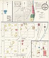
 Sanborn Fire Insurance Map from Le Claire, Scott County, Iowa. LOC sanborn02715 001-1.jpg 6,450 × 7,650; 3.12 MB
-
 Sanborn Fire Insurance Map from Le Claire, Scott County, Iowa. LOC sanborn02715 001-1.tif 6,450 × 7,650; 141.17 MB
-
 Sanborn Fire Insurance Map from Le Claire, Scott County, Iowa. LOC sanborn02715 001-2.jpg 6,450 × 7,650; 3.33 MB
-
 Sanborn Fire Insurance Map from Le Claire, Scott County, Iowa. LOC sanborn02715 001-2.tif 6,450 × 7,650; 141.17 MB
-
 Sanborn Fire Insurance Map from Le Claire, Scott County, Iowa. LOC sanborn02715 003-1.jpg 6,450 × 7,650; 3.68 MB
-
 Sanborn Fire Insurance Map from Le Claire, Scott County, Iowa. LOC sanborn02715 003-1.tif 6,450 × 7,650; 141.17 MB
-
 Sanborn Fire Insurance Map from Le Claire, Scott County, Iowa. LOC sanborn02715 003-2.jpg 6,450 × 7,650; 3.23 MB
-
 Sanborn Fire Insurance Map from Le Claire, Scott County, Iowa. LOC sanborn02715 003-2.tif 6,450 × 7,650; 141.17 MB
-
 Sanborn Fire Insurance Map from Le Claire, Scott County, Iowa. LOC sanborn02715 003-3.jpg 6,450 × 7,650; 3.32 MB
-
 Sanborn Fire Insurance Map from Le Claire, Scott County, Iowa. LOC sanborn02715 003-3.tif 6,450 × 7,650; 141.17 MB


