Category:Sanborn Fire Insurance Map from Parsons, Labette County, Kansas
Subcategories
This category has the following 2 subcategories, out of 2 total.
Media in category "Sanborn Fire Insurance Map from Parsons, Labette County, Kansas"
The following 62 files are in this category, out of 62 total.
-
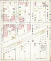
 Sanborn Fire Insurance Map from Parsons, Labette County, Kansas. LOC sanborn03055 001-1.jpg 6,450 × 7,650; 3.54 MB
-
 Sanborn Fire Insurance Map from Parsons, Labette County, Kansas. LOC sanborn03055 001-1.tif 6,450 × 7,650; 141.17 MB
-
 Sanborn Fire Insurance Map from Parsons, Labette County, Kansas. LOC sanborn03055 001-2.jpg 6,450 × 7,650; 3.46 MB
-
 Sanborn Fire Insurance Map from Parsons, Labette County, Kansas. LOC sanborn03055 001-2.tif 6,450 × 7,650; 141.17 MB
-
 Sanborn Fire Insurance Map from Parsons, Labette County, Kansas. LOC sanborn03055 001-3.jpg 6,450 × 7,650; 3.22 MB
-
 Sanborn Fire Insurance Map from Parsons, Labette County, Kansas. LOC sanborn03055 001-3.tif 6,450 × 7,650; 141.17 MB
-

-
 Sanborn Fire Insurance Map from Parsons, Labette County, Kansas. LOC sanborn03055 001-4.tif 6,450 × 7,650; 141.17 MB
-
 Sanborn Fire Insurance Map from Parsons, Labette County, Kansas. LOC sanborn03055 002-1.jpg 6,450 × 7,650; 4.03 MB
-
 Sanborn Fire Insurance Map from Parsons, Labette County, Kansas. LOC sanborn03055 002-1.tif 6,450 × 7,650; 141.17 MB
-
 Sanborn Fire Insurance Map from Parsons, Labette County, Kansas. LOC sanborn03055 002-2.jpg 6,450 × 7,650; 3.58 MB
-
 Sanborn Fire Insurance Map from Parsons, Labette County, Kansas. LOC sanborn03055 002-2.tif 6,450 × 7,650; 141.17 MB
-
 Sanborn Fire Insurance Map from Parsons, Labette County, Kansas. LOC sanborn03055 002-3.jpg 6,450 × 7,650; 3.36 MB
-
 Sanborn Fire Insurance Map from Parsons, Labette County, Kansas. LOC sanborn03055 002-3.tif 6,450 × 7,650; 141.17 MB
-
 Sanborn Fire Insurance Map from Parsons, Labette County, Kansas. LOC sanborn03055 002-4.jpg 6,450 × 7,650; 3.66 MB
-
 Sanborn Fire Insurance Map from Parsons, Labette County, Kansas. LOC sanborn03055 002-4.tif 6,450 × 7,650; 141.17 MB
-
 Sanborn Fire Insurance Map from Parsons, Labette County, Kansas. LOC sanborn03055 002-5.jpg 6,450 × 7,650; 3.64 MB
-
 Sanborn Fire Insurance Map from Parsons, Labette County, Kansas. LOC sanborn03055 002-5.tif 6,450 × 7,650; 141.17 MB
-
 Sanborn Fire Insurance Map from Parsons, Labette County, Kansas. LOC sanborn03055 002-6.jpg 6,450 × 7,650; 3.25 MB
-
 Sanborn Fire Insurance Map from Parsons, Labette County, Kansas. LOC sanborn03055 002-6.tif 6,450 × 7,650; 141.17 MB
-

-
 Sanborn Fire Insurance Map from Parsons, Labette County, Kansas. LOC sanborn03055 002-7.tif 6,450 × 7,650; 141.17 MB
-
 Sanborn Fire Insurance Map from Parsons, Labette County, Kansas. LOC sanborn03055 002-8.jpg 6,450 × 7,650; 3.09 MB
-
 Sanborn Fire Insurance Map from Parsons, Labette County, Kansas. LOC sanborn03055 002-8.tif 6,450 × 7,650; 141.17 MB
-
 Sanborn Fire Insurance Map from Parsons, Labette County, Kansas. LOC sanborn03055 002-9.jpg 6,450 × 7,650; 3.21 MB
-
 Sanborn Fire Insurance Map from Parsons, Labette County, Kansas. LOC sanborn03055 002-9.tif 6,450 × 7,650; 141.17 MB
-
 Sanborn Fire Insurance Map from Parsons, Labette County, Kansas. LOC sanborn03055 003-1.jpg 6,450 × 7,650; 4.04 MB
-
 Sanborn Fire Insurance Map from Parsons, Labette County, Kansas. LOC sanborn03055 003-1.tif 6,450 × 7,650; 141.17 MB
-
 Sanborn Fire Insurance Map from Parsons, Labette County, Kansas. LOC sanborn03055 003-2.jpg 6,450 × 7,650; 3.93 MB
-
 Sanborn Fire Insurance Map from Parsons, Labette County, Kansas. LOC sanborn03055 003-2.tif 6,450 × 7,650; 141.17 MB
-
 Sanborn Fire Insurance Map from Parsons, Labette County, Kansas. LOC sanborn03055 003-3.jpg 6,450 × 7,650; 3.64 MB
-
 Sanborn Fire Insurance Map from Parsons, Labette County, Kansas. LOC sanborn03055 003-3.tif 6,450 × 7,650; 141.17 MB
-
 Sanborn Fire Insurance Map from Parsons, Labette County, Kansas. LOC sanborn03055 003-4.jpg 6,450 × 7,650; 3.48 MB
-
 Sanborn Fire Insurance Map from Parsons, Labette County, Kansas. LOC sanborn03055 003-4.tif 6,450 × 7,650; 141.17 MB
-
 Sanborn Fire Insurance Map from Parsons, Labette County, Kansas. LOC sanborn03055 003-5.jpg 6,450 × 7,650; 3.65 MB
-
 Sanborn Fire Insurance Map from Parsons, Labette County, Kansas. LOC sanborn03055 003-5.tif 6,450 × 7,650; 141.17 MB
-
 Sanborn Fire Insurance Map from Parsons, Labette County, Kansas. LOC sanborn03055 003-6.jpg 6,450 × 7,650; 3.24 MB
-
 Sanborn Fire Insurance Map from Parsons, Labette County, Kansas. LOC sanborn03055 003-6.tif 6,450 × 7,650; 141.17 MB
-
 Sanborn Fire Insurance Map from Parsons, Labette County, Kansas. LOC sanborn03055 003-7.jpg 6,450 × 7,650; 3.36 MB
-
 Sanborn Fire Insurance Map from Parsons, Labette County, Kansas. LOC sanborn03055 003-7.tif 6,450 × 7,650; 141.17 MB
-
 Sanborn Fire Insurance Map from Parsons, Labette County, Kansas. LOC sanborn03055 003-8.jpg 6,450 × 7,650; 3.41 MB
-
 Sanborn Fire Insurance Map from Parsons, Labette County, Kansas. LOC sanborn03055 003-8.tif 6,450 × 7,650; 141.17 MB
-
 Sanborn Fire Insurance Map from Parsons, Labette County, Kansas. LOC sanborn03055 003-9.jpg 6,450 × 7,650; 3.61 MB
-
 Sanborn Fire Insurance Map from Parsons, Labette County, Kansas. LOC sanborn03055 003-9.tif 6,450 × 7,650; 141.17 MB
-
 Sanborn Fire Insurance Map from Parsons, Labette County, Kansas. LOC sanborn03055 004-1.jpg 6,450 × 7,650; 4.37 MB
-
 Sanborn Fire Insurance Map from Parsons, Labette County, Kansas. LOC sanborn03055 004-1.tif 6,450 × 7,650; 141.17 MB
-
 Sanborn Fire Insurance Map from Parsons, Labette County, Kansas. LOC sanborn03055 004-2.jpg 6,450 × 7,650; 3.72 MB
-
 Sanborn Fire Insurance Map from Parsons, Labette County, Kansas. LOC sanborn03055 004-2.tif 6,450 × 7,650; 141.17 MB
-
 Sanborn Fire Insurance Map from Parsons, Labette County, Kansas. LOC sanborn03055 004-3.jpg 6,450 × 7,650; 3.33 MB
-
 Sanborn Fire Insurance Map from Parsons, Labette County, Kansas. LOC sanborn03055 004-3.tif 6,450 × 7,650; 141.17 MB
-
 Sanborn Fire Insurance Map from Parsons, Labette County, Kansas. LOC sanborn03055 004-4.jpg 6,450 × 7,650; 3.53 MB
-
 Sanborn Fire Insurance Map from Parsons, Labette County, Kansas. LOC sanborn03055 004-4.tif 6,450 × 7,650; 141.17 MB
-
 Sanborn Fire Insurance Map from Parsons, Labette County, Kansas. LOC sanborn03055 004-5.jpg 6,450 × 7,650; 3.61 MB
-
 Sanborn Fire Insurance Map from Parsons, Labette County, Kansas. LOC sanborn03055 004-5.tif 6,450 × 7,650; 141.17 MB
-
 Sanborn Fire Insurance Map from Parsons, Labette County, Kansas. LOC sanborn03055 004-6.jpg 6,450 × 7,650; 3.06 MB
-
 Sanborn Fire Insurance Map from Parsons, Labette County, Kansas. LOC sanborn03055 004-6.tif 6,450 × 7,650; 141.17 MB
-
 Sanborn Fire Insurance Map from Parsons, Labette County, Kansas. LOC sanborn03055 004-7.jpg 6,450 × 7,650; 3.11 MB
-
 Sanborn Fire Insurance Map from Parsons, Labette County, Kansas. LOC sanborn03055 004-7.tif 6,450 × 7,650; 141.17 MB
-
 Sanborn Fire Insurance Map from Parsons, Labette County, Kansas. LOC sanborn03055 004-8.jpg 6,450 × 7,650; 3.26 MB
-
 Sanborn Fire Insurance Map from Parsons, Labette County, Kansas. LOC sanborn03055 004-8.tif 6,450 × 7,650; 141.17 MB
-
 Sanborn Fire Insurance Map from Parsons, Labette County, Kansas. LOC sanborn03055 004-9.jpg 6,450 × 7,650; 3.68 MB
-
 Sanborn Fire Insurance Map from Parsons, Labette County, Kansas. LOC sanborn03055 004-9.tif 6,450 × 7,650; 141.17 MB


