Category:Sandford-on-Thames
village and civil parish in South Oxfordshire, England  | |||||
| Upload media | |||||
| Instance of | |||||
|---|---|---|---|---|---|
| Location | South Oxfordshire, Oxfordshire, South East England, England | ||||
| Located in or next to body of water | |||||
| Area |
| ||||
| official website | |||||
 | |||||
English: Sandford-on-Thames is a village and Parish Council beside the River Thames in Oxfordshire just south of Oxford. The village is just west of the A4074 road between Oxford and Henley.
Subcategories
This category has the following 9 subcategories, out of 9 total.
I
- Isis Bridge (8 F)
K
- Kennington Railway Bridge (21 F)
- Kings Arms, Sandford-on-Thames (12 F)
R
- Rose Isle (9 F)
S
- Sandford Lasher (8 F)
- Sandford Mill (6 F)
Media in category "Sandford-on-Thames"
The following 170 files are in this category, out of 170 total.
-
 A backwater of the Thames at Sandford - geograph.org.uk - 3292413.jpg 1,500 × 1,000; 267 KB
-
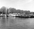
 A former college barge by the Four Pillars Hotel - geograph.org.uk - 3292404.jpg 1,500 × 989; 156 KB
-
 A weir at Sandford - geograph.org.uk - 3292420.jpg 1,500 × 1,000; 396 KB
-
 A4074 crossed by the Sandford Road bridge - geograph.org.uk - 2800694.jpg 3,648 × 2,484; 1.45 MB
-
 A4074 crosses the Henley Road link - geograph.org.uk - 2800703.jpg 3,511 × 2,538; 1.51 MB
-
 A4074 heading to Nuneham Courtenay - geograph.org.uk - 1384970.jpg 640 × 480; 70 KB
-
 A4074 south of Sandford on Thames - geograph.org.uk - 2800707.jpg 3,457 × 2,442; 1.29 MB
-
 A4074 towards Oxford - geograph.org.uk - 6236618.jpg 1,024 × 684; 343 KB
-
 A4074 towards Oxford - geograph.org.uk - 6236622.jpg 1,024 × 684; 314 KB
-
 A4074 towards Oxford - geograph.org.uk - 6236631.jpg 1,024 × 684; 360 KB
-

-
 Apartment at Sandford Lock - geograph.org.uk - 2612014.jpg 1,024 × 680; 170 KB
-
 Apartment at Sandford Lock - geograph.org.uk - 2612015.jpg 1,024 × 680; 205 KB
-
 Approaching Sandford Lock - geograph.org.uk - 2497058.jpg 640 × 427; 138 KB
-
 Approaching Sandford Lock - geograph.org.uk - 2497062.jpg 640 × 427; 147 KB
-
 Approaching Sandford Lock - geograph.org.uk - 2531280.jpg 640 × 447; 136 KB
-
 Approaching Sandford Lock - geograph.org.uk - 3292430.jpg 1,500 × 1,000; 202 KB
-
 Benchmark on the house at Sandford Lock - geograph.org.uk - 3323347.jpg 683 × 1,024; 170 KB
-

-
 Birds along the River Thames - geograph.org.uk - 4531410.jpg 1,024 × 636; 282 KB
-
 Black Bridge over the River Thames - geograph.org.uk - 5698640.jpg 2,700 × 2,025; 485 KB
-
 Black Bridge over the River Thames - geograph.org.uk - 5698645.jpg 2,700 × 2,025; 394 KB
-
 Boat near Sandford - geograph.org.uk - 3400735.jpg 470 × 640; 248 KB
-
 Boats moored near Sandford - geograph.org.uk - 1539002.jpg 640 × 549; 81 KB
-
 Bridge over River Thames for Cowley Works branch - geograph.org.uk - 3862130.jpg 1,024 × 683; 190 KB
-
 Bridges of Kennington - geograph.org.uk - 3007885.jpg 1,500 × 1,125; 233 KB
-
 Coat of Arms carving - geograph.org.uk - 2925309.jpg 2,134 × 2,848; 1.04 MB
-
 College barge above Sandford Lock - geograph.org.uk - 1539031.jpg 640 × 544; 79 KB
-
 Contrast at Rose Isle - geograph.org.uk - 3400727.jpg 640 × 427; 179 KB
-
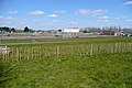
 Cowley Substation - geograph.org.uk - 2137519.jpg 3,500 × 2,572; 2.69 MB
-
 Cross Pattee carving - geograph.org.uk - 2925286.jpg 2,134 × 2,848; 889 KB
-
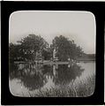
 Dawn reflected in the Thames - geograph.org.uk - 3306039.jpg 1,500 × 1,000; 158 KB
-
 Dock at Four Pillars Hotel - geograph.org.uk - 2925318.jpg 4,572 × 1,248; 1.53 MB
-

-
 Entering Sandford Lock going downstream - geograph.org.uk - 2531287.jpg 640 × 427; 156 KB
-
 Farm track at Sandford Brake - geograph.org.uk - 1447311.jpg 640 × 427; 71 KB
-
 Farmland, Sandford-on-Thames - geograph.org.uk - 2809271.jpg 640 × 480; 137 KB
-
 Farmland, Sandford-on-Thames - geograph.org.uk - 2809283.jpg 640 × 480; 183 KB
-
 Farmland, Sandford-on-Thames - geograph.org.uk - 2809287.jpg 640 × 480; 148 KB
-
 Flood path along Sandford Lane - geograph.org.uk - 1222591.jpg 640 × 427; 100 KB
-
 Footbridge along the River Thames - geograph.org.uk - 4531632.jpg 831 × 1,024; 315 KB
-
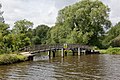
 Footbridge and weir along the River Thames - geograph.org.uk - 4531434.jpg 1,024 × 735; 282 KB
-
 Footbridge over Hinskey Stream - geograph.org.uk - 2497369.jpg 640 × 427; 160 KB
-
 Footbridge over the Hinksey stream - geograph.org.uk - 5666647.jpg 5,202 × 3,465; 5.2 MB
-
-
 Footbridge to Fiddler's Elbow - geograph.org.uk - 3292410.jpg 1,500 × 1,000; 259 KB
-
 Footpath from Sandford lock to Radley - geograph.org.uk - 129561.jpg 427 × 640; 115 KB
-
 Footpath past Sandford Brake Farm - geograph.org.uk - 3401504.jpg 640 × 427; 196 KB
-
 Footpath towards Blackbird Leys - geograph.org.uk - 3401448.jpg 640 × 427; 144 KB
-
 Four Pillars Hotel - geograph.org.uk - 3401181.jpg 640 × 432; 262 KB
-
 Four Pillars Hotel, Sandford - geograph.org.uk - 2925279.jpg 6,146 × 2,044; 1.86 MB
-
 Four Pillars Hotel, Sandford - geograph.org.uk - 2925294.jpg 5,100 × 1,210; 1.26 MB
-
 Gardens run down to the River Thames - geograph.org.uk - 3292426.jpg 1,500 × 1,000; 175 KB
-
 Gate along the Thames Path - geograph.org.uk - 4531427.jpg 1,024 × 724; 289 KB
-
 Gate to Littlemoor Brook. - geograph.org.uk - 2925331.jpg 2,134 × 2,848; 1.12 MB
-
 Graffiti under the bridge - geograph.org.uk - 5048866.jpg 1,500 × 1,125; 177 KB
-
 Gravestone in Sandford churchyard - geograph.org.uk - 3401223.jpg 427 × 640; 207 KB
-
 Heyford Hill Roundabout - geograph.org.uk - 6236638.jpg 1,024 × 684; 307 KB
-
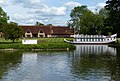
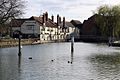
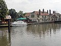
 Hotel beside Thames - geograph.org.uk - 2612022.jpg 1,024 × 680; 151 KB
-
 House by the Thames on Rose Isle - geograph.org.uk - 6078424.jpg 2,700 × 2,025; 746 KB
-
 House on Rose Isle - geograph.org.uk - 4530542.jpg 1,024 × 790; 315 KB
-
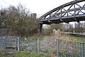
 Kennington railway bridge - geograph.org.uk - 5219858.jpg 5,184 × 3,456; 6.43 MB
-

-
 Kings Arms, Sandford-on-Thames - geograph.org.uk - 3973904.jpg 1,748 × 1,312; 395 KB
-
 Leaving Sandford Lock going downstream - geograph.org.uk - 2531296.jpg 640 × 427; 141 KB
-
 Lock Keeper's House, Sandford Lock - geograph.org.uk - 3323353.jpg 1,024 × 683; 102 KB
-
 Looking across Rose Isle - geograph.org.uk - 2497362.jpg 640 × 427; 124 KB
-
 Nosing into Sandford Lock - geograph.org.uk - 2497063.jpg 547 × 640; 165 KB
-
 Old houses, old car - geograph.org.uk - 3401287.jpg 640 × 433; 193 KB
-
 Old Pumping Station Channel - geograph.org.uk - 2813348.jpg 720 × 800; 232 KB
-
 Orchard in the Sewage Works - geograph.org.uk - 1901269.jpg 1,600 × 1,194; 418 KB
-
 Oxford Thames Four Pillars Hotel - geograph.org.uk - 4531420.jpg 1,024 × 690; 212 KB
-

-

-
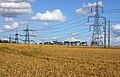
 Pylons near Sandford Brake - geograph.org.uk - 2969547.jpg 1,600 × 1,200; 431 KB
-
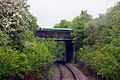
 Railway Bridge in Sandford Lane - geograph.org.uk - 1222585.jpg 640 × 427; 102 KB
-
 Railway bridge over the River Thames - geograph.org.uk - 6078423.jpg 2,700 × 2,025; 766 KB
-
 Rain Gauge Inspection at Oxford STW - geograph.org.uk - 1933786.jpg 2,048 × 1,536; 956 KB
-
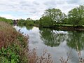
 River Thames at Sandford - geograph.org.uk - 2925227.jpg 2,848 × 2,134; 1.21 MB
-
 River Thames at Sandford - geograph.org.uk - 2925233.jpg 5,766 × 1,812; 2.55 MB
-
 River Thames near Kennington - geograph.org.uk - 2611627.jpg 1,024 × 680; 178 KB
-
 River Thames near Kennington Railway Bridge - geograph.org.uk - 4530525.jpg 1,024 × 768; 298 KB
-
 River Thames under the A423 - geograph.org.uk - 3400668.jpg 640 × 427; 232 KB
-
 River Thames, looking south from Kennington rail bridge - geograph.org.uk - 5666649.jpg 5,202 × 3,465; 4.01 MB
-
 River View - geograph.org.uk - 3401206.jpg 640 × 427; 202 KB
-
 Riverside Reedbeds - geograph.org.uk - 2813356.jpg 1,024 × 745; 340 KB
-
 Rose Isle by the River Thames - geograph.org.uk - 5698635.jpg 2,700 × 2,060; 545 KB
-
 Rose Isle on River Thames - geograph.org.uk - 2531266.jpg 543 × 640; 160 KB
-
 Roundabout at Grenoble Road - geograph.org.uk - 3401291.jpg 640 × 427; 200 KB
-
 Route past the sewage works - geograph.org.uk - 3401442.jpg 640 × 427; 248 KB
-
 Route past the sewage works - geograph.org.uk - 3401443.jpg 640 × 427; 244 KB
-
 Sandford Brake Farm - geograph.org.uk - 1447301.jpg 640 × 416; 94 KB
-
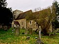
 Sandford church - geograph.org.uk - 3401213.jpg 640 × 564; 282 KB
-
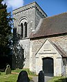 Sandford church - geograph.org.uk - 3401218.jpg 521 × 640; 328 KB
-
 Sandford church - geograph.org.uk - 3401224.jpg 640 × 437; 203 KB
-
 Sandford Green - geograph.org.uk - 3401282.jpg 640 × 427; 193 KB
-
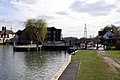 Sandford Lock - geograph.org.uk - 1231135.jpg 640 × 427; 69 KB
-
 Sandford Lock - geograph.org.uk - 3401200.jpg 640 × 427; 209 KB
-
 Sandford Lock - geograph.org.uk - 3401201.jpg 640 × 427; 186 KB
-
 Sandford Lock - geograph.org.uk - 5218541.jpg 5,184 × 3,456; 6.49 MB
-
 Sandford Lock along the River Thames - geograph.org.uk - 4531609.jpg 1,024 × 788; 280 KB
-
 Sandford Lock along the River Thames - geograph.org.uk - 4531618.jpg 1,024 × 701; 218 KB
-
 Sandford Lock and Private flats - geograph.org.uk - 1231149.jpg 640 × 427; 63 KB
-
 Sandford Lock house - geograph.org.uk - 3401205.jpg 640 × 482; 258 KB
-
 Sandford Lock, looking upstream - geograph.org.uk - 4691402.jpg 2,592 × 1,944; 1.21 MB
-
 Sandford Village - geograph.org.uk - 2925213.jpg 5,886 × 1,053; 986 KB
-
 Cowley electricity sub-station - geograph.org.uk - 190895.jpg 640 × 479; 93 KB
-
-

-

-
 The Swan Inn, Rose Island, River Thames, Oxfordshire.jpg 792 × 800; 80 KB
-
 SandfordOnThames ChurchRd furniture.jpg 1,024 × 614; 425 KB
-
 SandfordOnThames ChurchRd TypeM.jpg 768 × 1,024; 653 KB
-
 Sewage works - back entrance - geograph.org.uk - 3401437.jpg 640 × 427; 171 KB
-
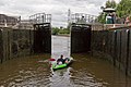
 Small Canoe in a Large Lock - geograph.org.uk - 441281.jpg 640 × 480; 98 KB
-
 Solar Panels ^ - geograph.org.uk - 2925264.jpg 2,848 × 2,134; 1.01 MB
-
 South of Kennington railway bridge - geograph.org.uk - 3400711.jpg 640 × 428; 230 KB
-
 St Andrews Church in Sandford on Thames - geograph.org.uk - 5270569.jpg 1,500 × 1,125; 252 KB
-
-
 Thames river at Sandford.JPG 1,600 × 1,200; 332 KB
-
 The A4074, Sandford-on-Thames - geograph.org.uk - 5993174.jpg 1,990 × 1,454; 1.39 MB
-
 The A423 crosses the River Thames - geograph.org.uk - 6075168.jpg 2,700 × 2,025; 615 KB
-
 The backwater past Sandford Lock - geograph.org.uk - 3296240.jpg 1,500 × 1,000; 247 KB
-
 The Catherine Wheel on Henley Road - geograph.org.uk - 5270575.jpg 1,500 × 963; 134 KB
-
 The Fox on Henley Road - geograph.org.uk - 3539433.jpg 1,500 × 984; 252 KB
-
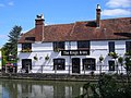
 The Kings Arms - geograph.org.uk - 2612025.jpg 1,024 × 680; 168 KB
-
-
 The Kings Arms by Sandford Lock - geograph.org.uk - 3292433.jpg 1,500 × 992; 265 KB
-
 The Kings Arms, Sandford Lock - geograph.org.uk - 3136863.jpg 2,272 × 1,704; 2.1 MB
-
 The line goes over Heyford Hill Lane - geograph.org.uk - 3040068.jpg 1,500 × 1,000; 343 KB
-
 The line runs under the A4074 - geograph.org.uk - 3040064.jpg 1,500 × 1,000; 256 KB
-
 The Lock at Sandford-on-Thames - geograph.org.uk - 3469406.jpg 4,288 × 2,848; 4.99 MB
-
 The Old Manor House, Sandford - geograph.org.uk - 2925303.jpg 2,848 × 2,134; 1.2 MB
-
 The Old Post Office, Sandford - geograph.org.uk - 2925270.jpg 7,000 × 1,715; 1.41 MB
-
 The Old School on Church Road - geograph.org.uk - 5270573.jpg 1,500 × 1,125; 218 KB
-
 The River Thames above Fiddler's Elbow - geograph.org.uk - 5073300.jpg 2,592 × 1,944; 1.46 MB
-
 The River Thames above Sandford Lock - geograph.org.uk - 5073293.jpg 2,592 × 1,944; 1.74 MB
-
 The River Thames at Kennington - geograph.org.uk - 3292333.jpg 1,500 × 1,000; 197 KB
-
 The River Thames at Kennington - geograph.org.uk - 3292341.jpg 1,500 × 1,000; 226 KB
-
 The River Thames at Sandford - geograph.org.uk - 6156955.jpg 2,700 × 2,025; 561 KB
-
 The River Thames in Kennington - geograph.org.uk - 5698636.jpg 2,700 × 2,025; 379 KB
-
 The River Thames in Kennington - geograph.org.uk - 5698637.jpg 2,700 × 2,025; 499 KB
-
 The River Thames near Kennington - geograph.org.uk - 1932940.jpg 1,500 × 984; 158 KB
-
 The River Thames on a frosty morning - geograph.org.uk - 2769914.jpg 1,500 × 1,125; 196 KB
-
 The Thames at Sandford - geograph.org.uk - 31785.jpg 640 × 480; 75 KB
-
 The Thames Path - geograph.org.uk - 1231143.jpg 640 × 427; 63 KB
-
 The Thames south of Sandford Lock - geograph.org.uk - 1932959.jpg 1,500 × 1,000; 305 KB
-
 Time for a break - geograph.org.uk - 3176609.jpg 640 × 480; 105 KB
-
 Towards Sandford Brake sub-station - geograph.org.uk - 3401455.jpg 640 × 424; 179 KB
-
 Track near Sandford - geograph.org.uk - 2814768.jpg 1,600 × 1,200; 715 KB
-
 Tree reflections near Rose Isle - geograph.org.uk - 5219842.jpg 4,954 × 3,265; 3.73 MB
-
 Vale House, Sandford - geograph.org.uk - 2814658.jpg 1,600 × 964; 518 KB
-
 View from St Andrew's Church, Sandford - geograph.org.uk - 2925223.jpg 7,048 × 1,272; 1.62 MB
-
 View towards Kassam Stadium - geograph.org.uk - 3401445.jpg 640 × 425; 178 KB
-
 Walled Garden, Four Pillars Hotel, Sandford - geograph.org.uk - 2925326.jpg 4,655 × 1,900; 1.84 MB
-
 Waterfront housing by Sandford Lock - geograph.org.uk - 3292435.jpg 1,500 × 1,000; 210 KB
-
 Weir stream at Sandford - geograph.org.uk - 129558.jpg 640 × 427; 105 KB
-
 Willows near Rose Isle - geograph.org.uk - 5219834.jpg 5,202 × 3,465; 2.22 MB
-
 Wood at Sandford Brake - geograph.org.uk - 1447308.jpg 640 × 427; 98 KB
-
 Yeftly Drive, Sandford - geograph.org.uk - 2814606.jpg 1,600 × 1,399; 604 KB
-
 Apartment Blocks at Sandford Lock - geograph.org.uk - 441274.jpg 640 × 480; 63 KB
-
 Hedgerow near Radley Little Wood - geograph.org.uk - 129567.jpg 640 × 427; 120 KB
-
 Kennington, Sandford Lane - geograph.org.uk - 661133.jpg 640 × 480; 101 KB
-
 Littlemore Brook in Sandford-on-Thames - geograph.org.uk - 726986.jpg 640 × 432; 105 KB
-

-
 River Thames near Sandford Lock - geograph.org.uk - 661155.jpg 640 × 480; 86 KB
-
 River Thames, Sandford Lock - geograph.org.uk - 661166.jpg 640 × 456; 60 KB
-
 Thames at Sandford - geograph.org.uk - 129550.jpg 427 × 640; 105 KB
-
 Tree near Sandford Lock - geograph.org.uk - 356434.jpg 479 × 640; 70 KB
-
 Winter on Heyford Hill Lane - geograph.org.uk - 356403.jpg 640 × 479; 90 KB


