Category:Sandhutton
village in United Kingdom  | |||||
| Upload media | |||||
| Instance of | |||||
|---|---|---|---|---|---|
| Location | Hambleton, North Yorkshire, Yorkshire and the Humber, England | ||||
| Population |
| ||||
| Area |
| ||||
| Different from | |||||
 | |||||
English: Sandhutton is a small village and civil parish in Hambleton district of North Yorkshire, England. It lies about 2 miles (3.2 km) west of Thirsk on the A167.
Subcategories
This category has the following 2 subcategories, out of 2 total.
S
- Sandhutton War Memorial (1 F)
Media in category "Sandhutton"
The following 82 files are in this category, out of 82 total.
-
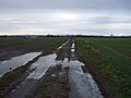 A frozen Foss Sike Lane, Sand Hutton - geograph.org.uk - 5630606.jpg 640 × 480; 49 KB
-
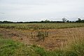
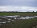
 Almost harvested field near Sandhutton - geograph.org.uk - 3633811.jpg 3,872 × 2,592; 5.38 MB
-
 An icy Sandhutton Lane - geograph.org.uk - 5630740.jpg 640 × 480; 45 KB
-
 An icy Sandhutton Lane - geograph.org.uk - 5630745.jpg 640 × 480; 72 KB
-
 Bales ready for collection - geograph.org.uk - 3631670.jpg 3,687 × 2,429; 3.13 MB
-
 Bean harvest near Sandhutton - geograph.org.uk - 3633766.jpg 3,872 × 2,592; 4.4 MB
-
 Building Remains (To Be Seen) - geograph.org.uk - 1933909.jpg 637 × 640; 93 KB
-
 Busby's Stoop, Carlton Miniott - geograph.org.uk - 2147604.jpg 480 × 640; 68 KB
-
 Carr Lane - geograph.org.uk - 3606044.jpg 1,600 × 1,200; 490 KB
-
 Carr Lane beside Carr Plantation - geograph.org.uk - 3606043.jpg 1,310 × 983; 494 KB
-
 Carr Lane towards Mowbray Farm - geograph.org.uk - 3606049.jpg 1,600 × 1,200; 677 KB
-
 Corner of the field - geograph.org.uk - 3633910.jpg 3,872 × 2,592; 5.08 MB
-
 Country to the North of Carlton Miniott - geograph.org.uk - 5651626.jpg 5,152 × 3,864; 6.87 MB
-
 Disappearing field boundaries - geograph.org.uk - 3631729.jpg 3,872 × 2,592; 3.29 MB
-
 East Coast Main Line near of Woodhouse Field - geograph.org.uk - 3605791.jpg 1,406 × 1,055; 246 KB
-
 Elizabeth II postbox, Sandhutton - geograph.org.uk - 5636287.jpg 2,136 × 2,848; 1.16 MB
-
 Entering Sandhutton - geograph.org.uk - 4910730.jpg 1,600 × 1,067; 644 KB
-
 Entrance to the former Skipton airfield - geograph.org.uk - 3631742.jpg 3,696 × 2,368; 2.75 MB
-
 Farm track near Sandhutton - geograph.org.uk - 5630585.jpg 640 × 480; 40 KB
-
 Farmland and building, Mowbray Farm - geograph.org.uk - 5630612.jpg 640 × 483; 46 KB
-
 Farmland off the A61 - geograph.org.uk - 2900726.jpg 640 × 480; 93 KB
-
 Farmland, Sandhutton - geograph.org.uk - 2809211.jpg 640 × 480; 142 KB
-
 Field between Sandhutton and Carlton Miniott - geograph.org.uk - 4912313.jpg 1,600 × 1,067; 414 KB
-
 Field Boundary leading towards Carlton Miniott Park - geograph.org.uk - 5651624.jpg 5,152 × 3,864; 7.33 MB
-
 Field north of Sandhutton Lane - geograph.org.uk - 5630747.jpg 640 × 480; 43 KB
-
 Footpath off Sandhutton Lane - geograph.org.uk - 3633798.jpg 3,872 × 2,592; 4.95 MB
-
 Footpath to Sandhutton - geograph.org.uk - 1807804.jpg 3,648 × 2,736; 3.34 MB
-
 Footpath towards Carlton Miniott - geograph.org.uk - 3606062.jpg 1,494 × 1,120; 303 KB
-
 Garage on the edge of Sandhutton - geograph.org.uk - 3633687.jpg 3,872 × 2,592; 3.56 MB
-
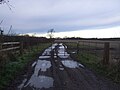 Gated farm track off Sandhutton Lane - geograph.org.uk - 5630736.jpg 640 × 480; 51 KB
-
 Harvested field near Carlton Miniott - geograph.org.uk - 3633917.jpg 3,872 × 2,592; 5.26 MB
-
 Haystacks beside the Former Skipton-on-Swale Airfield - geograph.org.uk - 4912300.jpg 1,600 × 1,067; 576 KB
-
 Houses, Sandhutton - geograph.org.uk - 5636288.jpg 2,848 × 2,136; 1.46 MB
-
 Milepost beside the A167, Sandhutton - geograph.org.uk - 5630596.jpg 640 × 450; 50 KB
-
 MilePost On A167 - geograph.org.uk - 637629.jpg 375 × 640; 76 KB
-
 Mowbray Farm - geograph.org.uk - 3633852.jpg 3,872 × 2,592; 4.53 MB
-
 Muddy Track heading North towards Sandhutton - geograph.org.uk - 4912309.jpg 1,600 × 1,067; 615 KB
-
 Muddy Track heading South towards Carlton Miniott - geograph.org.uk - 4913196.jpg 1,600 × 1,067; 535 KB
-
 On the Footpath between Sandhutton and Carlton Miniott - geograph.org.uk - 5651629.jpg 5,152 × 3,864; 7.37 MB
-
 Partly harvested field near Sandhutton - geograph.org.uk - 3633788.jpg 3,872 × 2,592; 4.54 MB
-
 Path by a caravan site - geograph.org.uk - 3633927.jpg 3,872 × 2,592; 6.45 MB
-
 Path by the edge of a harvested field - geograph.org.uk - 3633902.jpg 3,872 × 2,592; 3.88 MB
-
 Petrol station at Busby Stoop - geograph.org.uk - 3631683.jpg 3,872 × 2,592; 3.13 MB
-
 Private road near Carlton Miniott - geograph.org.uk - 3633890.jpg 3,872 × 2,592; 4.05 MB
-
 Redundant Posts beside the River Swale - geograph.org.uk - 4908309.jpg 1,600 × 1,067; 675 KB
-
 River Embankment near Sandy Bank Turkey Farm - geograph.org.uk - 4908194.jpg 1,600 × 1,067; 615 KB
-
 Sandhutton - geograph.org.uk - 4910718.jpg 1,600 × 1,067; 605 KB
-
 Sandhutton and Breckenbrough Village Hall - geograph.org.uk - 4910722.jpg 1,600 × 1,067; 650 KB
-
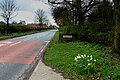
 Sandhutton bus stop - geograph.org.uk - 2226972.jpg 1,024 × 768; 106 KB
-
 Sandhutton Lane - geograph.org.uk - 5651628.jpg 5,152 × 3,864; 7.4 MB
-
 Sandhutton Lane towards Toad Hall - geograph.org.uk - 3606054.jpg 1,600 × 1,200; 565 KB
-
 Sandhutton Methodist Chapel - geograph.org.uk - 3633705.jpg 3,872 × 2,592; 3.84 MB
-
 Sandhutton Methodist Chapel - geograph.org.uk - 5630609.jpg 640 × 480; 66 KB
-

-
 Sharp bend on Sandhutton Lane - geograph.org.uk - 3633869.jpg 3,872 × 2,592; 4.14 MB
-
 Sharp bend on Sandhutton Lane - geograph.org.uk - 5630750.jpg 640 × 480; 63 KB
-
 Sheep on a frozen field - geograph.org.uk - 5630743.jpg 640 × 480; 57 KB
-
 Sign for the Busby Stoop - geograph.org.uk - 2147526.jpg 480 × 640; 93 KB
-
 Sign for the Kings Arms, Sandhutton - geograph.org.uk - 5630591.jpg 486 × 640; 69 KB
-
 St Leonard's Church, Sandhutton - geograph.org.uk - 3633735.jpg 3,872 × 2,592; 4.14 MB
-
 St Leonard's Church, Sandhutton - geograph.org.uk - 5630759.jpg 640 × 480; 81 KB
-
 Straight Furrows, Sand Hutton - geograph.org.uk - 402084.jpg 640 × 480; 82 KB
-
 Stubble field off Sandhutton Lane - geograph.org.uk - 5630738.jpg 640 × 480; 66 KB
-
 The Busby Stoop - geograph.org.uk - 851351.jpg 640 × 480; 75 KB
-
 The Busby Stoop inn on a cold and wet Easter Monday 2012 - geograph.org.uk - 2895239.jpg 4,752 × 3,168; 2.27 MB
-
 The Busby Stoop, Carlton Miniott - geograph.org.uk - 2147781.jpg 640 × 480; 74 KB
-
 The Jaipur Spice - geograph.org.uk - 5630756.jpg 640 × 480; 50 KB
-
 The Jaipur Spice, Busby Stoop - geograph.org.uk - 3631656.jpg 3,872 × 2,592; 2.97 MB
-
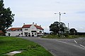
 The King's Arms, Sandhutton - geograph.org.uk - 489966.jpg 640 × 480; 111 KB
-
 The Kings Arms has grown - geograph.org.uk - 2337888.jpg 2,667 × 2,000; 951 KB
-
 The Kings Arms, Sandhutton - geograph.org.uk - 3633693.jpg 3,872 × 2,592; 2.9 MB
-
 The Kings Arms, Sandhutton - geograph.org.uk - 419998.jpg 640 × 480; 59 KB
-
 The Kings Arms, Sandhutton - geograph.org.uk - 5630589.jpg 640 × 480; 47 KB
-
 The village green, Sandhutton - geograph.org.uk - 3633713.jpg 3,872 × 2,592; 3.05 MB
-
 Track leading off Sandhutton Lane - geograph.org.uk - 5651627.jpg 5,152 × 3,864; 6.61 MB
-
 Two old Saabs - geograph.org.uk - 743508.jpg 640 × 427; 70 KB
-
 View across the Swale - geograph.org.uk - 4908197.jpg 1,600 × 1,067; 349 KB
-
 War memorial at Sandhutton - geograph.org.uk - 3633726.jpg 3,872 × 2,592; 5.92 MB
-
 Winter cereal crop, Sandhutton - geograph.org.uk - 5630599.jpg 640 × 480; 52 KB
-
 Winter trees - geograph.org.uk - 2226967.jpg 1,024 × 768; 166 KB
-
 Woodhouse Field Farm - geograph.org.uk - 2336279.jpg 640 × 430; 38 KB
-
 Young crop field near Sandhutton - geograph.org.uk - 5630580.jpg 640 × 480; 55 KB


_-_geograph.org.uk_-_1933909.jpg)


