Category:Sant Ponç d'Alinyà
| Object location | | View all coordinates using: OpenStreetMap |
|---|
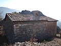
Historic building in Fígols i Alinyà (Alt Urgell, Catalonia)  | |||||
| Upload media | |||||
| Instance of | |||||
|---|---|---|---|---|---|
| Location | Fígols i Alinyà, Alt Urgell, Lleida Province, Catalonia | ||||
| Architectural style | |||||
| Heritage designation |
| ||||
 | |||||
Català: Ermita de Sant Ponç d'Alinyà (Alt Urgell)
This is a category about a building indexed in the Catalan heritage register as Bé Cultural d'Interès Local (BCIL) under the reference IPA-15568. |
Media in category "Sant Ponç d'Alinyà"
The following 2 files are in this category, out of 2 total.
-
 Sant Ponç d'Alinyà.JPG 3,648 × 2,736; 4.85 MB
-
 Sant Ponç des d'Alzina d'Alinyà.JPG 2,560 × 1,920; 2.77 MB
