Category:Saskatoon Weir
|
Saskatoon Weir has an entry on OpenStreetMap (show). |
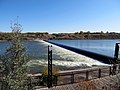
English: The Saskatoon Weir is an overflow dam on the South Saskatchewan River in Saskatoon.
Media in category "Saskatoon Weir"
The following 15 files are in this category, out of 15 total.
-
 Dark skies rolling in (9265733438).jpg 1,536 × 1,024; 611 KB
-
 Don't even think about trying to get them back (9887192725).jpg 1,000 × 667; 239 KB
-
 Looking Toward Downtown (4756564155).jpg 1,280 × 960; 879 KB
-
 Not much of a weir left (9262972301).jpg 4,258 × 2,838; 5.09 MB
-
 Rushing Water (2877534213).jpg 1,280 × 1,707; 1.93 MB
-
 Saskatchewan River 2.jpg 2,048 × 1,536; 1.12 MB
-
 Saskatoon River Weir.jpg 2,592 × 1,936; 1.66 MB
-
 The South Saskatchewan weir (9887192835).jpg 1,000 × 667; 241 KB
-
 Trapped Log (4757199160).jpg 1,280 × 960; 1.23 MB
-
 View from the East Bank (4756565587).jpg 1,280 × 960; 1.34 MB
-
 Waves crash in (5415301370).jpg 1,024 × 682; 296 KB
-
 Weir 2010 (4756562387).jpg 1,280 × 960; 1.24 MB
-
 Weir 2016 (29536597594).jpg 2,448 × 3,264; 2.86 MB
-
 Weir Through the Trees (16749212612).jpg 3,264 × 2,448; 5.29 MB
-
 Weir Water (6588288445).jpg 1,280 × 960; 1.08 MB
.jpg)
.jpg)
.jpg)
.jpg)
.jpg)


.jpg)
.jpg)
.jpg)
.jpg)
.jpg)
.jpg)
.jpg)
.jpg)