Category:Satellite pictures (meteorology)
English: Satellite imagery of special meteorological interest (you'll find clouds on nearly any satellite picture
)
See also
edit- Category:Meteorological maps
- Category:Climate maps
- Category:Aerial photographs of clouds
- Category:Satellite pictures by continent
- Category:Satellite pictures by ocean and other basins
- Category:Satellite pictures of Earth's hemispheres
- Category:Satellite pictures by country
Please always sort also into Category:Satellite pictures by satellite or instrument
Subcategories
This category has the following 6 subcategories, out of 6 total.
M
S
T
V
Media in category "Satellite pictures (meteorology)"
The following 102 files are in this category, out of 102 total.
-
 2018-01-23 Sea of Japan cold wave convergence zone by Aqua.jpg 3,600 × 2,700; 2.09 MB
-
 20180205 Sea of Japan cold wave turbulences by Aqua.jpg 4,801 × 3,600; 3.65 MB
-
 2182v1 20180122-StLawrenceB.png 1,920 × 965; 1.41 MB
-
 2184v1 20180129-Alps.png 1,800 × 1,080; 1.25 MB
-
 5 11 15 Brian AquabyMonth.gif 720 × 360; 2.4 MB
-

-
 Aleutian Islands amo 2014135 lrg.jpg 5,200 × 4,000; 3.8 MB
-
 Arcmosaic tmo 2007259.png 540 × 540; 535 KB
-
 Baltic Sea 2017 04 04 (33452217860).jpg 4,325 × 3,187; 2.25 MB
-
 Barbuda 2017 09 12 (37065176231).jpg 3,000 × 3,120; 856 KB
-
 Barbuda20170827 (36393151993).jpg 3,000 × 3,120; 979 KB
-
 Black Sea 2017 06 02 (34244944663).jpg 3,141 × 1,789; 1.1 MB
-
 BlackRockDesert16July17-190.tif 1,916 × 1,023; 7.48 MB
-
 BlackRockDesert26February17-190.tif 1,916 × 1,023; 7.48 MB
-
 Blizzard Bears Down on U.S. East Coast (24464292321).jpg 2,048 × 1,152; 476 KB
-
 Blizzard Blankets Eastern United States (24524102356).jpg 3,072 × 3,072; 1.12 MB
-
 Borneo 2017 07 29 (36197467976).jpg 3,170 × 2,990; 2.73 MB
-
 CaliforniaFire2007.jpg 600 × 725; 115 KB
-
 Caspiansatelliteimage.jpg 2,300 × 2,600; 1.62 MB
-
 Catalina Eddy.jpg 800 × 800; 273 KB
-
 Cavado e frente fria no sul do Brasil em 06 de agosto de 2023.png 720 × 478; 710 KB
-
 Closed Cellular Convection Cloud.png 682 × 507; 587 KB
-
 Cloud Arcs in the Western Pacific - PIA03720.tif 1,548 × 1,256; 4.65 MB
-
 Cloud streets over Scandinavia ESA235621.tiff 4,279 × 5,243; 65.43 MB
-
 Clouds and valleys (49304728773).jpg 5,584 × 3,728; 5.33 MB
-
 Clouds near Antarctica 2017 04 14 (33898962771).jpg 1,936 × 1,356; 530 KB
-
 Clouds over Russia 2017 03 07 (32464379494).jpg 5,105 × 2,878; 2.78 MB
-
 Cold drop over the west of the Iberian Peninsula on September 2023 (NASA Worldview).jpg 4,491 × 3,118; 2.33 MB
-
 Corriente de California-Feb-13-2013-20.jpg 640 × 455; 77 KB
-
 Cotton Clouds Over the Upsala Glacier, Argentina (51328818089).png 12,130 × 8,208; 64.96 MB
-
 Curvatura De Las Nubes 二十八 (2243915).jpeg 2,048 × 1,536; 692 KB
-
 Desert Lop Nur 89.00E, 40.30N between Kuruktagh and Astintagh.jpg 1,187 × 1,180; 1.56 MB
-
 Earth and Clouds.jpeg 4,896 × 2,760; 5.39 MB
-
 Eastern View of the US via GOES Satellite (4406941096).jpg 3,600 × 3,000; 1.7 MB
-
 False gray scale temperature deriving heights of cloud tops (2268-428).jpg 2,500 × 1,629; 554 KB
-
 Faxai Geostationary VIS-IR 2019.png 320 × 320; 55 KB
-
 Finland 2017 01 27 (32177423450).jpg 5,745 × 4,317; 4.06 MB
-
 Finland and the Baltic States 2017 05 16 (34538055132).jpg 5,003 × 4,461; 4.45 MB
-
 Foggy Peruvian Valleys.jpg 2,899 × 3,306; 10.05 MB
-
 Globalcldfr amo 200207-201504 lrg.jpg 3,600 × 1,800; 1.99 MB
-
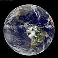
 GOES "Full Disk" image of Earth (4407007292).jpg 3,072 × 3,072; 1.25 MB
-
 Grimsvotn sat.jpg 1,050 × 800; 271 KB
-
 Hole-Punch Clouds over the Southeast (24056873426).jpg 2,400 × 1,800; 954 KB
-
 Hole-Punch Clouds over the Southeast.jpg 720 × 720; 225 KB
-
 Iberian Peninsula and Northwest Africa 2017 02 20 (32978502386).jpg 3,936 × 3,860; 2.67 MB
-
 India.A2010021.0535.250m.jpg 7,600 × 5,800; 7.21 MB
-
 Iraqdust2005220.jpg 540 × 711; 88 KB
-
 ISS-42 Cloud formation.jpg 4,928 × 3,280; 1.13 MB
-
 ISS-48 Stratus cloud field over North Atlantic Ocean.jpg 4,928 × 3,280; 1.15 MB
-
 ISS-59 Cloud patterns south of the Aleutian Islands.jpg 5,568 × 3,712; 2.51 MB
-
 ISS-59 Cloudy formation in the south Indian Ocean.jpg 2,768 × 4,928; 1.12 MB
-
 ISS-64 Earth's limb, Western Australia.jpg 4,928 × 2,768; 1.53 MB
-
 ISS-66 Clouds above the north Atlantic Ocean.jpg 4,928 × 2,768; 1.12 MB
-
 Jan Mayen Island 2017 03 27 (32890941993).jpg 3,308 × 2,834; 2.6 MB
-
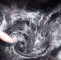
 Jan Mayen Von Karman Vortex street Apr 5 2012.jpg 547 × 916; 299 KB
-
 Karding Sept 7 2014 0630Z.jpg 4,449 × 5,345; 2.7 MB
-
 Kiribati Washington Island.jpg 3,060 × 2,032; 1.1 MB
-
 Lake victoria NASA.jpg 500 × 321; 85 KB
-
 Land ocean ice cloud hires.jpg 8,192 × 4,096; 9.77 MB
-
 MODIS Aqua 1304z 2011 November 7 99L.jpg 4,096 × 4,096; 2.19 MB
-
 NASA image acquired April 8 2011.jpg 4,400 × 5,600; 2.66 MB
-
 NASA Worldview of Croatia on 24 July evening.png 827 × 693; 994 KB
-
 Nasa-worldview-modis-cloud-holes.jpg 567 × 436; 170 KB
-
 New NASA 3D Animation Shows Seven Days of Simulated Earth Weather (14906862243).jpg 1,920 × 1,080; 74 KB
-
 NNVL - US Jet Stream 2012-03-02.png 1,920 × 1,080; 504 KB
-
 Open and Closed Cell Clouds over the Pacific Ocean (MODIS 2023-12-16).jpg 4,091 × 3,216; 1.95 MB
-
 Open- and Closed-Cell Clouds over the Pacific Ocean (MODIS).jpg 3,485 × 2,689; 1.69 MB
-
 Ora721.JPG 936 × 857; 200 KB
-
 Popcorn Clouds over the Southeast United States (MODIS).jpg 4,666 × 3,998; 12.24 MB
-

-
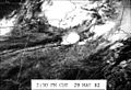
 Possiblesouthatlantictcmar2005.JPG 156 × 164; 7 KB
-
 Possiblestormfeb2005.JPG 285 × 263; 16 KB
-
 Previsão tempo Brasil 17 agosto 2022.png 658 × 657; 942 KB
-

-

-

-
Satellite images of Monterey Bay with fog - ZooKeys-241-077-SP-5.ogv 44 s, 640 × 480; 1.75 MB
-
 Satellite Observes "12-12-12" (8266791489).jpg 768 × 768; 104 KB
-
 Satellite Shows West Coast "June Gloom" and Actinoform clouds (9009302654).jpg 3,600 × 3,000; 1.59 MB
-
 Satellite Takes "CAT Scan" of Hurricane Katrina (2553050022).png 720 × 480; 480 KB
-
 Satellite View of Earth on 11.11.11 (6335669459).jpg 3,072 × 3,072; 1.23 MB
-
 Satellitemarion.jpg 546 × 371; 51 KB
-
 Source and location of image from space unknown (2268-495).jpg 2,500 × 2,326; 696 KB
-
 Spac0599 (5277569959).jpg 2,500 × 1,406; 965 KB
-
 Spac0636 (20387355669).jpg 1,920 × 1,080; 2.04 MB
-
 Spac0650 (19951457054).jpg 2,048 × 1,152; 674 KB
-
 Storm over the northeastern United States (9128829908).jpg 3,600 × 2,800; 2.09 MB
-
 Storm System That Generated Midwest Tornadoes (10967121266).jpg 1,280 × 720; 88 KB
-
 STS107-E-5311.JPG 3,032 × 2,008; 1.38 MB
-
 Sun behind cloud.jpg 896 × 540; 24 KB
-
 Sunniest Place On Earth September 2017 (36766170073).jpg 3,333 × 1,861; 1.56 MB
-
 Ten Days of Weather (14184590652).jpg 1,136 × 768; 97 KB
-
 Twelve depresion 2022.jpg 503 × 487; 211 KB
-
 Unimak island.jpg 5,240 × 5,240; 10.85 MB
-
 UnitedStates.A2010266.1905.250m.jpg 7,600 × 8,800; 15.07 MB
-
 Useastcoast goe 2015046 front.jpg 1,800 × 1,200; 1.55 MB
-
 Visible Satellite Imagery of vicinity of Japan, 2006-06-09 0600Z.jpg 291 × 217; 51 KB
-
 Visible Satellite Imagery of Western Pacific, 2006-06-09 0600Z.jpg 999 × 858; 936 KB
-
 Wave pattern in clouds south of Cape Cod (2268-426).jpg 2,692 × 1,752; 663 KB
-
 Weather patterns, ice cover, the Aleutian Islands, and western Alaska (2268-441).jpg 1,640 × 1,885; 422 KB
-
 Whirl clouds map.jpg 635 × 626; 263 KB
-
 Whirl in air map.jpg 637 × 628; 230 KB


.jpg)


.jpg)
.jpg)
.jpg)
.jpg)
.jpg)
.jpg)


.jpg)
.jpg)
.jpg)
.jpg)

.png)
.jpeg)


.jpg)
.jpg)

.jpg)
.jpg)


.jpg)

.jpg)

.jpg)


.jpg)


.jpg)

.jpg)
.jpg)

.jpg)
.jpg)


.jpg)


.jpg)
.jpg)
.png)
.jpg)

.jpg)
.jpg)
.jpg)
.jpg)
.jpg)
.jpg)


.jpg)
.jpg)


.jpg)
.jpg)


.jpg)