Category:Satellite pictures of Guatemala in 2023
Subcategories
This category has only the following subcategory.
Media in category "Satellite pictures of Guatemala in 2023"
The following 19 files are in this category, out of 19 total.
-
 Amatitlan Lake - Satellite view.jpg 1,840 × 855; 555 KB
-
 Antigua Guatemala - Satellite View.jpg 1,840 × 855; 585 KB
-
 Chimaltenango Guatemala - Satellite View.jpg 1,840 × 855; 609 KB
-
 Coatepeque Town - Guatemala Satellite View.jpg 1,840 × 855; 378 KB
-
 Coban Urban Area - Guatemala satellite view.jpg 1,840 × 855; 581 KB
-
 Embalse Chixoy Guatemala Satellite View.jpg 1,840 × 855; 347 KB
-
 Flores Peten Guatemala - Satellite View.jpg 1,840 × 855; 393 KB
-
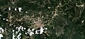
 Guatemala City - by Sentinel-2.jpg 1,711 × 817; 1.71 MB
-
 Huehuetenango Guatemala - Satellite View.jpg 1,840 × 855; 655 KB
-
 Lago Amatitlán Satellite View.jpg 1,840 × 855; 566 KB
-
 Lago de Izabal Guatemala.jpg 1,840 × 855; 457 KB
-
 Lago Petén Itzá Guatemala.jpg 1,840 × 855; 335 KB
-
 Laguna Brava Guatemala Satellite View.jpg 1,840 × 855; 294 KB
-
 Laguna Yaxhá Guatemala Satellite View.jpg 1,840 × 855; 307 KB
-
 Quetzaltenango Urban Area - by Sentinel-2.jpg 1,840 × 855; 656 KB
-
 San Jose Escuintla Guatemala - satellite view.jpg 1,840 × 855; 379 KB
-
 San Lucas Sacatepéquez Guatemala - Satellite View.jpg 1,840 × 855; 553 KB
-
 San Marcos Guatemala - Satellite View.jpg 1,840 × 855; 551 KB
-
 Villa Nueva Guatemala - Satellite View.jpg 1,840 × 855; 769 KB


