Category:Satellite pictures of Hurricane Michael (2018)
Media in category "Satellite pictures of Hurricane Michael (2018)"
The following 52 files are in this category, out of 52 total.
-
 14L 2018-10-06 1900Z.jpg 3,200 × 4,201; 2.58 MB
-
 181010 goes16 infrared Hurricane Michael anim.gif 1,282 × 740; 86.12 MB
-

-
A Night-time Animation of Hurricane Michael.webm 7.6 s, 776 × 600; 936 KB
-
 A Visible Look at Category 1 Hurricane Michael (45204223501).png 1,000 × 1,000; 1,011 KB
-
 ASA's AIRs captures Hurricane Michael off Florida coast (31359835798).jpg 1,041 × 717; 520 KB
-
 Category 5 Atlantic hurricanes 1980-present.jpg 10,000 × 13,000; 36.23 MB
-
-
 Hurricane Michael (MODIS 2018-10-10).jpg 8,451 × 7,594; 8.36 MB
-
 Hurricane Michael (MODIS 2018-10-13).jpg 7,309 × 6,436; 6.45 MB
-
 Hurricane Michael a Major Hurricane in the Gulf of Mexico (43411564730).gif 654 × 550; 14.41 MB
-
 Hurricane Michael making landfall on Florida on October 10, 2018.gif 480 × 480; 44.27 MB
-
 Hurricane Michael on October 10, 2018.gif 640 × 370; 16.03 MB
-
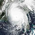
 Hurricane Michael on October 10, 2018.jpg 2,034 × 1,860; 786 KB
-
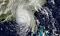
 Hurricane Michael on October 8, 2018.jpg 2,499 × 1,502; 697 KB
-
 Hurricane Michael Reaches North Carolina (31417257688).jpg 3,517 × 3,913; 1.99 MB
-
 Hurricane Michael's Eye in 3D (31359835008).jpg 3,957 × 1,343; 491 KB
-
 Hurricane Michael.gif 600 × 450; 2.88 MB
-
 IMAGE -1-Michael- NPP (30286851547).jpg 1,416 × 996; 1.13 MB
-
 Michael 2018-10-07 1640Z.jpg 3,300 × 4,300; 10.67 MB
-
 Michael 2018-10-08 1850Z.jpg 3,000 × 3,600; 2.1 MB
-
 Michael 2018-10-08 1855Z.jpg 4,713 × 5,237; 6.12 MB
-
 Michael 2018-10-09 1625Z.jpg 3,600 × 4,601; 3.94 MB
-
 Michael 2018-10-09 1815Z.jpg 1,600 × 1,800; 2.73 MB
-
 Michael 2018-10-09 1817Z.jpg 1,000 × 1,009; 912 KB
-
 Michael 2018-10-09 1905Z.jpg 3,000 × 4,000; 2.41 MB
-
 Michael 2018-10-10 0000Z.jpg 1,609 × 1,591; 407 KB
-
 Michael 2018-10-10 0740Z.jpg 3,000 × 4,000; 3.98 MB
-
 Michael 2018-10-10 1257Z.jpg 2,900 × 3,600; 14.22 MB
-
 Michael 2018-10-10 1430Z.jpg 1,600 × 2,000; 2.91 MB
-
 Michael 2018-10-10 1632Z.jpg 1,650 × 1,650; 3.08 MB
-
 Michael 2018-10-10 1700Z.jpg 4,715 × 2,879; 2.68 MB
-
 Michael 2018-10-10 1715Z cropped.jpg 2,860 × 3,510; 11.18 MB
-
 Michael 2018-10-10 1715Z.jpg 1,800 × 2,200; 3.93 MB
-
 Michael 2018-10-10 1732Z.jpg 3,200 × 4,000; 15.01 MB
-
 Michael 2018-10-10 1840Z.jpg 5,800 × 7,800; 8.52 MB
-
 Michael 2018-10-10 1840Z.png 5,067 × 6,444; 35.68 MB
-
 Michael 2018-10-11 1610Z.jpg 3,400 × 4,201; 3.17 MB
-
 Michael 2018-10-13 1415Z.jpg 4,200 × 5,000; 3.91 MB
-
 Michael loop Oct 9 to Oct 11.gif 640 × 480; 30.18 MB
-
 MISR Captures Hurricane Michael Near Florida Panhandle (31359836218).jpg 6,500 × 4,726; 2.56 MB
-
 NASA Eyes Hurricane Michael Moving Inland (31373832458).jpg 5,694 × 4,061; 3.53 MB
-
 NASA Gets a Night-time View of Hurricane Michael (30286852567).png 1,416 × 996; 2.54 MB
-
NASA's CloudSat Examines Water and Ice in Hurricane Michael.webm 29 s, 960 × 540; 3.08 MB
-
 NASA's Infrared Look at Hurricane Michael (45204222191).png 900 × 695; 502 KB
-
 NASA’s Aqua Satellite Sees Hurricane Michael Strengthening (44296315195).jpg 1,102 × 927; 404 KB
-
 NASA’s Infrared View Shows Power in Hurricane Michael (31352547888).jpg 1,797 × 1,862; 2.46 MB
-
Satellite Close Up of Hurricane Michael's Eye.webm 6.4 s, 950 × 750; 753 KB
-
 Satellite image of Hurricane Michael. (44316110765).jpg 1,200 × 1,200; 1.12 MB
-
 Sergio, Michael, Leslie and Nadine 2018-10-10 1715Z.jpg 10,848 × 5,681; 49.08 MB
-
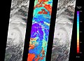
 The GPM Core Satellite Views of Hurricane Michael (44507785624).jpg 1,280 × 720; 301 KB
-
Tropical Storm Michael Moves into North Carolina.webm 7.1 s, 800 × 650; 5.78 MB


.png)
.png)
.jpg)

_(45173657372).jpg)
.jpg)
.jpg)
.gif)


.jpg)

.jpg)


.jpg)
.jpg)
.png)
.png)
.jpg)
.jpg)
.jpg)

.jpg)
.jpg)